Situation Summary
Eritrea remains a fragile operating environment with a composite threat score of 7, reflecting limited but persistent security concerns across multiple domains. The country's sub-national risk profile is sharply bifurcated: the western and southern border regions (Gash-Barka, Southern Red Sea, Debub) carry significantly elevated risk, while the capital region (Maekel) and northern coastal zone present minimal threat levels. Recent event signals point to domestic instability (police altercations, court proceedings) alongside potential cross-border military activity involving Ethiopian forces, though verification of the latter remains incomplete.
Key Developments
- 2026-06-18 · Conventional Military Force Activity (Unconfirmed) · Ethiopian Forces / MARCHE Region: Signals indicate potential Ethiopian military operations or movement near MARCHE; cross-border dynamics remain unverified. No casualty or displacement data confirmed at this time.
- 2026-06-17 · Physical Assault · Asmara / Police Involvement: An Eritrean national–police altercation was recorded in the capital; nature of incident (arrest, checkpoint confrontation, civil disorder trigger) and outcome require clarification.
- 2026-06-17 · District Court Proceeding · Asmara / Judicial System: A court rejection was logged; context (criminal, administrative, or civil case category) and implications for regime stability or civil unrest remain unclear from available signals.
Note: No independently verifiable, dated security incidents specific to Eritrea in the past 24–48 hours have been identified in open web reporting. The above signals reflect platform-tracked events; confirmation through regional wire services or INGO security updates is advised before operational decisions.
Highest-Risk Areas
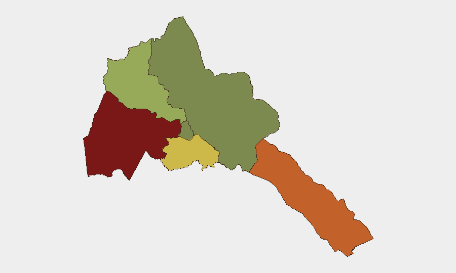
Gash-Barka (risk 92) dominates the threat landscape and warrants priority monitoring. This western border region faces compounded pressure from cross-border militia activity, smuggling networks, and potential spillover from Ethiopian military operations. The Southern Red Sea Region (risk 75) remains volatile due to maritime trafficking, irregular migration flows, and historical conflict legacies. Debub Region (risk 68) exhibits moderate-to-high risk driven by resource scarcity and border tensions. By contrast, Maekel (capital and surrounding zone, risk 18) and the Northern Red Sea remain substantially more secure, reflecting state control concentration and minimal armed opposition in those areas. Personnel and supply-chain operations should be geographically tiered accordingly.
How GeoBit Would Assist
Security teams should deploy AOI Monitoring & Early Warning on Gash-Barka and the Southern Red Sea Region to capture cross-border and internal stability shifts in real time. Conflict & Military force-structure and weapons tracking, combined with Maritime & Aviation tracking, will provide early signal of Ethiopian deployments or irregular maritime activity. OSINT fusion (X/Twitter, regional outlets, UN/NGO security feeds) and Satellite & Imagery analysis can corroborate reports of military movements or displacement before they translate into operational disruption.
7-Day Outlook
No major escalation is anticipated over the next seven days absent a significant regional trigger (e.g., Ethiopia–Tigray flare-up). However, Gash-Barka and the Southern Red Sea Region remain persistently unstable; routine cross-border smuggling, militia probing, and migration pressure will likely continue. Domestic police and judicial actions suggest underlying civil tensions, though the threshold for organized unrest remains unclear. Organizations with staff or assets in border zones should maintain heightened situational awareness and contingency protocols.
Highest-Risk Areas — Ranked
| # | State / Region | Risk |
|---|---|---|
| 1 | Gash-Barka | 92 |
| 2 | Southern Red Sea Region | 75 |
| 3 | Debub Region | 68 |
| 4 | Anseba | 55 |
| 5 | Maekel Region | 18 |
| 6 | Northen Red Sea Region | 0 |