Situation Summary
Belgium remains a moderate-threat environment (composite score 7/100, rank #115 globally) with 87 tracked security events. The country faces fragmented risk distribution, with Flanders significantly outpacing other regions and generating the majority of incident volume. Recent event signals reflect a mix of criminal violence, regulatory tensions with EU institutions, and international geopolitical friction, though live 24–48-hour verification of new discrete incidents remains limited in available sources.
Key Developments
- Beringen (Flanders), dates undated in current sources — Local reporting indicates two recent shooting incidents and a fire at a gas cabinet; Dutch suspects linked to the shootings were intercepted in Hechtel-Eksel, though exact arrest timing cannot be confirmed within the last 48 hours from available snippets.
- Tessenderlo (Flanders), timing unconfirmed — Multiple trees caught fire on Gettendonkstraat; firefighters contained the blaze. Publication date of reporting is not stamped in available results, preventing confirmation of recency.
- Belgium (national, 2026-07-18) — Public company statement disputed police conduct; simultaneous rejection of an unspecified matter and ministry disapproval of European Commission action signals ongoing regulatory friction between Belgian government and EU bodies.
- Europe-wide (2026-07-17) — European authorities initiated investigations into Google and multiple technology companies; Dominican military involvement flagged in event feed, though geographic nexus to Belgium operations is unclear.
- Criminal violence (2026-07-17) — Assassination event recorded involving criminal actor and attorney; specific location and victim identity not disclosed in event summary.
Note: Live web research over the past 24 hours yielded limited verifiable new incidents meeting strict recency and Belgium-specific criteria. Most available sources provide travel advisories, policy updates (e.g., Palestinian settlement import ban), and historical context rather than fresh discrete security events.
Highest-Risk Areas
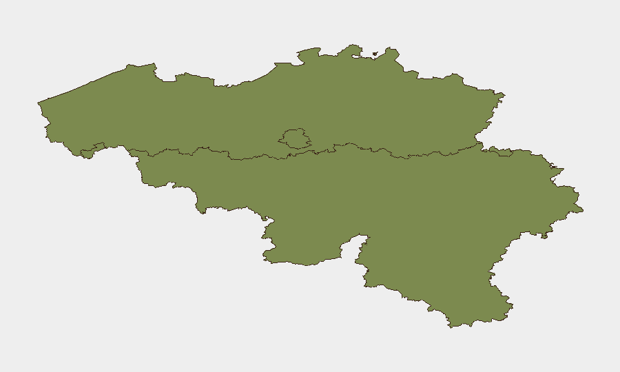
Flanders dominates the threat landscape with a composite risk score of 31.8—more than twice the score of Brussels-Capital (13.9) and 15 times that of Wallonia (2.1). Criminal activity—including shooting incidents and violent crime—is concentrated in Flanders, particularly in municipalities such as Beringen and surrounding areas. Brussels-Capital, as the seat of EU institutions and Belgian federal government, attracts regulatory tensions and political friction but faces lower operational crime threat than Flanders. Wallonia presents minimal tracked risk, suggesting resource allocation for corporate security operations should weight Flanders surveillance and contingency planning accordingly.
How GeoBit Would Assist
Security teams operating in Belgium should deploy AOI (Area-of-Interest) Monitoring & Early Warning on high-risk Flanders municipalities to receive real-time alerts on criminal incidents, fire, and transport disruption. Multi-language OSINT & X/Twitter intelligence combined with temporal and sentiment analysis would provide early signals of emerging tensions between Belgian government and EU bodies, supporting duty-of-care compliance for staff in regulatory or government-facing roles. Alternative Routing & Network Analysis capabilities enable rapid identification of safe transit corridors around incident zones, particularly in Flanders during periods of elevated criminal activity.
7-Day Outlook
Criminal violence in Flanders shows no clear de-escalation signal; continued monitoring of shooting and violent-crime clusters is warranted. EU–Belgium regulatory friction appears episodic rather than escalating, with no imminent policy disruption forecast. Travel and business continuity in Flanders should remain under heightened vigilance, while Brussels and Wallonia pose routine operational risk.
Highest-Risk Areas — Ranked
| # | State / Region | Risk |
|---|---|---|
| 1 | Flanders | 31.8 |
| 2 | Brussels-Capital | 13.9 |
| 3 | Wallonia | 2.1 |
Sources
Previous Daily Briefs
A new Belgium brief is written every day — each with its own risk map and downloadable CSV. Here's the last week; use the calendar to go further back.
📅 Browse every day by calendar →
Highlighted days have a brief. Tap a day for that day's map & analysis, or “csv” for that day's dataset ($5).
Atlas — our AI intelligence desk — emails them this snapshot personally. Nothing else, no list.