Situation Summary
Cambodia faces an acute escalation along its Thailand border coupled with persistent underlying crime and security risks in major urban centers and tourist zones. The Cambodia–Thailand frontier conflict has reached its most severe intensity in over a decade, with cross-border gunfire, artillery, and airstrikes prompting mass evacuations and UN Security Council intervention. While the national threat ranking remains moderate (#72 globally), concentration of risk in border provinces—particularly Ratanakiri—and the volatile security environment around casinos, nightlife districts, and transport corridors create compartmentalized but serious hazards for corporate personnel and assets.
Key Developments
- Preah Vihear / Oddar Meanchey border sector — Confirmed gunfire exchanges, shelling, and Thai airstrikes targeting Cambodian military positions; fighting described as most severe escalation in 10+ years; UN called to emergency Security Council session.
- Cross-border evacuations — 130,000+ civilians displaced on Thai side; reports of civilian displacement on Cambodian side; border communities under active threat; land crossings remain volatile with rapid condition changes.
- Cambodian defense ministry statement — Military confirmed artillery and small-arms engagements; acknowledged Thai strikes on Cambodian military sites; fighting spread to multiple border areas rather than isolated incidents.
- Phnom Penh organized-crime environment — December 2022 casino-linked bomb and shooting incidents underscore persistent organized-crime violence; risk remains elevated in casino and entertainment districts.
- Urban petty crime hotspots — Phnom Penh riverfront and surrounding districts experience recurring bag snatching from motorbikes; Siem Reap's Pub Street area reports sexual assaults involving men posing as motorbike taxi drivers.
- Sihanoukville nightlife risks — Drink spiking, robbery, sexual assault, and trafficking-related labor exploitation documented at parties and bars; broader scam and exploitation environment in coastal zone.
- Landmine and UXO hazard — Rural areas and some temple complexes remain unmapped mined zones; unexploded ordnance poses continuing travel hazard for field operations.
Highest-Risk Areas
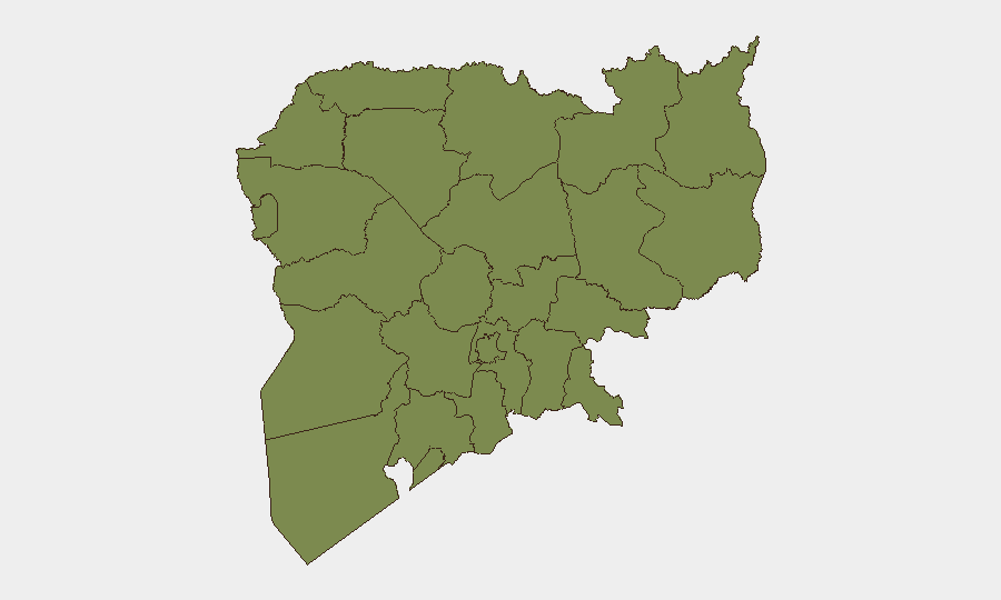
Ratanakiri province dominates the sub-national risk landscape with a composite score of 31.5—more than 2.7× the next-ranked province—largely driven by proximity to the active Cambodia–Thailand border conflict zone and cross-border instability. Battambang and Kampong Thom follow at 11.5 each, reflecting secondary border-region exposure and criminal activity corridors. All remaining provinces score 6.5 or below, indicating that geographic risk is heavily concentrated in the northern and northeastern frontier belt. Corporate teams with personnel or operations in Ratanakiri, Battambang, or along any Thailand land crossing face materially elevated exposure; those in Phnom Penh and Sihanoukville face primarily urban crime and organized-crime risks rather than armed conflict.
How GeoBit Would Assist
Real-time AOI Monitoring & Early Warning on the Preah Vihear and Oddar Meanchey border sectors provides persistent watch for escalation signals, shelling patterns, and airfield activity. Conflict & Military battle mapping and force-structure tracking enables duty-of-care teams to assess proximity of active fighting to company operations and adjust evacuation or sheltering protocols. Routing & Network Analysis supports alternative journey planning away from compromised land crossings and volatile provinces, while Intel Sweep and OSINT fusion synthesize cross-border security reporting to identify emerging organized-crime and trafficking activity in urban zones.
7-Day Outlook
The border conflict is unlikely to de-escalate rapidly absent international mediation; further clashes, artillery exchanges, and airstrikes remain probable. Evacuation corridors and land crossings will remain unpredictable. Urban crime (petty and organized) in Phnom Penh and coastal zones will persist at baseline levels, with elevated risk around nightlife and casino districts.
Highest-Risk Areas — Ranked
| # | State / Region | Risk |
|---|---|---|
| 1 | Ratanakiri | 31.5 |
| 2 | Battambang | 11.5 |
| 3 | Kampong Thom | 11.5 |
| 4 | Preah Vihear | 6.5 |
| 5 | Koh Kong | 1.5 |
| 6 | Kampong Speu | 1.5 |
| 7 | Kandal | 1.5 |
| 8 | Prey Veng | 1.5 |
| 9 | Khaet Preah Sihanouk | 1.5 |
| 10 | Kampot | 1.5 |
| 11 | Kep | 1.5 |
| 12 | Takeo | 1.5 |
Sources
Previous Daily Briefs
A new Cambodia brief is written every day — each with its own risk map and downloadable CSV. Here's the last week; use the calendar to go further back.
📅 Browse every day by calendar →
Highlighted days have a brief. Tap a day for that day's map & analysis, or “csv” for that day's dataset ($5).