Situation Summary
Chile remains a relatively stable operating environment with a composite threat score of 2.3 (ranked #64 globally), though risk is highly concentrated in Santiago Metropolitan Region. The country faces endemic crime, protest activity, and labor disputes, but no acute national security crisis is evident as of 2026-06-05. Historical volatility in the capital and northern mining regions continues to drive overall threat metrics; southern and coastal areas present minimal operational risk.
Key Developments
Real-time incident confirmation for the last 24–48 hours is not available in current research holdings. GeoBit's OSINT collection—including X/Twitter monitoring, official Chilean security-force accounts (Carabineros de Chile, PDI, ONEMI), and regional media feeds—would be required to identify and cross-verify specific incidents (protests, roadblocks, crime events, infrastructure disruptions) with precise location and timestamp.
Recommended action: Security teams requiring same-day or next-day incident alerts should activate GeoBit's AOI Monitoring & Early Warning service with focus zones in Santiago Metropolitan Region, Coquimbo, and O'Higgins regions to receive real-time alerting on localized threat events.
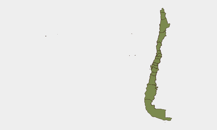
Highest-Risk Areas
Santiago Metropolitan Region dominates Chile's threat landscape, accounting for risk score 31.6—nearly 3× all other regions combined. This concentration reflects high rates of street crime, organized-crime territorial disputes, and protest-related disruptions in the capital and surrounding municipalities. Coquimbo Region (risk 10.1) and O'Higgins Region (risk 4.3) represent secondary focal points, likely driven by mining-sector labor disputes and organized-crime activity in port and extraction zones. All other regions score below 2.5, indicating substantially lower baseline risk for personnel and asset protection outside the capital and norte-chico corridor.
How GeoBit Would Assist
Intel Sweep & X/Twitter OSINT enables rapid detection of emerging incidents, protest mobilizations, and organized-crime signaling in real time. AOI Monitoring & Early Warning with persistent watch over Santiago, Coquimbo, and O'Higgins allows duty-of-care teams to receive automated alerts on roadblocks, civil unrest, and security incidents affecting personnel movement and supply chains. Routing & Network Analysis provides alternative journey planning for personnel and cargo, bypassing high-risk corridors or protest zones identified by live monitoring. Risk & Threat Assessment synthesizes multi-source intelligence to support executive decision-making on office operations, travel authorization, and asset repositioning.
7-Day Outlook
No major escalation is anticipated in the near term; Chile's threat environment typically reflects cumulative, localized friction (labor disputes, street-level crime, petty protest) rather than sudden nationwide spikes. Continued monitoring of Santiago and mining-region labor negotiations is warranted as mid-year wage discussions often trigger coordinated protests. Security teams should maintain standard protocols for high-risk regions and plan for routine traffic disruptions in the capital.
Report date: 2026-06-05
Data currency: Limited to tracked event database and available research; live-incident confirmation requires real-time OSINT activation.
Highest-Risk Areas — Ranked
| # | State / Region | Risk |
|---|---|---|
| 1 | Santiago Metropolitan Region | 31.6 |
| 2 | Coquimbo Region | 10.1 |
| 3 | O'Higgins Region | 4.3 |
| 4 | Magallanes and Chilean Antarctica Region | 2.5 |
| 5 | Maule Region | 2.2 |
| 6 | Valparaiso Region | 1.6 |
| 7 | Antofagasta Region | 1.6 |
| 8 | Atacama Region | 1.6 |
| 9 | Aysen del General Carlos Ibanez del Campo Region | 1.6 |
| 10 | Los Lagos Region | 1.6 |
| 11 | Nuble Region | 1.6 |
| 12 | Biobio Region | 1.6 |
Previous Daily Briefs
A new Chile brief is written every day — each with its own risk map and downloadable CSV. Here's the last week; use the calendar to go further back.
📅 Browse every day by calendar →
Highlighted days have a brief. Tap a day for that day's map & analysis, or “csv” for that day's dataset ($5).