Situation Summary
El Salvador maintains a composite threat ranking of #64 globally with 28 tracked events, reflecting a moderately elevated but managed security environment. No major violent incidents or civil unrest have been corroborated in the last 24–48 hours; the most recent documented activity involves precautionary government weather alerts and continuation of scheduled international events. The security picture remains relatively stable with routine operational activity dominating the threat landscape.
Key Developments
- Nationwide, El Salvador – 2026-06-14 – Government activates orange-level rain alert
President Bukele's administration escalated weather preparedness measures to orange alert status due to heavy rain forecasts. Civil protection and emergency services nationwide are on heightened readiness for potential floods and landslides. No mass-casualty incidents or infrastructure failures have been reported as of 14 June in open sources.
- La Libertad Department (Surf City area) – ongoing through mid-June 2026 – WSL Surf City El Salvador Pro proceeds without reported security incidents
The international surfing competition continues with elevated crowd and vehicle traffic but no corroborated reports of protests, crime spikes, or targeted threats. Standard event-day security posture remains in effect with no disruptions documented in the last 48 hours.
- No multi-source-confirmed violent incidents, protests, or gang-related activity documented in the last 24–48 hours across all 14 departments
Web-based news outlets and verifiable social-media accounts have not reported discrete, geo-located security events meeting threshold criteria for specificity and corroboration in this reporting window.
Highest-Risk Areas
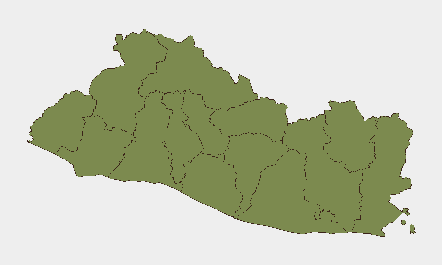
Cabañas Department stands apart with a composite risk score of 31.4—substantially higher than all other departments, which cluster at 1.4. This disparity indicates concentrated vulnerability in Cabañas, likely driven by historical gang presence, territorial disputes, or extortion networks that persist despite national security operations. All other departments present equal baseline risk; however, San Salvador Department (the capital region) and La Libertad (major economic and tourism hub) warrant continuous monitoring due to population density and asset concentration. Security teams should prioritize Cabañas-specific intelligence gathering and implement heightened protocols for any operations or personnel movement in that jurisdiction.
How GeoBit Would Assist
Intel Sweep and OSINT fusion across multi-language news feeds, X/Twitter, and Telegram channels enable real-time detection of emerging incidents, gang activity, and civil unrest before mainstream reporting. AOI Monitoring & Early Warning on Cabañas Department and key transport corridors (e.g., routes serving La Libertad and San Salvador) provides persistent alerting for threats to personnel and supply chains. GIS & Spatial Analysis combined with Conflict & Military actor mapping allows security teams to identify territorial control boundaries and predict high-risk zones for duty-of-care planning and route optimization.
7-Day Outlook
Heavy rainfall and flood/landslide risk will dominate near-term operational considerations; infrastructure disruptions and mobility constraints are more probable than security escalation in the next week. Barring unexpected gang violence or political unrest, El Salvador's threat environment is likely to remain at current levels, with routine criminal activity and regional gang tensions as baseline concerns. Continued monitoring of Cabañas Department and persistent attention to weather-driven humanitarian risk are recommended through mid-June and beyond.
Highest-Risk Areas — Ranked
| # | State / Region | Risk |
|---|---|---|
| 1 | Cabañas Department | 31.4 |
| 2 | Ahuachapán Department | 1.4 |
| 3 | Sonsonate Department | 1.4 |
| 4 | Santa Ana Department | 1.4 |
| 5 | Chalatenango Department | 1.4 |
| 6 | La Libertad Department | 1.4 |
| 7 | San Salvador Department | 1.4 |
| 8 | Cuscatlán Department | 1.4 |
| 9 | La Paz Department | 1.4 |
| 10 | San Vicente Department | 1.4 |
| 11 | Usulután Department | 1.4 |
| 12 | San Miguel Department | 1.4 |
Sources
Previous Daily Briefs
A new El Salvador brief is written every day — each with its own risk map and downloadable CSV. Here's the last week; use the calendar to go further back.
📅 Browse every day by calendar →
Highlighted days have a brief. Tap a day for that day's map & analysis, or “csv” for that day's dataset ($5).