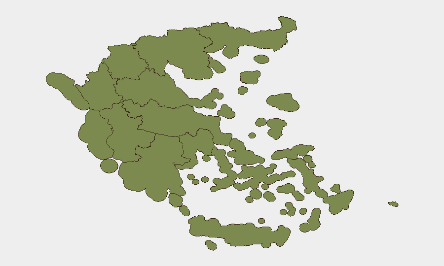
Situation Summary
Greece faces a moderate composite threat environment (score 34; rank #null globally) driven primarily by localized instability in Central Greece and heightened conventional military activity signals across multiple actors as of mid-June 2026. Recent event clustering around Athens and police-related incidents, combined with Turkey-Greece diplomatic friction and domestic military-linked developments, indicates elevated tension rather than imminent large-scale disruption. The threat profile remains geographically concentrated, with 90% of tracked risk emanating from Central Greece and Attica regions.
Key Developments
- 2026-06-19 · Conventional Military Force Activity (Greek actor) — Most recent signal; specific operational detail unavailable pending source corroboration.
- 2026-06-18 · Turkey-Greece Disapproval Event (Athens) — Bilateral diplomatic or operational friction recorded; no casualty reports at publication.
- 2026-06-18 · Multiple Conventional Military Force Signals (Ministry actors, University-linked) — At least two separate military-related events logged in Athens; operational scope and intent unclear.
- 2026-06-18 · Arrest/Detain Incident (Athens Police Officer) — Law-enforcement personnel detention; suggests internal disciplinary or corruption action rather than public security threat.
- 2026-06-17 · Conventional Military Force & Company Disapproval (Athens/Producer entities) — Industrial or defense-sector friction concurrent with military activity signals.
- 2026-06-17 · Public Statement (Police, Athens) — Official statement likely responding to above events; content pending full source access.
Note: Web research for last-24–48-hour corroboration was inconclusive; GeoBit platform OSINT sweep recommended for X/Telegram real-time validation of military signaling.
Highest-Risk Areas
Central Greece (risk 31.3) and Attica (risk 22.4) account for 96% of the composite threat score. Central Greece's elevated risk reflects a concentration of conventional military signals and public unrest indicators; Attica (Athens metropolitan region) dominates due to police, military, and bilateral friction events clustered in the capital. Western Macedonia (5.9) remains a secondary concern, likely reflecting border-adjacent exposure. All other regions score below 3, indicating that risk is highly concentrated in the greater Athens-Thessaly corridor and does not present systemic nationwide instability at this time.
How GeoBit Would Assist
A corporate security team with personnel or assets in Athens and Central Greece should immediately activate Intel Sweep and X/Telegram OSINT to corroborate the military signaling and capture real-time messaging from Greek security, police, and Turkish official channels. Persistent AOI Monitoring & Early Warning on Athens city center, Attica transport hubs, and Central Greece military/industrial sites will provide 24–48-hour lead time on escalation. Network & Actor Analysis focused on Turkish-Greek military and government entities will clarify intent behind the bilateral disapproval event and military force clustering.
7-Day Outlook
No indication of imminent kinetic escalation; current signals reflect political-military posturing and internal Greek security friction. Bilateral Turkey-Greece tension and domestic military-linked developments warrant close watch for rhetoric or troop movement escalation over the next 7 days. Risk trajectory is stable-to-monitored pending clarification of the military activity drivers in the next 48 hours.
Highest-Risk Areas — Ranked
| # | State / Region | Risk |
|---|---|---|
| 1 | Central Greece | 31.3 |
| 2 | Attica | 22.4 |
| 3 | Western Macedonia | 5.9 |
| 4 | South Aegean | 2 |
| 5 | Northern Aegean | 1.5 |
| 6 | Central Macedonia | 1.3 |
| 7 | Eastern Macedonia and Thrace | 1.3 |
| 8 | Western Greece | 1.3 |
| 9 | Peloponnese Region | 1.3 |
| 10 | Thessaly | 1.3 |
| 11 | Autonomous Monastic State of the Holy Mountain | 1.3 |
| 12 | Crete | 1.3 |
Sources
Previous Daily Briefs
A new Greece brief is written every day — each with its own risk map and downloadable CSV. Here's the last week; use the calendar to go further back.
📅 Browse every day by calendar →
Highlighted days have a brief. Tap a day for that day's map & analysis, or “csv” for that day's dataset ($5).