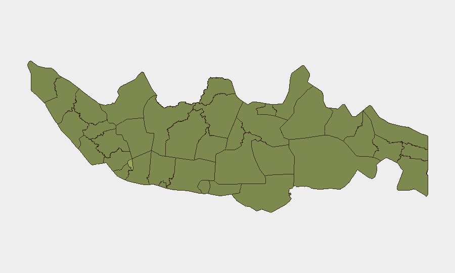
Situation Summary
Indonesia remains a mid-tier security concern globally (ranked #38, composite threat score 37.7) with 417 tracked events reflecting persistent but manageable risks across terrorism, cyber, protests, and regional instability. The threat environment is marked by cyclical rather than escalating patterns: cyberattacks on critical infrastructure, periodic enforcement crackdowns, and ongoing separatist activity in eastern provinces remain the dominant vectors. Jakarta dominates the overall risk profile due to population density, critical infrastructure concentration, and terrorist target preference, while eastern regions (Papua, parts of East Java) face armed conflict and civil unrest. The security posture appears stable but requires sustained monitoring across urban and frontier zones.
Key Developments
- Jakarta – Critical infrastructure cyber vulnerability: Indonesia's cyber agency (BSSN) reported 5.5 billion cyberattacks in 2025; ransomware targeted the Temporary National Data Centre, disrupting immigration and government services. Cybersecurity measures are being tightened nationwide, signaling acknowledged gaps in state system resilience.
- West Nusa Tenggara (Lombok) – Foreign national detained: An Australian national was detained for possession of cannabis vape liquid, reinforcing strict narcotics enforcement against international travellers and associated deportation/detention risks.
- Nationwide – Nitrous oxide regulatory crackdown: Central government announced tighter oversight of N₂O distribution following influencer misuse case, with regulators signalling closer supplier monitoring, particularly in nightlife venues.
- Sumatra – Wildfire and air-quality escalation: Authorities deployed additional personnel and equipment to combat forest and land fires; haze control efforts underway to protect transport corridors and plantations.
- Central Papua and Highland Papua – Separatist threat persistence: U.S. travel advisory maintains Level 4: Do Not Travel status due to ongoing armed separatist activity, civil unrest, violent demonstrations, and documented kidnapping and ambush risks against foreign nationals.
- Nationwide urban centres – Terrorism and protest frequency: Terrorist groups continue plotting attacks against police facilities, places of worship, malls, hotels, and entertainment venues in major cities; demonstrations occur frequently with potential for violent escalation.
Highest-Risk Areas
Jakarta's composite risk score (56.4) is nearly double that of the second-ranked region (East Java, 34.2), reflecting its role as the national capital, economic hub, and preferred target location for both organised crime and extremist activity. East Java, Central Java, West Kalimantan, and North Sumatra form a secondary cluster (30–34 risk range) driven by a mix of criminal networks, separatist presence, and resource-conflict dynamics. The gap between Jakarta and all other provinces indicates that capital-based risks (cyber attacks on state systems, urban terrorism, diplomatic incidents, and organised crime) significantly outweigh dispersed provincial threats, though Yogyakarta, South Sulawesi, and West Java warrant continuous monitoring for protest activity and extremist recruitment networks.
How GeoBit Would Assist
Security teams operating in Indonesia should employ AOI Monitoring & Early Warning on Jakarta's critical infrastructure zones and Papuan conflict areas to receive persistent alerting on protest escalation and separatist activity. Intel Sweep and multi-language OSINT (X/Twitter, Telegram, local forums) would track emerging cyber threats, narcotics enforcement patterns, and terrorism plotting in real time. Risk & Threat Assessment and Network & Actor Analysis capabilities would help map terrorist and criminal actor relationships across urban centres and flag high-risk venues or supply chains ahead of disruption.
7-Day Outlook
No major escalation is forecast, but the frequency of public statements in the event signals suggests continued civic contestation and protest activity across multiple sectors. Cyber threats to state infrastructure will remain elevated; organisations should expect continued BSSN enforcement and possible service disruptions. Wildfire season in Sumatra may worsen air quality and disrupt logistics in affected corridors over the coming week.
Highest-Risk Areas — Ranked
| # | State / Region | Risk |
|---|---|---|
| 1 | Special capital Region of Jakarta | 56.4 |
| 2 | East Java | 34.2 |
| 3 | Central Java | 32 |
| 4 | West Kalimantan | 31.3 |
| 5 | North Sumatra | 31 |
| 6 | Special Region of Yogyakarta | 31 |
| 7 | South Sulawesi | 30.3 |
| 8 | West Java | 29.9 |
| 9 | Banten | 29.2 |
| 10 | Riau | 27.8 |
| 11 | West Nusa Tenggara | 27.1 |
| 12 | South Sumatra | 27.1 |
Sources
Previous Daily Briefs
A new Indonesia brief is written every day — each with its own risk map and downloadable CSV. Here's the last week; use the calendar to go further back.
📅 Browse every day by calendar →
Highlighted days have a brief. Tap a day for that day's map & analysis, or “csv” for that day's dataset ($5).