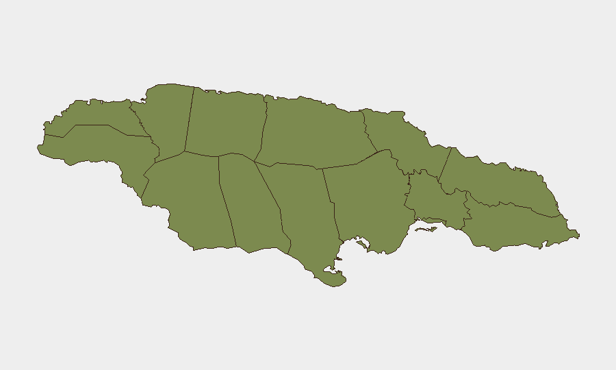
Situation Summary
Jamaica remains under moderate security pressure driven by urban gang activity, armed robbery, and transport-corridor vulnerability. A fatal multi-victim shooting on a public taxi and ongoing armed robberies in rural areas underscore the persistence of firearm-enabled crime across Kingston and provincial routes. Irregular maritime migration from Haiti continues to strain southern coastal security. Overall threat trajectory is stable but unresolved, with localized spikes in gang and criminal violence.
Key Developments
- Mandeville, Manchester – 18 July evening. A gunman aboard a public taxi en route between Mandeville and Royal Flat opened fire at Caledonia Road (Horseshoe Curve), killing nursing students Deneekia Pounall (24) and Sadefa Henry (21), and injuring two others who later died at Mandeville Regional Hospital. Transport operator advocacy groups flagged the incident as indicative of persistent public-transport security risk.
- Tivoli Gardens, Kingston 14 – 18 July morning. National Strategic Anti-Gang Division police recovered a 9mm pistol with six rounds of ammunition during an operation at an abandoned house on Shearer Drive and arrested one suspect pending investigation.
- Eleven Miles, St Catherine – 17 July late night (reported 20 July). Armed men in a Toyota Probox forced a farmer's vehicle off the road and stole approximately JMD 100,000; Guanaboa Vale police are conducting an active search for the suspects.
- St Catherine coast – 18–19 July. Marine Police intercepted six Haitian nationals in bushes less than 24 hours after discovering two others; combined total of eight nationals (five adult males, two adult females, one teenage female) recovered following evasion of police by an unconfirmed Haitian vessel. Reflects ongoing irregular maritime migration on Jamaica's southern maritime boundary.
- Trelawny, north coast – 18 July. A two-truck collision resulted in seven fatalities at or shortly after the scene, with additional deaths at Falmouth Hospital, contributing to recurring fatal road-crash risk on this corridor.
Highest-Risk Areas
Clarendon parish dominates sub-national threat ranking (composite risk 31.3), reflecting sustained gang activity and armed crime in and around the capital region's western approaches. All other tracked parishes register significantly lower composite scores (1.3), indicating that risk concentration is sharply skewed toward Clarendon and the greater Kingston urban zone. Manchester, St Catherine, and Trelawny show episodic but notable criminal and transport-safety events; however, sustained gang and firearms activity remains the primary driver of national risk differentiation.
How GeoBit Would Assist
Intel Sweep, OSINT Fusion & Corroboration, and X/Twitter OSINT enable continuous tracking of gang signaling, criminal network communications, and transport-corridor incident reporting to identify attack patterns and high-risk windows. AOI Monitoring & Early Warning with persistent geofencing on Clarendon, Manchester, and St Catherine transport routes and known criminal hotspots would provide real-time alerting for incidents affecting corporate travel and supply chains. Routing & Network Analysis supports alternative journey planning for personnel and assets transiting high-risk parishes, reducing exposure to identified shooting corridors and robbery points.
7-Day Outlook
Firearm-enabled gang and criminal violence will remain the primary threat vector over the next week, with transport corridors (particularly rural taxi routes in Manchester and St Catherine) continuing to present elevated risk for both passengers and operators. Clarendon-based gang activity is expected to sustain current pressure. Maritime interdiction activity on the southern coast will likely persist as irregular migration attempts continue.
Highest-Risk Areas — Ranked
| # | State / Region | Risk |
|---|---|---|
| 1 | Clarendon | 31.3 |
| 2 | Hanover | 1.3 |
| 3 | Westmoreland | 1.3 |
| 4 | Saint James | 1.3 |
| 5 | Saint Elizabeth | 1.3 |
| 6 | Trelawny | 1.3 |
| 7 | Manchester | 1.3 |
| 8 | Saint Ann | 1.3 |
| 9 | Saint Catherine | 1.3 |
| 10 | Saint Mary | 1.3 |
| 11 | Saint Andrew | 1.3 |
| 12 | Portland | 1.3 |
Sources
Previous Daily Briefs
A new Jamaica brief is written every day — each with its own risk map and downloadable CSV. Here's the last week; use the calendar to go further back.
📅 Browse every day by calendar →
Highlighted days have a brief. Tap a day for that day's map & analysis, or “csv” for that day's dataset ($5).
Atlas — our AI intelligence desk — emails them this snapshot personally. Nothing else, no list.