Situation Summary
Kuwait is experiencing active military strikes as part of broader US–Iran regional hostilities, with confirmed Iranian attacks on critical infrastructure, military facilities, and border posts on 17 July 2026. The national power grid and water desalination network have been damaged, triggering emergency stabilization protocols and public conservation directives. Ground force casualties, drone interceptions, and secondary security incidents indicate sustained operational tempo across multiple domains and a destabilized near-term security environment.
Key Developments
- Doha West power & desalination station (southern Kuwait), 17 July 2026: Iranian strike caused fire, facility damage, and loss of multiple electricity-generation units; emergency grid protocols activated; Ministry of Electricity issued national conservation directive.
- Kuwaiti army facilities and camps (multiple locations), 17 July 2026: Enemy drone attacks injured multiple ground forces soldiers; personnel hospitalized and reported stable.
- Kuwaiti airspace (national, morning 17 July 2026): Air defences intercepted hostile aerial targets; engagement confirmed as part of Iranian strike wave.
- Northern land border posts (northern Kuwait, 24–48h prior to 17 July report): Ministry of Defence reported three border centres sustained "criminal attacks" with material damage attributed to Iran–US hostilities.
- Kuwait Oil Company offshore drilling platform (Kuwaiti territorial waters, 24–48h prior to 17 July report): Drone strike wounded one worker; material damage to facility confirmed.
- Southern Kuwait fires (17 July 2026): Two fires in unspecified southern locations linked to US–Iran strike exchange; both contained with no additional casualties beyond previously noted military injuries.
- Ali Sabah Al Salem area (mid-July, exact timing unclear but current cycle): Ministry of Interior reported patrol officer attacked while on duty; security personnel fatally shot assailant; officer sustained serious injuries requiring surgery; investigation ongoing.
Highest-Risk Areas
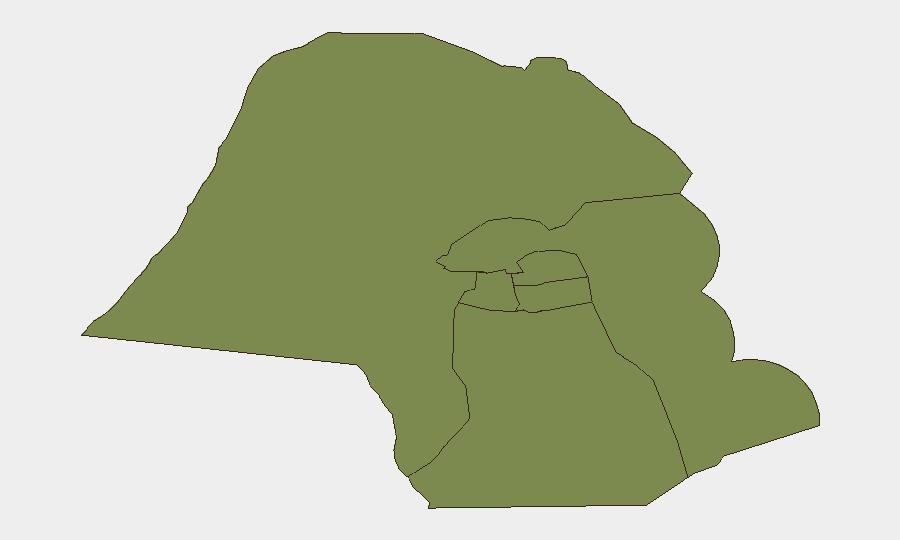
Jahra Governorate is significantly elevated above all other sub-national zones (risk score 31.8 vs. 4.5 for Ahmadi), reflecting its position as a primary impact zone during the current strike cycle and its proximity to Iraqi and Iranian borders where drone and artillery ingress routes converge. Ahmadi Governorate ranks second (4.5), likely reflecting its concentration of oil and energy infrastructure—a validated target set evidenced by the offshore platform strike and power-station damage. Remaining governorates cluster at risk 1.8, indicating lower but residual exposure; the Capital Governorate's inclusion reflects airspace vulnerability and population density near defence installations.
How GeoBit Would Assist
AOI Monitoring & Early Warning on Jahra and Ahmadi governorates—combined with satellite and imagery analysis of power, desalination, and oil-sector assets—provides persistent watch for secondary strikes or infrastructure repair timelines. Conflict & Military battle mapping correlated with maritime and aviation tracking of Iranian and allied drone/missile launch signatures enables advance warning of inbound strike windows. Routing & network analysis supports alternative logistics, supply, and personnel evacuation planning around damaged critical infrastructure and damaged border posts.
7-Day Outlook
Assuming no major escalation in US–Iran hostilities, strike tempo is likely to plateau or reduce, though sporadic drone and artillery activity targeting infrastructure remains probable. Grid restoration and casualty evacuation will occupy Kuwaiti emergency services through early week; secondary incidents (civil unrest, border incursions, maritime interference) may increase if power and water shortages extend beyond 3–5 days. Regional diplomatic engagement and ceasefire signalling will be the primary determinants of whether the current active phase transitions to de-escalation or recycles.
Highest-Risk Areas — Ranked
| # | State / Region | Risk |
|---|---|---|
| 1 | Jahra Governorate | 31.8 |
| 2 | Ahmadi Governorate | 4.5 |
| 3 | Farwaniya Governorate | 1.8 |
| 4 | Hawalli Governorate | 1.8 |
| 5 | Mubarak al-Kabir Governorate | 1.8 |
| 6 | Capital Governorate | 1.8 |
Sources
Previous Daily Briefs
A new Kuwait brief is written every day — each with its own risk map and downloadable CSV. Here's the last week; use the calendar to go further back.
📅 Browse every day by calendar →
Highlighted days have a brief. Tap a day for that day's map & analysis, or “csv” for that day's dataset ($5).
Atlas — our AI intelligence desk — emails them this snapshot personally. Nothing else, no list.