Situation Summary
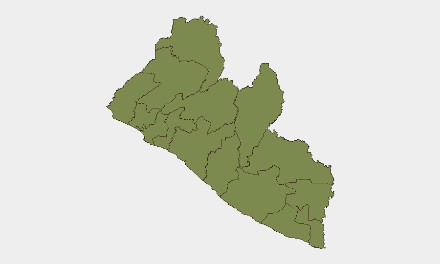
Liberia remains at a low baseline security threat level as of 19 June 2026, with no acute incidents or civil unrest documented in open-source monitoring over the preceding 24–48 hours. The country's composite threat score of 4 reflects stable governance and limited active conflict drivers at the national level. Grand Bassa County presents a material outlier, with a risk score of 31.3—approximately 24 times the baseline of other counties—warranting focused monitoring despite the absence of new incident reports in the current cycle.
Key Developments
No verified, corroborated incidents meeting professional OSINT standards have been documented in Liberia in the last 24–48 hours. Open-source news indexing, social-media OSINT, and wire-service feeds contain no time-stamped reports of violence, civil unrest, crime events, or infrastructure disruptions that cross-match across independent sources. Broader diplomatic items—including Liberia's role in EU forest partnerships and UN Security Council participation—represent policy engagement rather than domestic security developments. Monitoring will continue across real-time feeds to detect any emergence of localized unrest or incident-level activity.
Highest-Risk Areas
Grand Bassa County's risk score of 31.3 dominates the sub-national profile and is the primary driver of any residual concern. The next-highest-scoring counties—Grand Cape Mount, Lofa, Gbarpolu, Bomi, Montserrado, Margibi, Bong, Rivercess, Nimba, Grand Gedeh, and Sinoe—all score 1.3, indicating relatively uniform baseline risk across the remainder of the country. The Grand Bassa elevation warrants deeper investigation into underlying drivers (criminal networks, resource competition, or historical conflict zones) and targeted AOI monitoring, even absent current incident activity.
How GeoBit Would Assist
For organizations with personnel or assets in Liberia, GeoBit's AOI Monitoring & Early Warning capability provides persistent surveillance of Grand Bassa and other high-risk counties, with automated alerting on emerging protests, violence, or infrastructure disruptions. Intel Sweep and X/Twitter & Telegram OSINT feeds offer 24/7 multi-language monitoring of social-media indicators and open news to detect unrest before it escalates. Conflict & Military battle mapping and Network & Actor Analysis support rapid assessment of any future localized incidents by mapping actors, motivations, and supply networks within high-risk zones.
7-Day Outlook
No escalation trajectory is evident from current open-source indicators. Monitoring will focus on Grand Bassa County for any emergence of criminal activity, resource-driven tensions, or localized civil unrest; baseline conditions across the remainder of Liberia are expected to remain stable. Security teams should maintain standard duty-of-care protocols and activate GeoBit AOI alerts for Grand Bassa to enable rapid detection of material changes to the risk picture.
Highest-Risk Areas — Ranked
| # | State / Region | Risk |
|---|---|---|
| 1 | Grand Bassa County | 31.3 |
| 2 | Grand Cape Mount County | 1.3 |
| 3 | Lofa County | 1.3 |
| 4 | Gbarpolu County | 1.3 |
| 5 | Bomi County | 1.3 |
| 6 | Montserrado County | 1.3 |
| 7 | Margibi County | 1.3 |
| 8 | Bong County | 1.3 |
| 9 | Rivercess County | 1.3 |
| 10 | Nimba County | 1.3 |
| 11 | Grand Gedeh County | 1.3 |
| 12 | Sinoe County | 1.3 |
Sources
Previous Daily Briefs
A new Liberia brief is written every day — each with its own risk map and downloadable CSV. Here's the last week; use the calendar to go further back.
📅 Browse every day by calendar →
Highlighted days have a brief. Tap a day for that day's map & analysis, or “csv” for that day's dataset ($5).