Situation Summary
Luxembourg remains a low-threat environment (global rank #168, composite score 4) with no tracked major security incidents. Current risk is driven by cross-border spillover from the Belgian High Fens wildfire and routine public-safety events (traffic collisions, street crime, industrial safety). Infrastructure and emergency-response systems are functioning; no systemic instability or unrest is present.
Key Developments
- Bertrange, 18 Aug 2026 – Residential apartment fire overnight displaced approximately 50 residents across multiple units; emergency services contained the spread. Origin and extent of damage under investigation.
- Luxembourg–Belgium border / air quality, 17–18 Aug 2026 – Smoke and PM10 fine-particle concentrations from Belgium's High Fens wildfire exceeded alert thresholds in Luxembourg; authorities advised residents to close windows and limit outdoor activity.
- Government response, 17 Aug 2026 – National government convened to assess impact of Belgian wildfire; concluded no new emergency measures required at present, indicating situation remains monitored but stable.
- Cross-border emergency deployment, 17–18 Aug 2026 – Eleven Luxembourg volunteer firefighters returned after 36-hour deployment supporting Belgian crews; Luxembourg also deployed a firefighting robot to assist operations in adjacent Saarland, reflecting regional fire-danger environment.
- Routine law enforcement, 15 Aug 2026 – Three arrests following drug checks in Gare district; one European arrest warrant executed. Limited operational details available.
- Street violence, 13 Aug 2026 – Assault at bus stop on Avenue du Luxembourg; suspect apprehended near shopping center. Victim sustained fall-related injuries.
Highest-Risk Areas
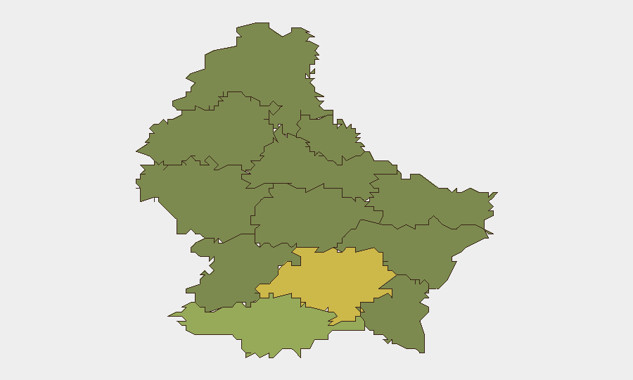
Luxembourg Canton dominates sub-national risk (score 68), driven by urban concentration of population, transport hubs, and commercial activity in the capital and surrounding municipalities. Esch Canton (score 55) follows, reflecting industrial and logistics infrastructure. Together these two cantons account for the majority of recorded incidents—street crime, traffic collisions, and industrial hazards—typical of urban-area risk profiles. Remaining cantons show significantly lower scores (<35), indicating risk is geographically concentrated rather than distributed. No canton exhibits systemic instability or organized threat activity.
How GeoBit Would Assist
Intel Sweep & OSINT Fusion would monitor Luxembourg's public-safety, emergency-response, and cross-border incident feeds in real time, flagging emerging patterns (e.g., cluster of street robberies, industrial incidents) before they escalate. AOI Monitoring & Early Warning would track high-risk urban zones (Gare district, commercial centers) and wildfire-adjacent border regions, with automated alerts on air-quality breaches, evacuation orders, or crowd events. Routing & Network Analysis would support security teams in planning alternative transport routes for personnel and assets in response to road disruptions, air-quality warnings, or emergency closures. Environmental & Health monitoring would track transboundary smoke and pollution events affecting operations and staff welfare.
7-Day Outlook
The High Fens wildfire remains the primary near-term driver of operational risk in Luxembourg, with cross-border smoke expected to persist through mid-week depending on wind patterns. Routine street crime and traffic incidents will likely continue at baseline rates; no escalation in violence or organized activity is anticipated. Emergency-response capacity is engaged but adequate; no infrastructure disruption to transport or commerce is currently forecast.
Highest-Risk Areas — Ranked
| # | State / Region | Risk |
|---|---|---|
| 1 | Luxembourg Canton | 68 |
| 2 | Esch Canton | 55 |
| 3 | Mersch Canton | 32 |
| 4 | Capellen Canton | 28 |
| 5 | Grevenmacher Canton | 22 |
| 6 | Diekirch Canton | 18 |
| 7 | Echternach Canton | 16 |
| 8 | Redange Canton | 15 |
| 9 | Remich Canton | 14 |
| 10 | Wiltz Canton | 12 |
| 11 | Clervaux Canton | 10 |
| 12 | Vianden Canton | 8 |
Sources
Previous Daily Briefs
A new Luxembourg brief is written every day — each with its own risk map and downloadable CSV. Here's the last week; use the calendar to go further back.
- August 16, 2026
- August 14, 2026
- August 12, 2026
- August 10, 2026
- August 8, 2026
- August 6, 2026
- August 5, 2026
📅 Browse every day by calendar →
Highlighted days have a brief. Tap a day for that day's map & analysis, or “csv” for that day's dataset ($5).
Atlas — our AI intelligence desk — emails them this snapshot personally. Nothing else, no list.