Situation Summary
Madagascar remains a low-to-moderate security environment globally (rank #61, composite score 19) with concentrated risk in the capital region. No confirmed security incidents, civil unrest, armed clashes, or infrastructure disruptions have been reported in open sources over the last 24–48 hours. Regional diplomatic engagement through SADC is intensifying, but has not translated into observable domestic instability at this time.
Key Developments
- SADC Political Oversight Mechanism (Antananarivo, 3–4 July 2026): Southern African Development Community leaders established a formal liaison office in Antananarivo and mandated quarterly transition progress reports and a draft roadmap due 28 February 2026. This represents tightened external scrutiny of Madagascar's political transition process but carries no associated reports of violence, protests, or transport disruption.
- No Corroborated Incidents (Last 24–48 Hours): Open-source monitoring including news wires, social media, and travel advisories has not surfaced any discrete security events (protests, riots, crimes, or facility damage) in Madagascar during 3–4 July 2026. Closed-source intelligence feeds may contain additional information not yet indexed publicly.
Highest-Risk Areas
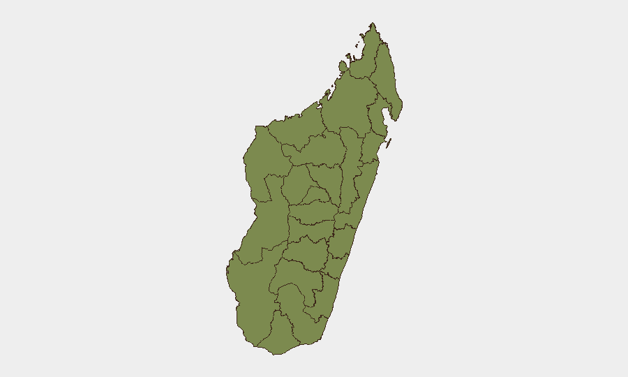
Analamanga region (composite risk 31.4)—which contains the capital Antananarivo—accounts for the overwhelming majority of Madagascar's measurable threat exposure. All other eleven tracked regions cluster at risk score 1.4, indicating that security concern, event frequency, and operational disruption are heavily concentrated in the capital and its immediate surroundings. Risk drivers in Analamanga likely include urban crime, political activity, and demonstration potential; southern and western regions show minimal recorded activity or reported incidents in the current dataset.
How GeoBit Would Assist
Security teams with personnel or assets in Madagascar should deploy AOI Monitoring & Early Warning capability on Analamanga (especially Antananarivo) to detect emerging protests, political gatherings, or civil unrest before they escalate. Intel Sweep and multi-language OSINT (including X/Twitter, local media, and Telegram) should be configured to flag any change in political transition messaging, SADC demands, or street-level sentiment. For mobility security, Routing & Network Analysis can model alternative transport corridors away from high-risk urban centers if circumstances deteriorate.
7-Day Outlook
SADC's institutional oversight—while not an immediate security trigger—establishes a formal accountability framework that could amplify political tensions if transition milestones slip or if civil-society actors view external pressure as insufficient. No imminent incident indicators are visible in current open-source data. Duty-of-care teams should maintain baseline awareness of Analamanga region dynamics and monitor for any friction between government entities and SADC representatives, but the near-term environment remains stable relative to regional and global benchmarks.
Report Date: 2026-07-05
Confidence: Open-source data only; closed-source feeds may contain additional current detail.
Next Update: 2026-07-06
Highest-Risk Areas — Ranked
| # | State / Region | Risk |
|---|---|---|
| 1 | Analamanga | 31.4 |
| 2 | Menabe | 1.4 |
| 3 | Atsimo-Andrefana | 1.4 |
| 4 | Ihorombe | 1.4 |
| 5 | Anosy | 1.4 |
| 6 | Androy | 1.4 |
| 7 | Melaky | 1.4 |
| 8 | Boeny | 1.4 |
| 9 | Haute Matsiatra | 1.4 |
| 10 | Fitovinany | 1.4 |
| 11 | Atsimo-Atsinanana | 1.4 |
| 12 | Diana Region | 1.4 |
Previous Daily Briefs
A new Madagascar brief is written every day — each with its own risk map and downloadable CSV. Here's the last week; use the calendar to go further back.
📅 Browse every day by calendar →
Highlighted days have a brief. Tap a day for that day's map & analysis, or “csv” for that day's dataset ($5).
Atlas — our AI intelligence desk — emails them this snapshot personally. Nothing else, no list.