Situation Summary
Malawi's security environment remains stable with no acute incidents confirmed in the last 24–48 hours. The Central Region continues to carry elevated composite risk (31.3), though current reporting does not clarify the underlying drivers. Economic and food-security stress, underscored by an IMF mission concluding 18 June 2026 in Lilongwe and Blantyre, represents the primary structural concern; such pressures can erode stability over months if unaddressed.
Key Developments
Insufficient verifiable incidents in the last 24–48 hours to populate a full current-event briefing. Open-source reporting indexed to the past two days does not surface discrete security, unrest, crime, or infrastructure events meeting standard verification thresholds. The most recent substantive development is:
- Lilongwe & Blantyre – 18 June 2026 – IMF Economic Review Concludes
An IMF staff mission led by Justin Tyson completed an in-country visit to discuss Malawi's Extended Credit Facility arrangement. The mission highlighted ongoing fiscal stabilization efforts and food-security challenges as policy priorities. No security incidents or protest activity were reported in connection with the visit, but continued economic stress and potential food-security volatility remain structural risk factors warranting monitoring.
Note: GeoBit's event signals for 17–19 June (military mobilization alerts, public statements involving Durban and regional actors) require corroboration against verified local and international sources. Until independently confirmed, these should be treated as preliminary and investigated via real-time OSINT tasking.
Highest-Risk Areas
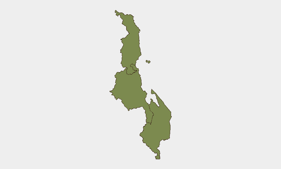
The Central Region (composite risk 31.3) is significantly elevated relative to Southern and Northern regions (both 1.3). The gap suggests localized drivers—whether political, economic, criminal, or institutional—concentrated in or around Lilongwe, Malawi's capital and administrative centre. The disparity warrants immediate tasking of geo-specific OSINT and area-of-interest monitoring to clarify whether risk reflects known structural vulnerabilities (e.g., urban crime, resource competition, governance challenges) or emerging tensions not yet visible in English-language open reporting. Southern and Northern regions show minimal comparative risk at present.
How GeoBit Would Assist
Real-time OSINT and AOI Monitoring would immediately clarify the Central Region risk spike: persistent monitoring of Lilongwe via social-media intelligence, local news feeds (Nation Online, Times Group, MBC, Zodiak), police and disaster-management agency statements, and sentiment analysis would surface nascent unrest, crime patterns, or political friction before operational impact. Conflict & Military tracking would validate or refute the military-mobilization signals dated 18 June; cross-referencing defence-ministry statements, unit SIGINT, and border-surveillance data would distinguish genuine force movements from rhetorical posturing. Economic & Trade analysis paired with humanitarian data would contextualize food-security pressures and forecast friction points (e.g., market volatility, transport disruption, livelihood collapse) that could drive secondary unrest.
7-Day Outlook
Barring new unrest or external shocks, Malawi is likely to remain operationally calm in the near term. However, structural economic and food-security pressures—especially if the IMF arrangement stalls or regional drought worsens—pose medium-term destabilization risk. Duty-of-care teams should maintain heightened awareness of the Central Region and task continuous OSINT monitoring rather than rely on incident-driven alerts.
Highest-Risk Areas — Ranked
| # | State / Region | Risk |
|---|---|---|
| 1 | Central Region, Malawi | 31.3 |
| 2 | Southern Region, Malawi | 1.3 |
| 3 | Northern Region, Malawi | 1.3 |
Sources
Previous Daily Briefs
A new Malawi brief is written every day — each with its own risk map and downloadable CSV. Here's the last week; use the calendar to go further back.
📅 Browse every day by calendar →
Highlighted days have a brief. Tap a day for that day's map & analysis, or “csv” for that day's dataset ($5).