Situation Summary
Niger remains under a U.S. Level 4 "Do Not Travel" advisory following the January 2026 drawdown of non-emergency U.S. government staff, reflecting sustained and elevated risks from terrorism, kidnapping, armed crime, and civil unrest. The security environment is characterized by active jihadist operations across multiple regions, limited state capacity for emergency response, and movement restrictions that constrain both travel and humanitarian access. Recent event signals indicate elevated political and social tension, though no mass demonstrations have materialized since 2023. The overall threat trajectory remains downward in global ranking (position #25), but localized risks in border and Sahel zones remain acute.
Key Developments
- Nationwide (Niger) – U.S. State Department reaffirmed Level 4 advisory on 30 January 2026 citing crime, unrest, terrorism, health risks, and kidnapping; non-emergency diplomatic personnel and families ordered to depart; limited U.S. capacity for emergency assistance outside Niamey.
- Niamey (capital) – Recent attacks and kidnappings of foreigners documented; terrorist groups continue active planning against international targets; local police response capacity described as limited, particularly outside business hours.
- Tillabéri Region (tri-border Mali/Burkina Faso zone) – Ongoing state of emergency and movement restrictions; recent terrorist attacks and kidnappings reported; jihadist groups operate across porous borders with limited state interdiction.
- Diffa Region (Lake Chad basin) – Identified as current high-activity zone for terrorist plots and kidnappings for ransom; sustained jihadist presence and kidnapping networks pose acute risk to personnel and supply lines.
- Countrywide demonstrations risk – Political and economic grievances can trigger rapid, unannounced protests that turn violent; no mass demonstrations since 2023, but underlying tension remains.
- Nationwide armed crime – Frequent violent robbery, residential break-ins, and banditry targeting foreigners; medical and emergency response infrastructure severely limited, elevating injury/illness severity.
- Multi-region state of emergency – Border areas and Sahel zones under active restrictions; overland travel severely constrained; humanitarian and diplomatic movement limited.
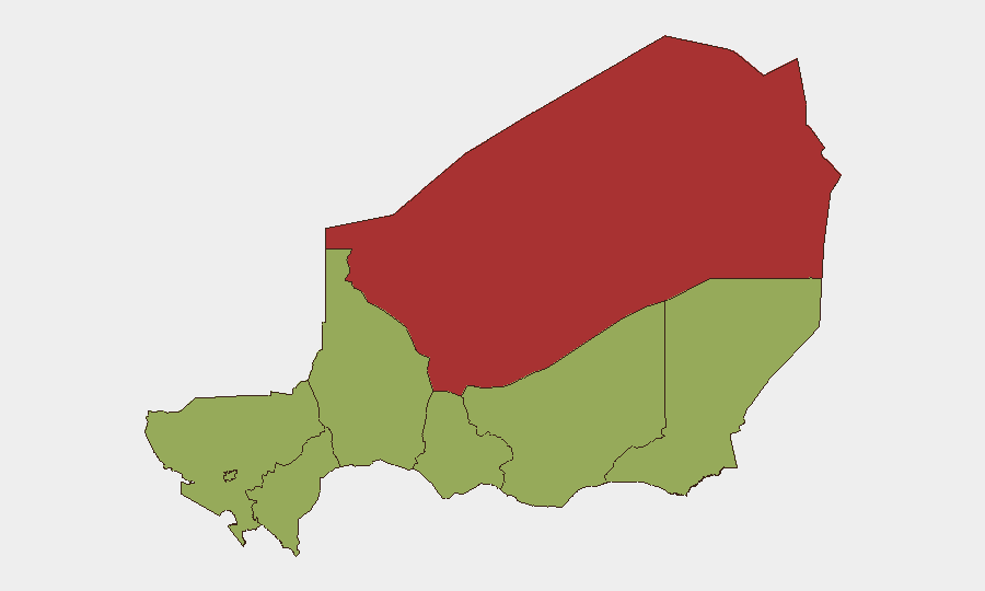
Highest-Risk Areas
Agadez Region (79.8) drives the sub-national ranking significantly above all other zones, reflecting proximity to Mali/Burkina Faso jihadist sanctuaries, porous borders, and mining-sector vulnerabilities. Zinder, Diffa, and Tillabéri regions (all 49.8) form a secondary tier characterized by Lake Chad basin instability, tri-border ungoverned space, and state-of-emergency restrictions. Niamey itself scores 49.8 despite capital-city state presence, indicating documented kidnappings, recent terrorist attacks, and limited police capacity create persistent risk even in the seat of government. All remaining regions score 49.8, suggesting diffuse risk distribution across Niger, with secondary hotspots in Tahoua and Maradi reflecting spillover from Agadez/Diffa activity.
How GeoBit Would Assist
Security and risk teams operating in Niger should leverage AOI Monitoring & Early Warning to establish persistent watch on Agadez, Diffa, Tillabéri, and Niamey for real-time alerts on kidnapping/attack activity. Intelligence Sweep, OSINT fusion, and multi-language Telegram/X monitoring enable early detection of jihadist cell communications, ransom demands, and protest organizing before incidents escalate. Routing & Network Analysis supports contingency planning by identifying alternative cross-border and intra-national routes avoiding state-of-emergency zones, critical for duty-of-care evacuation planning.
7-Day Outlook
No imminent change to the overall threat posture is anticipated. Jihadist groups will likely maintain operational tempo in Agadez, Diffa, and Tillabéri; crime and kidnapping risk will remain persistent in Niamey and secondary cities. State-of-emergency restrictions are expected to remain in place, constraining movement and external support options for international personnel and assets.
Highest-Risk Areas — Ranked
| # | State / Region | Risk |
|---|---|---|
| 1 | Agadez Region | 79.8 |
| 2 | Zinder Region | 49.8 |
| 3 | Diffa Region | 49.8 |
| 4 | Tillabéri Region | 49.8 |
| 5 | Niamey | 49.8 |
| 6 | Tahoua Region | 49.8 |
| 7 | Dosso Region | 49.8 |
| 8 | Maradi Region | 49.8 |
Previous Daily Briefs
A new Niger brief is written every day — each with its own risk map and downloadable CSV. Here's the last week; use the calendar to go further back.
📅 Browse every day by calendar →
Highlighted days have a brief. Tap a day for that day's map & analysis, or “csv” for that day's dataset ($5).