Situation Summary
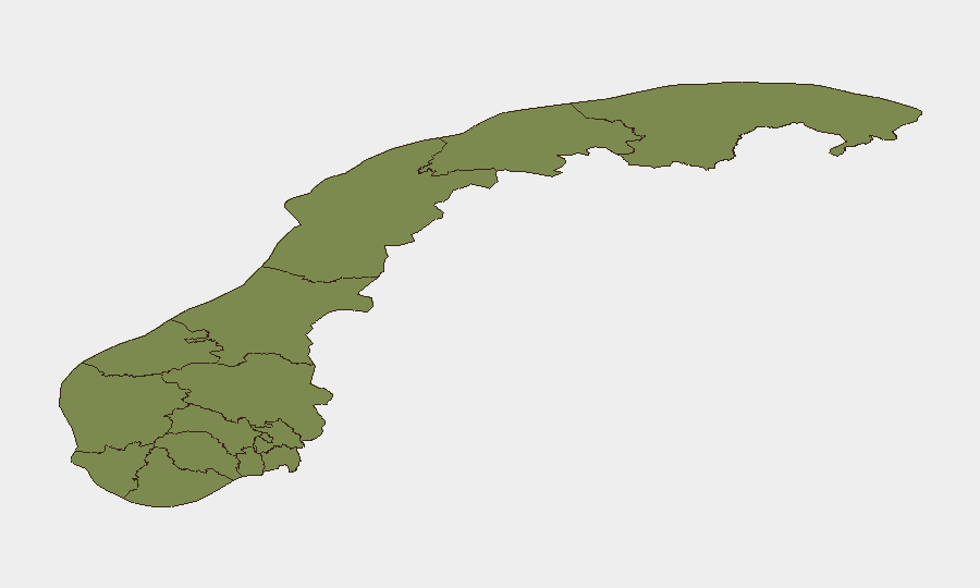
Norway remains a low-threat environment globally (rank #136, composite score 5), but localized volatility in Buskerud and Oslo counties has generated a cluster of property-damage incidents, violent confrontations, and police-resident tensions in the past 48 hours. The spike in small-scale criminal and civil-order events—including knife assault, arson attempt, gas evacuation, and threatening behavior—does not indicate systemic destabilization but reflects concentrated friction in two high-density regions. Overall trajectory remains stable; no credible terrorism, organized-crime escalation, or state-actor involvement has been confirmed.
Key Developments
- Asker (Buskerud), 18 July: Police responded to a violent incident involving knife and blunt-force weapons; two individuals were injured and received treatment. This is the region's highest-risk county and reflects the ongoing concentration of interpersonal violence.
- Nannestad (Innlandet), night of 18 July: Police received a report of attempted arson at Stensgård church, with an attempt to ignite a door frame and lighter fluid detected. This marks a second recent arson attempt at the same location, signaling a potential pattern.
- Oslo, Tjuvholmen, 18 July: Police and emergency services evacuated the restaurant Hanami following reports of a gas leak; firefighters confirmed no hazardous readings and the evacuation was lifted without injury.
- Drammen (Buskerud), Strømsø, 18 July: Police responded to a report of a person being threatened in an apartment; the victim had already left and no injuries were reported.
- Bodø (Nordland), Stormyra, 18 July: Police arrested an individual after locating a knife during a search following reports of threatening and non-compliant behavior.
- Event Signal Cluster: GeoB's event tracker recorded six property-seizure/damage incidents and multiple police-resident confrontations (18–19 July), concentrated in Buskerud and Oslo, alongside a political-dissent signal and an unspecified demand attributed to Russia on 18 July. The Russia signal requires clarification and further corroboration.
Highest-Risk Areas
Buskerud county (composite risk 31.9) is the dominant driver, accounting for multiple recent violent and property-damage incidents within a 48-hour window. Oslo (risk 20.5) is the secondary hotspot, with the gas-leak evacuation and ongoing police-resident friction. Together, these two regions represent approximately 71% of Norway's tracked composite threat; Innlandet (11.2), primarily driven by the church-arson pattern, ranks third. All other regions remain below 5.0 risk scores. The concentration suggests localized criminal activity and civil tensions rather than nationwide instability.
How GeoBit Would Assist
Corporate security and duty-of-care teams operating in Buskerud and Oslo should employ Intel Sweep and multi-language OSINT fusion to monitor emerging police incident logs, local media, and social-media sentiment in real time. AOI Monitoring & Early Warning with persistent geographic focus on high-risk municipalities (Asker, Drammen, central Oslo) would provide automated alerting on new violent incidents, arson attempts, or police actions before they escalate. Routing & Network Analysis can identify safer alternative routes and facility siting for personnel and assets in these two counties, while Conflict & Military event tracking will distinguish isolated criminal events from organized unrest or state-level pressure.
7-Day Outlook
No imminent major escalation is forecast. The current event cluster appears consistent with routine criminal and civil-order activity typical of high-density urban areas, albeit elevated in Buskerud. Monitoring of the arson pattern at Stensgård church and the unspecified Russia-linked demand is warranted to confirm whether either signals an emerging organized threat. Personnel in Buskerud and Oslo should maintain standard security posture; no evacuations or travel restrictions are recommended at present.
Highest-Risk Areas — Ranked
| # | State / Region | Risk |
|---|---|---|
| 1 | Buskerud | 31.9 |
| 2 | Oslo | 20.5 |
| 3 | Innlandet | 11.2 |
| 4 | Rogaland | 10.5 |
| 5 | Vestland | 4 |
| 6 | Agder | 3.3 |
| 7 | Trøndelag | 2.6 |
| 8 | Troms | 1.9 |
| 9 | Finnmark | 1.9 |
| 10 | Nordland | 1.9 |
| 11 | Telemark | 1.9 |
| 12 | Akershus | 1.9 |
Sources
Previous Daily Briefs
A new Norway brief is written every day — each with its own risk map and downloadable CSV. Here's the last week; use the calendar to go further back.
📅 Browse every day by calendar →
Highlighted days have a brief. Tap a day for that day's map & analysis, or “csv” for that day's dataset ($5).
Atlas — our AI intelligence desk — emails them this snapshot personally. Nothing else, no list.