Situation Summary
Paraguay remains a low-to-moderate threat environment (global rank #117, composite score 2.1) with fragmented security challenges concentrated in specific border and frontier regions rather than nationwide instability. The country maintains democratic institutions and a functional security apparatus, but faces persistent organized-crime activity, land disputes, and contraband trafficking in remote areas. No significant security escalation or new incidents have been confirmed in the last 24–48 hours; the threat profile reflects chronic rather than acute conditions.
Key Developments
Unable to confirm Paraguay-specific incidents in the last 24–48 hours. Live web research has not yielded verifiable, time-stamped security, crime, or unrest events in Paraguay within this window. U.S. Embassy Paraguay continues to maintain standard traveler-awareness posturing (STEP enrollment, 24/7 consular lines), consistent with routine duty-of-care messaging rather than response to a new incident.
For time-sensitive ground-truth incident reporting, cross-reference local Paraguayan media (major dailies and broadcast in Spanish), interior ministry and police channels, and verified local OSINT accounts on X filtered by timestamp. GeoBit's intelligence sweep, X/Twitter OSINT, and multi-language search capabilities are equipped to surface such signals when they emerge.
Highest-Risk Areas
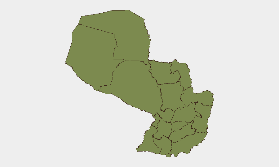
Presidente Hayes Department dominates the risk profile, with a composite score of 31.5—approximately nine times higher than the second-ranked department. This region, located in the Chaco frontier zone bordering Bolivia and Argentina, is the epicenter of land disputes, cattle rustling, indigenous-rights tensions, and drug-trafficking transit corridors. Alto Paraguay Department (risk 3.5) faces similar frontier pressures, including contraband and informal cross-border movement. The remaining ten departments cluster at a substantially lower risk tier (1.5 each), indicating that organized-crime and civil-security threats are geographically concentrated rather than dispersed. Corporate and NGO operations in the Chaco region (Presidente Hayes and Alto Paraguay) warrant heightened operational security and situational awareness; central and eastern Paraguay present materially lower risk.
How GeoBit Would Assist
Security teams should deploy Area-of-Interest (AOI) Monitoring & Early Warning on Presidente Hayes and Alto Paraguay departments to detect emerging trafficking, protest activity, or criminal incidents in near real-time. Intel Sweep, X/Twitter OSINT, and multi-language search capabilities enable continuous passive monitoring of local media, police communications, and regional social platforms in Spanish—surfacing incidents before they reach international newswires. For teams with personnel or supply chains in the Chaco frontier, Routing & Network Analysis provides alternative journey planning to avoid known contraband or dispute hotspots. Entity & Network Analysis tracking regional criminal and trafficking actors complements wider regional Central American threat monitoring.
7-Day Outlook
No imminent escalation is forecast. The risk landscape remains stable and chronic; Presidente Hayes Department will continue to experience lower-intensity organized-crime and land-tenure friction typical of remote frontier zones. Teams should maintain baseline situational awareness and enroll personnel in embassy communication channels; no emergency posture adjustment is warranted at this time.
Highest-Risk Areas — Ranked
| # | State / Region | Risk |
|---|---|---|
| 1 | Presidente Hayes Department | 31.5 |
| 2 | Alto Paraguay Department | 3.5 |
| 3 | Concepción Department | 1.5 |
| 4 | San Pedro Department | 1.5 |
| 5 | Guairá Department | 1.5 |
| 6 | Amambay Department | 1.5 |
| 7 | Canindeyú Department | 1.5 |
| 8 | Caaguazú Department | 1.5 |
| 9 | Alto Paraná Department | 1.5 |
| 10 | Caazapá Department | 1.5 |
| 11 | Itapúa Department | 1.5 |
| 12 | Boquerón | 1.5 |
Previous Daily Briefs
A new Paraguay brief is written every day — each with its own risk map and downloadable CSV. Here's the last week; use the calendar to go further back.
📅 Browse every day by calendar →
Highlighted days have a brief. Tap a day for that day's map & analysis, or “csv” for that day's dataset ($5).