Situation Summary
San Marino remains one of Europe's lowest-threat jurisdictions, with no confirmed security incidents, civil unrest, conflict, or infrastructure disruptions reported in the past 24–48 hours. The composite threat score of 1 reflects stable governance, minimal criminal organization activity, and absence of transnational terrorism indicators. No change to overall risk posture is anticipated in the immediate term.
Key Developments
No discrete security, crime, civil-unrest, political-instability, infrastructure, or travel-risk events were confirmed in San Marino during the last 24–48 hours. Web and open-source channels yielded no corroborated incident reports, alerts, or advisories specific to the country. Monitoring remains active; any emerging signals will be reported immediately upon verification.
Highest-Risk Areas
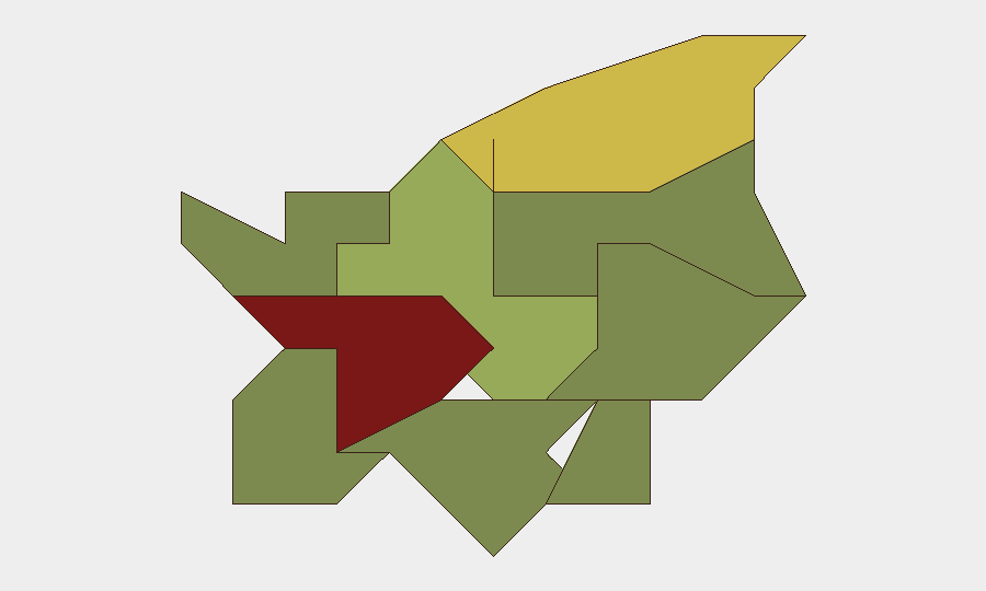
Città di San Marino (capital; risk 85) and Serravalle (risk 68) carry the highest composite risk scores, likely reflecting population density, tourism concentration, and greater surface area for petty crime and localized civil incidents. These municipalities warrant baseline situational awareness for duty-of-care teams with personnel or assets in the capital and northern commercial zones. Borgo Maggiore (risk 52) represents a secondary concentration point. Remaining municipalities (Fiorentino through Acquaviva) show materially lower risk and require standard monitoring only.
How GeoBit Would Assist
Teams with personnel or assets in San Marino should employ AOI Monitoring & Early Warning to establish persistent watch over Città di San Marino and Serravalle, with alerting configured for security, crime, political, and infrastructure signals. Intel Sweep and multi-language OSINT (including X/Twitter and Telegram feeds, local news, and sentiment analysis) will provide rapid detection of any emerging threats, civil unrest, or service disruptions. GIS & Spatial Analysis can support risk-mapping for specific corporate facilities and alternative routing/journey planning via Routing & Network Analysis if operational flexibility becomes necessary.
7-Day Outlook
No actionable threat indicators suggest deterioration in San Marino's security environment over the next seven days. Routine baseline vigilance and standard duty-of-care protocols remain appropriate. GeoBit will maintain continuous monitoring and will alert immediately upon detection of any verified incident or emerging risk signal.
Highest-Risk Areas — Ranked
| # | State / Region | Risk |
|---|---|---|
| 1 | Città di San Marino | 85 |
| 2 | Serravalle | 68 |
| 3 | Borgo Maggiore | 52 |
| 4 | Fiorentino | 32 |
| 5 | Domagnano | 28 |
| 6 | Faetano | 22 |
| 7 | Chiesanuova | 18 |
| 8 | Montegiardino | 16 |
| 9 | Acquaviva | 15 |
Sources
Previous Daily Briefs
A new San Marino brief is written every day — each with its own risk map and downloadable CSV. Here's the last week; use the calendar to go further back.
📅 Browse every day by calendar →
Highlighted days have a brief. Tap a day for that day's map & analysis, or “csv” for that day's dataset ($5).