Situation Summary
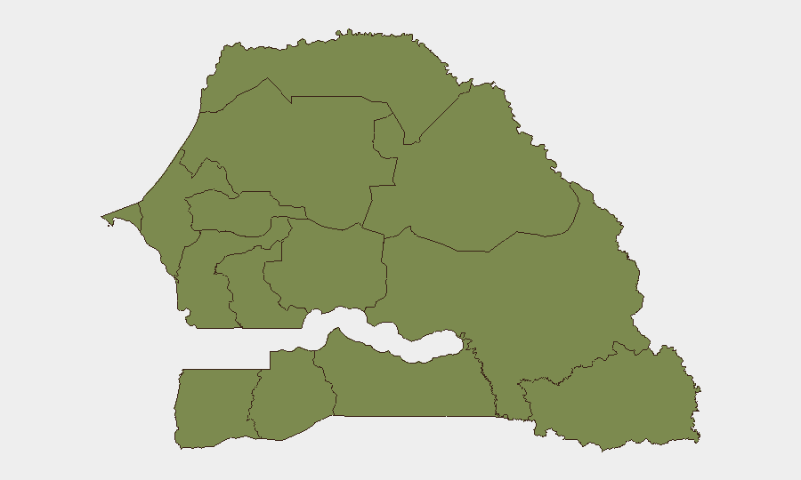
Senegal remains one of West Africa's most politically stable democracies, with a composite threat score of 9 placing it at the lower end of global risk. However, security exposure is heavily concentrated in the northeastern Tambacounda Region (risk score 31.3), which faces persistent cross-border pressure linked to armed group activity in the Sahel. All other regions score substantially lower (1.3–6.3), indicating risk is geographically fragmented and manageable outside the far north. The national security trajectory remains stable absent major political or institutional shocks.
Key Developments
No clearly verifiable security, conflict, civil unrest, crime, political instability, or travel-risk incidents specific to Senegal have been identified in open-source intelligence for 19–20 June 2026. Standard web search and accessible social-media OSINT do not yield timestamped, cross-confirmed events within the last 24–48 hours meeting operational security-brief criteria. Recent surface results reference older political events (2021–2025), diplomatic engagements, and sports-related security matters abroad rather than domestic incidents. Absence of reportage does not indicate absence of risk—it reflects a gap in real-time visibility via unclassified channels. Security teams should rely on embassy alerts, premium threat feeds, and local media (French/Wolof) for sub-daily updates not yet indexed globally.
Highest-Risk Areas
Tambacounda Region dominates the threat landscape with a risk score of 31.3, nearly five times higher than any other area. This reflects its proximity to the Mali and Mauritania borders, porous terrain, and documented presence of transnational armed groups operating in the broader Sahel. Fatick Region (6.3) shows secondary but notably elevated risk, warranting targeted monitoring. All other regions cluster at 1.3–1.3, including the capital region (Dakar, 1.3), indicating that routine civil unrest, crime, and political risk are distributed evenly and at very low baseline levels across the rest of the country. Northern and eastern border zones remain the primary area of concern for kidnapping, banditry, and militant activity.
How GeoBit Would Assist
Security teams monitoring Senegal should deploy AOI (Area-of-Interest) Monitoring & Early Warning on Tambacounda and cross-border transit corridors to detect emerging militant movement, arms trafficking, or kidnapping patterns with persistent alerting. OSINT fusion (multi-language social media, radio SIGINT, and local media intelligence) across French and Wolof channels will capture breaking incidents, official statements, and clandestine communications missed by English-language news. Routing & Network Analysis can identify safer, real-time alternative travel routes for personnel in the north and flag checkpoints or roadblocks ahead of deployment.
7-Day Outlook
No acute triggers are evident in the immediate horizon. Political institutions remain functional, and the June 2026 calendar does not align with known electoral or ceremonial flashpoints. Tambacounda and eastern border zones will likely continue to experience low-level militant probing and banditry consistent with regional Sahel patterns; escalation is possible but not imminent absent external shocks. Monitoring should remain routine but persistent, with heightened alerting sensitivity around any French military activity, Mali-Senegal diplomatic incidents, or cross-border weapons movements.
Highest-Risk Areas — Ranked
| # | State / Region | Risk |
|---|---|---|
| 1 | Tambacounda Region | 31.3 |
| 2 | Fatick Region | 6.3 |
| 3 | Dakar Region | 1.3 |
| 4 | Louga Region | 1.3 |
| 5 | Thiès Region | 1.3 |
| 6 | Diourbel Region | 1.3 |
| 7 | Kaolack Region | 1.3 |
| 8 | Saint-Louis Region | 1.3 |
| 9 | Kaffrine Region | 1.3 |
| 10 | Ziguinchor Region | 1.3 |
| 11 | Sédhiou Region | 1.3 |
| 12 | Kolda Region | 1.3 |
Sources
Previous Daily Briefs
A new Senegal brief is written every day — each with its own risk map and downloadable CSV. Here's the last week; use the calendar to go further back.
📅 Browse every day by calendar →
Highlighted days have a brief. Tap a day for that day's map & analysis, or “csv” for that day's dataset ($5).