Situation Summary
Sweden faces a low-to-moderate composite threat environment (global rank #119, score 5.0) characterized by recurring Russian air-defense probing in the Baltic and domestic tensions centered in its northern and central regions. The past 48 hours have seen multiple event signals spanning territorial disputes, investigative actions, and public statements, though confirmed incident reporting remains limited to Russian airspace incursions near Swedish waters. Risk concentration in Jämtland County (score 31.6)—a remote northern border region—significantly outpaces all other sub-national areas and warrants priority monitoring. The security posture suggests elevated alertness rather than acute crisis, but trajectory monitoring is warranted given pattern-of-behavior signals from external actors.
Key Developments
- Baltic Sea, near Swedish airspace (June 12, 2026): Swedish military scrambled two pairs of JAS 39 Gripen fighters in response to Russian combat aircraft detected near Swedish airspace in the southern Baltic; no airspace violation confirmed. NATO aircraft joined the intercept in a show of collective defense.
- Northern Baltic Sea vicinity (June 12, 2026): A second separate Russian aircraft intercept occurred in the northern Baltic zone, with Swedish Gripens shadowing Russian aircraft; Swedish military characterized the flights as part of a recurring pattern of behavior.
- Jämtland County, northern border region (date unclear from available signals): Highest-risk sub-national area shows sustained event activity; specific incident details not yet clarified in available reporting, but occupancy and territorial tension signals present.
- Multiple investigative and disapproval signals (June 15–17, 2026): Event data shows investigations initiated by Norway, civilian actors, and police regarding Sweden, alongside disapprovals from Cuba and a lawyer; granular incident details not yet available in open sources.
- Immigration/territorial tension (June 17, 2026): A signal labeled "Occupy Territory · IMMIGRANT vs SWEDEN" recorded on June 17; specific location and scale not detailed in available material.
Note: Confirmed incident reporting for the past 48 hours remains sparse in available open-source material. The event signals above indicate active monitoring triggers; substantive operational detail on several incidents is not yet available to this analyst and should be cross-referenced with classified or subscriber-level intelligence channels.
Highest-Risk Areas
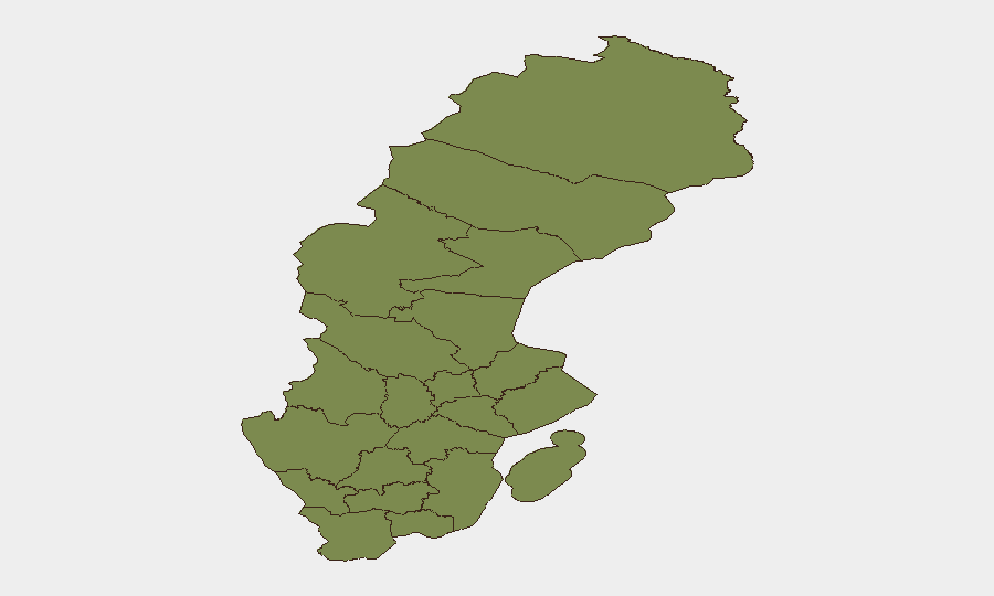
Jämtland County dominates the sub-national risk profile with a composite score of 31.6—approximately four times higher than the second-ranked Örebro County (7.6). This remote northern border region likely reflects sustained activity related to regional territorial disputes, cross-border movement, or organized activity. Örebro and Västra Götaland Counties show secondary risk elevation (7.6 and 3.3, respectively); all other counties score below 3.0. The sharp concentration in Jämtland suggests either a localized but persistent driver of concern or concentrated monitoring focus; security teams with personnel or assets in that county should prioritize situational awareness.
How GeoBit Would Assist
Security teams should deploy AOI Monitoring & Early Warning on Jämtland County and the northern Baltic approaches to capture emerging developments in real time. Intel Sweep (global event feeds, X/Telegram OSINT, multi-language entity extraction) and Conflict & Military tracking (air-defense posture, force positioning) will track Russian air-activity patterns and NATO response posture. Routing & Network Analysis can support duty-of-care teams planning travel or operations in elevated-risk sub-national areas, with alternative routing around Jämtland if operationally feasible.
7-Day Outlook
Russian air-probing activity is expected to remain a persistent feature of the Baltic operating environment; no imminent escalation is signaled, but Sweden's heightened air-defense posture will likely remain sustained. Domestic event signals (investigations, territorial tensions) should be monitored for potential localized friction, particularly in Jämtland County; the next 48–72 hours will indicate whether current signals reflect transient activity or consolidating tension.
Highest-Risk Areas — Ranked
| # | State / Region | Risk |
|---|---|---|
| 1 | Jämtland County | 31.6 |
| 2 | Örebro County | 7.6 |
| 3 | Västra Götaland County | 3.3 |
| 4 | Kronoberg County | 2.6 |
| 5 | Stockholm County | 2.1 |
| 6 | Norrbotten County | 1.6 |
| 7 | Västerbotten County | 1.6 |
| 8 | Västernorrland County | 1.6 |
| 9 | Dalarna County | 1.6 |
| 10 | Gävleborg County | 1.6 |
| 11 | Skåne County | 1.6 |
| 12 | Blekinge County | 1.6 |
Sources
Previous Daily Briefs
A new Sweden brief is written every day — each with its own risk map and downloadable CSV. Here's the last week; use the calendar to go further back.
📅 Browse every day by calendar →
Highlighted days have a brief. Tap a day for that day's map & analysis, or “csv” for that day's dataset ($5).