Situation Summary
Togo remains at a low overall threat level (composite score 11, ranked #null globally) with minimal tracked security incidents in the past 48 hours. However, the northern Savanes and Kara regions present significantly elevated risk (scores 92 and 78 respectively), driven by persistent regional instability factors. A 18 June arrest/detention event involving Togolese authorities and the African Union warrants monitoring for diplomatic or political ramifications, though details remain limited in current reporting.
Key Developments
- 18 June, Nationwide: Togolese authorities arrested or detained an individual or entity in connection with African Union business; no verified follow-up developments or escalation reported in the 48 hours since.
- No verified security, civil-unrest, crime, or infrastructure incidents have been confirmed in open sources for the period 19–20 June.
*Note: Live web research (last 24 hours) did not surface credible, time-stamped security incidents specific to Togo. Further incidents, if they exist, may not yet be indexed in accessible sources or may be reported in French-language media not yet captured in this sweep.*
Highest-Risk Areas
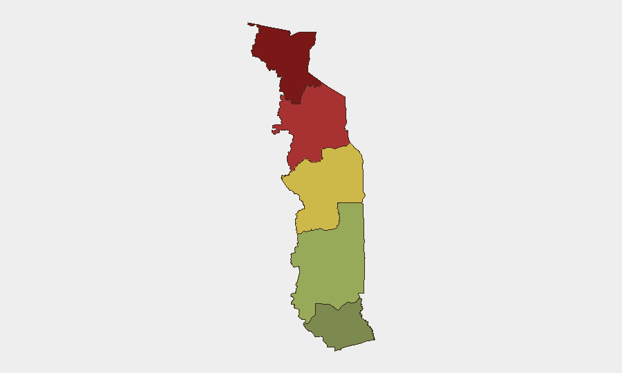
The Savanes Region (risk 92) and Kara Region (risk 78) account for the majority of Togo's sub-national threat profile. Both regions are adjacent to Burkina Faso and Mali, where armed group activity, intercommunal violence, and militant recruitment have intensified since early 2025. The Centrale Region (risk 65) also warrants attention. By contrast, Maritime Region (risk 28) and urban Lome remain comparatively secure. Risk drivers in the north likely include cross-border infiltration, trafficking networks, and spillover from regional conflicts; however, no mass-casualty events or direct takeover attempts in Togo proper have been confirmed recently.
How GeoBit Would Assist
Intel Sweep & OSINT Fusion would systematize real-time monitoring of French, English, and local-language Togolese media, X/Twitter, and Telegram channels to catch incident signals before they reach global wires. AOI Monitoring & Early Warning on the Savanes and Kara regions would establish persistent watch with alerting thresholds for security developments, allowing duty-of-care teams to initiate evacuation or shelter-in-place protocols ahead of deterioration. Network & Actor Analysis combined with multi-language entity extraction would map armed-group presence, trafficking rings, and security-force posture in northern border zones, informing travel-routing decisions and asset-protection placement.
7-Day Outlook
No major escalation is forecast in the immediate 7-day window; Togo's central and southern zones are expected to remain stable. The June 18 arrest event may trigger diplomatic communication or African Union response, but does not signal an imminent political crisis. Continued vigilance on the Savanes–Kara border corridor is warranted, particularly around informal crossing points and market towns frequented by business travelers.
Next Brief: 2026-06-21 (daily) | Recommendations: Enable continuous AOI monitoring on Savanes and Kara regions; subscribe to French-language regional conflict feeds; confirm duty-of-care contact details for all personnel in northern zones.
Highest-Risk Areas — Ranked
| # | State / Region | Risk |
|---|---|---|
| 1 | Savanes Region | 92 |
| 2 | Kara Region | 78 |
| 3 | Centrale Region | 65 |
| 4 | Plateaux Region | 45 |
| 5 | Maritime Region | 28 |
Sources
Previous Daily Briefs
A new Togo brief is written every day — each with its own risk map and downloadable CSV. Here's the last week; use the calendar to go further back.
📅 Browse every day by calendar →
Highlighted days have a brief. Tap a day for that day's map & analysis, or “csv” for that day's dataset ($5).