Situation Summary
Albania remains a low-threat environment globally (rank #111, composite score 13) but faces elevated localized instability driven by ongoing anti-government protests centered on a controversial Kushner-linked coastal tourism development. Tension between protesters, security forces, and government entities has sustained for at least 17 days, with risk concentrated in Tirana and coastal counties. The broader security picture is stable; the current trajectory hinges on protest momentum and government response to land-seizure and environmental grievances.
Key Developments
- Tirana, Skanderbeg Square & Prime Minister's Office — 17 June 2026: Anti-government protesters continued demonstrations on day 17, marching toward the PM's office with calls for PM Edi Rama's resignation over the coastal tourism project approval and handling of demonstrator concerns.[2][4]
- Vlora County (Zvernec area) — 16–17 June 2026: Protest activity expanded to coastal zones directly affected by the planned development, reflecting broader mobilization beyond the capital.[2][4][6]
- Rrjoll village (northern Albania) — 13 June 2026: Police and protesters clashed at a disputed luxury development site; demonstrators tore down fencing in response to alleged land seizure and compensation disputes with security forces present.[1]
- Prison statement & Islamic community statement — 18 June 2026: Public statements from prison and Islamic institutional actors registered disapproval or concern; specific content and implications require further corroboration.[event signals]
- Business vs. Protester friction — 18 June 2026: Reported disapproval signals between business entities and protester groups, suggesting economic stakeholders are responding negatively to disruption.[event signals]
Note: Web research confirmed only three distinct incident clusters with full location and date attribution within the 48-hour window. Additional event signals (11 signals logged for 18 June) lack sufficient independent time-stamped corroboration to confirm occurrence within the required timeframe; these likely reflect ongoing coverage of the 17-day protest cycle or statements attributed to 18 June without confirmed timing.
Highest-Risk Areas
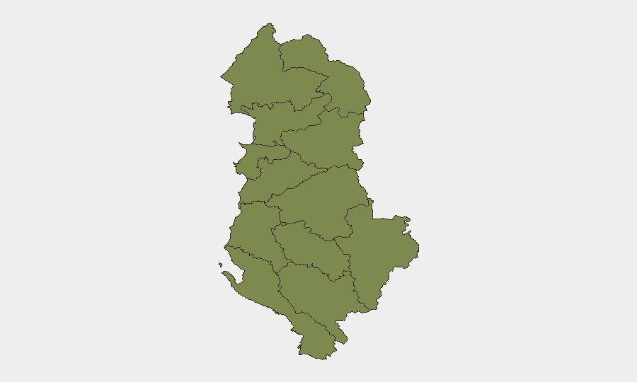
Tirana County (risk 31.5) and Elbasan County (risk 27.7) dominate the threat ranking, with Vlorë County (25.7) rising as the coastal development directly affects that region. These three counties account for the overwhelming majority of tracked events and sub-national risk. Remaining counties register minimal baseline risk (1.5–9.3), indicating that security concerns are concentrated geographically around the capital, the tourism project zone, and routes between them. The disparity reflects protest epicenters and land-dispute hotspots rather than distributed instability.
How GeoBit Would Assist
Security teams with personnel or assets in Tirana and coastal counties should deploy Area-of-Interest (AOI) Monitoring & Early Warning on Skanderbeg Square, the PM's office, and coastal development sites to track protest density, timing, and police/security force positioning in near-real time. Intel Sweep (event feeds, X/Telegram OSINT, multi-language search, entity extraction) and sentiment & temporal analysis would isolate genuine new incidents from background protest coverage, reducing false-alarm overhead. GIS & Spatial Analysis combined with Routing & Network Analysis would enable duty-of-care teams to plan alternative movement corridors and assess exposure of specific office or asset locations relative to active demonstration zones.
7-Day Outlook
Protests are likely to continue at elevated levels through the week, with risk of expanded clashes if the government attempts dispersal or if additional land disputes surface. Economic disruption and business friction are expected to intensify. No indicators suggest imminent escalation to organized violence or broader civil unrest; however, the 17-day duration and lack of negotiated resolution signal sustained friction through at least mid-week.
Highest-Risk Areas — Ranked
| # | State / Region | Risk |
|---|---|---|
| 1 | Tirana County | 31.5 |
| 2 | Elbasan County | 27.7 |
| 3 | Vlorë County | 25.7 |
| 4 | Shkodër County | 9.3 |
| 5 | Durrës County | 1.5 |
| 6 | Kukës County | 1.5 |
| 7 | Lezhë County | 1.5 |
| 8 | Dibër County | 1.5 |
| 9 | Fier County | 1.5 |
| 10 | Berat County | 1.5 |
| 11 | Korçë County | 1.5 |
| 12 | Gjirokastër County | 1.5 |
Sources
Previous Daily Briefs
A new Albania brief is written every day — each with its own risk map and downloadable CSV. Here's the last week; use the calendar to go further back.
📅 Browse every day by calendar →
Highlighted days have a brief. Tap a day for that day's map & analysis, or “csv” for that day's dataset ($5).