Situation Summary
Antigua and Barbuda faces low overall security risk (composite threat score 3; no tracked active events as of 13 June 2026). Web monitoring and open-source reporting confirm no significant security incidents, civil unrest, major crime spikes, or infrastructure disruptions in the past 24–48 hours. Routine government activity—housing redevelopment, education policy announcements, and national event logistics planning—continues without reported disturbance. The security environment remains stable, though Antigua island itself carries elevated sub-national risk relative to Barbuda and Redonda.
Key Developments
- No acute incidents documented. Live web research covering the past 24–48 hours (11–13 June) identified no credible, cross-verified security, conflict, crime, or travel-risk events requiring immediate corporate action.
- St. John's, Antigua – 10 June (evening): Local news coverage reported routine weather and general reporting; no security incidents or civil unrest flagged in overnight bulletins.
- Historic Pointe, St. John's – 10–11 June: ABS TV/Radio reported continued progress on the Booby Alley housing redevelopment project with no mention of labor unrest, forced-eviction protests, or police deployment.
- Bolans area, Antigua – this week: Government social media noted routine scheduling for new housing development; no construction-related labor disputes or protests reported.
- Nationwide – Cabinet update (this week): Office of the Prime Minister confirmed routine coordination on logistics, security, transportation, and accommodation for upcoming national events; no reference to current threats or security gaps.
- Nationwide education sector – this week: Government announced Spanish-language curriculum expansion; no linked social tension or protest activity noted.
- Standing travel advisory (ongoing, not new): U.S. State Department guidance on petty crime and valuables security remains in place but reflects no incident-driven change in advisory level over the 24–48 hour window.
Highest-Risk Areas
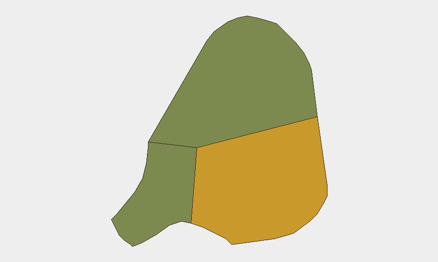
Antigua (composite risk score 72) significantly outpaces Barbuda (18) and Redonda (8), concentrating corporate concern on Antigua island. St. John's and surrounding population centers carry the highest relative exposure to petty crime, localized property crime, and routine criminal activity—consistent with Caribbean norms and historical patterns rather than acute escalation. Barbuda and Redonda present negligible active risk. Organizations with personnel or assets in Antigua should maintain standard duty-of-care protocols (awareness of isolated areas at night, valuables security, staff briefing) but need not elevate alert posture based on current reporting.
How GeoBit Would Assist
Security teams managing operations in Antigua and Barbuda should leverage AOI Monitoring & Early Warning to establish persistent watches on St. John's and key commercial/industrial zones, with automated alerting on protest activity, labor unrest, or security incidents. OSINT Fusion & Corroboration (X/Twitter, local news feeds, multi-language search, entity extraction) enables rapid cross-verification of emerging threats before they reach formal reporting channels. Conflict & Military and Maritime & Aviation tracking capabilities support situational awareness if regional events (e.g., naval or diplomatic incidents in the Eastern Caribbean) pose indirect spillover risk to the islands.
7-Day Outlook
No indicators suggest material change in Antigua and Barbuda's security posture over the next 7 days. Routine government activity and scheduled housing/infrastructure projects are expected to continue. Atlantic hurricane season (June–November) remains a standing environmental risk factor; organizations should ensure business-continuity and supply-chain resilience are current.
Highest-Risk Areas — Ranked
| # | State / Region | Risk |
|---|---|---|
| 1 | Antigua | 72 |
| 2 | Barbuda | 18 |
| 3 | Redonda | 8 |
Sources
Previous Daily Briefs
A new Antigua and Barbuda brief is written every day — each with its own risk map and downloadable CSV. Here's the last week; use the calendar to go further back.
📅 Browse every day by calendar →
Highlighted days have a brief. Tap a day for that day's map & analysis, or “csv” for that day's dataset ($5).