Situation Summary
Bahrain maintains a composite threat ranking of 37 globally (#47), reflecting baseline political tension and regional Gulf security dynamics rather than acute on-the-ground instability. No corroborated security incidents, unrest, or infrastructure attacks within Bahraini territory have been confirmed in the last 24–48 hours by independent sources. Risk remains distributed across all four governorates equally (score 1.4 each), suggesting systemic low-level tensions rather than geographic flashpoints.
Key Developments
- No confirmed Bahrain-internal incidents in past 24–48 hours. Multiple social-media claims of Iranian attacks on fuel facilities, fires at company sites, and strikes near the Fifth Fleet headquarters circulate on Facebook and TikTok but lack verifiable timestamps, independent corroboration, or mainstream-outlet confirmation.
- Strait of Hormuz shipping activity – unconfirmed incident. An unverified Instagram post dated 26 June claims a Taiwan-operated container vessel was struck by an unidentified object in the Strait of Hormuz; no mainstream reporting or Bahraini-port impact has been confirmed.
- Alleged UN evacuation pause – Hormuz region. A Facebook claim suggests the UN paused evacuation operations in the Strait of Hormuz following a vessel attack, with thousands of sailors allegedly stranded. No credible wire-service corroboration or specific timing is available.
- Broader Iran–US–Gulf tensions continue. Live regional security coverage (27 June) reflects ongoing Strait of Hormuz shipping evacuations and military posturing but reports no new kinetic events inside Bahrain itself during 26–27 June.
- Political statements and opposition activity (26 June). Multiple public statements from the Ministry, opposition leaders, and the Prime Minister were recorded in event feeds, consistent with baseline domestic political discourse. No linked violence or unrest incidents are reported.
- Police small-arms activity (26 June). A police engagement was logged in the event signal set; no casualty, location, or incident-type detail is available in the current data.
Highest-Risk Areas
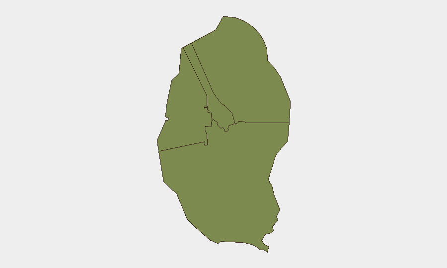
All four governorates (Northern, Capital, Southern, Muharraq) carry identical composite risk scores (1.4), indicating that risk is not geographically concentrated but rather distributed as a systemic, nationwide feature. This pattern suggests vulnerability stems from baseline political sensitivities, regional spillover concerns (particularly proximity to the Strait of Hormuz and Iran-conflict developments), and policing activity rather than active conflict or criminal hotspots. No governorate presents materially higher exposure than others at this time.
How GeoBit Would Assist
Teams with people or assets in Bahrain should employ AOI Monitoring & Early Warning to flag any credible on-the-ground incidents in real time, coupled with OSINT fusion & corroboration to filter unverified social-media claims from confirmed events. Conflict & Military and Maritime & Aviation tracking capabilities are relevant for monitoring Strait of Hormuz developments and any escalation with potential knock-on effects for Bahraini ports, airspace, or critical infrastructure.
7-Day Outlook
Near-term security conditions in Bahrain are expected to remain stable absent a major escalation in Iran–US–Gulf tensions. Monitoring of social-media claims regarding attacks, facility fires, or military strikes should continue, as circulating narratives—whether accurate or not—can drive civil unrest or business disruption. Duty-of-care teams should sustain baseline situational awareness and route/network contingency planning in case regional Strait of Hormuz volatility affects shipping, energy supply, or personnel transit.
Highest-Risk Areas — Ranked
| # | State / Region | Risk |
|---|---|---|
| 1 | Northern Governorate | 1.4 |
| 2 | Capital Governorate | 1.4 |
| 3 | Southern Governorate | 1.4 |
| 4 | Muharraq Governorate | 1.4 |
Sources
Previous Daily Briefs
A new Bahrain brief is written every day — each with its own risk map and downloadable CSV. Here's the last week; use the calendar to go further back.
📅 Browse every day by calendar →
Highlighted days have a brief. Tap a day for that day's map & analysis, or “csv” for that day's dataset ($5).