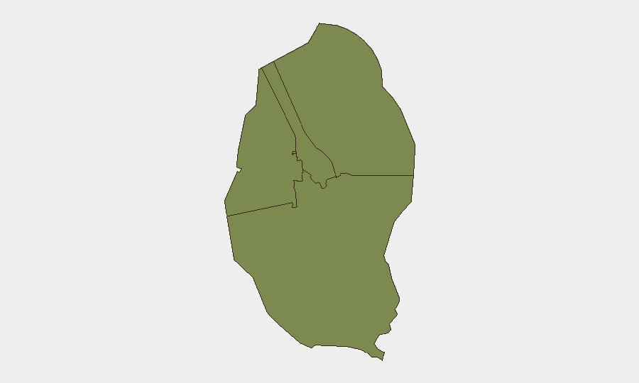
Situation Summary
Bahrain remains a low-threat environment globally (rank #43, composite score 44) with no tracked security events during the reporting period. The Northern and Southern Governorates carry elevated sub-national risk (72 and 68 respectively), driven by historical protest activity and socioeconomic friction. Regional maritime and aviation risks have intensified following Houthi attacks on Saudi Arabian infrastructure this week, with potential secondary effects on Bahrain's civil aviation and shipping operations through the Strait of Hormuz.
Key Developments
- King Hamad Highway, Al Lahsi vicinity — October 10: A petroleum tanker caught fire en route to Askar. Bahrain Civil Defence contained the fire with no reported injuries; traffic was diverted via Road 96. The incident had minor local impact but highlighted transport-sector vulnerability.
- Regional aviation threat — October 10: A Houthi attack on King Khalid International Airport in Riyadh killed 12 and injured more than 300, temporarily suspending airport operations. Bahrain's Foreign Ministry condemned the attack and designated civilian aviation infrastructure as a critical regional security concern, signaling potential knock-on effects for Bahrain's air corridor.
- Bahrain diplomatic response — October 6–7: Bahrain's Foreign Ministry condemned coordinated attacks on Abha International Airport and King Khalid International Airport in Saudi Arabia, characterizing attacks on civilian aviation as a threat to regional security and air navigation.
- Strait of Hormuz maritime incident — October 7: The Panama-flagged tanker *MT On Peace* was struck by a projectile outside Bahraini territorial waters, injuring 12 crew. The incident underscores persistent maritime risk in waters adjacent to Bahrain's exclusive economic zone and primary shipping lanes.
- Arrests (prior week, context for trend): Two separate October convictions for social-media posts endorsing attacks (10 years, BD2,000 each); one fraud case involving compromised payment credentials and OTPs. These reflect ongoing law-enforcement focus on online extremism and financial crime.
- Maritime safety operations — September 30: Bahrain Coast Guard conducted joint maritime inspections in Sa'ada Waterfront and Bahrain Bay, focusing on AIS compliance and passenger-transport authorization verification.
Highest-Risk Areas
The Northern Governorate (risk 72) and Southern Governorate (risk 68) remain Bahrain's principal risk concentrations, reflecting persistent socioeconomic grievances and historical protest corridors. The Capital Governorate (45) and Muharraq (38) carry lower but non-negligible risk. Northern and Southern zones are associated with Shiite-majority demographics and recurrent dissent over political representation and service provision; however, no active protest activity or mass security incidents were reported during the week.
How GeoBit Would Assist
Security teams monitoring Bahrain can deploy AOI Monitoring & Early Warning on the Northern and Southern Governorates and key transport corridors (King Hamad Highway, Bahrain Bay) to detect emerging protests, accidents, or port disruptions. Maritime & Aviation tracking combined with Intel Sweep and multi-language OSINT fusion on regional Houthi messaging and Saudi infrastructure reports enable risk teams to anticipate spillover effects on Bahrain's airspace and shipping. Network & Actor Analysis on social-media activity (X, Telegram) helps identify early indicators of coordinated online extremism or recruitment networks.
7-Day Outlook
Regional maritime and aviation risk will likely remain elevated as Houthi rhetoric and Saudi response dynamics persist; Bahrain's civil aviation and shipping sectors should maintain heightened situational awareness. Domestic security risk in Bahrain itself is expected to remain low, absent triggering events in the Northern or Southern Governorates. Transport safety and maritime compliance operations will continue as routine government activity.
Highest-Risk Areas — Ranked
| # | State / Region | Risk |
|---|---|---|
| 1 | Northern Governorate | 72 |
| 2 | Southern Governorate | 68 |
| 3 | Capital Governorate | 45 |
| 4 | Muharraq Governorate | 38 |
Sources
Previous Weekly Briefs
A new Bahrain brief is written every Monday, covering the week — each with its own risk map and downloadable CSV. Use the calendar to go further back.
- October 5, 2026
- September 28, 2026
- September 21, 2026
- September 14, 2026
- September 7, 2026
- September 1, 2026
- August 30, 2026
📅 Browse past briefs by calendar →
Highlighted days have a brief. Tap a day for that day's map & analysis, or “csv” for that day's dataset ($5).
Atlas — our AI intelligence desk — emails them this snapshot personally. Nothing else, no list.