Situation Summary
Botswana remains in a stable security environment with no confirmed incidents, civil unrest, armed conflict, or infrastructure disruptions reported in the last 24–48 hours. The composite national threat score of 4 reflects a low-risk baseline. Risk remains concentrated in urban and mining-sector areas, particularly Gaborone and the South-East District, but no acute triggers or escalation drivers are evident at present.
Key Developments
No discrete security, conflict, civil-unrest, crime, or infrastructure events meeting reporting criteria have been confirmed in Botswana within the last 24–48 hours.
Highest-Risk Areas
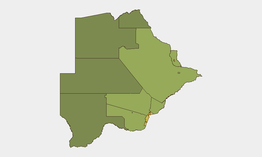
Risk concentration is heavily weighted toward Botswana's major urban and economic centers. Gaborone (risk score 72) and the South-East District (68) lead the sub-national ranking, reflecting the capital's density, economic activity, and associated petty crime, fraud, and organized-crime vectors. Lobatse (65) and Francistown (62)—both significant mining and transport hubs—follow, suggesting that mining-sector instability, labor disputes, or transnational criminal networks tied to mineral trafficking drive elevated localized risk. Jwaneng and Selebi Phikwe, both diamond-mining centers, carry similarly elevated scores (61 and 58 respectively), consistent with global patterns linking resource extraction to organized crime and labor tension. Rural and northern districts register substantially lower scores, indicating risk is fundamentally urban and economically concentrated rather than dispersed.
How GeoBit Would Assist
Intel Sweep and multi-language OSINT across news, social media, and sector-specific sources provide persistent visibility into labor, crime, and political developments that may precede unrest in mining and urban areas. AOI Monitoring & Early Warning on Gaborone, mining-zone border posts, and key highways (e.g., routes between Gaborone, Francistown, and South Africa) would detect emerging protests, roadblocks, or criminal incidents in real time. Network & Actor Analysis can map organized-crime and labor-union networks linked to mining regions, supporting duty-of-care teams in assessing supply-chain and personnel risk. Routing & Network Analysis enables security teams to identify safe, alternative transport routes in the event of localized unrest or infrastructure disruption.
7-Day Outlook
No significant escalation is anticipated over the next seven days absent external shocks (e.g., regional political instability, commodity-price collapse affecting mining employment, or cross-border criminal activity). Operational risk in Gaborone and mining zones should be monitored routinely for labor developments and criminal incidents, but the baseline expectation remains stable. Continuous monitoring via OSINT feeds and sector intelligence is warranted to detect early warning signals.
Next Brief: 2026-06-25 | Contact: GeoBit Security Intelligence
Highest-Risk Areas — Ranked
| # | State / Region | Risk |
|---|---|---|
| 1 | Gaborone | 72 |
| 2 | South-East District | 68 |
| 3 | Lobatse | 65 |
| 4 | Francistown | 62 |
| 5 | Jwaneng | 61 |
| 6 | Selebi Phikwe | 58 |
| 7 | Southern District | 55 |
| 8 | Kgatleng District | 50 |
| 9 | Kweneng District | 48 |
| 10 | North-East District | 45 |
| 11 | Central District | 42 |
| 12 | North-West District | 38 |
Previous Daily Briefs
A new Botswana brief is written every day — each with its own risk map and downloadable CSV. Here's the last week; use the calendar to go further back.
📅 Browse every day by calendar →
Highlighted days have a brief. Tap a day for that day's map & analysis, or “csv” for that day's dataset ($5).