Situation Summary
Burundi remains at a low overall threat level (composite score 3, globally unranked) with minimal discrete security incidents detected in the last 24–48 hours. Two public statements involving friction between Burundian nationals and refugee populations were logged on 17 June, but no escalation, violence, or operational impact has been corroborated. The country's stability profile is dominated by residual governance and humanitarian concerns rather than active conflict or civil unrest at present.
Key Developments
Open-source corroboration for discrete, time-stamped security incidents in Burundi during 18–19 June 2026 remains unavailable. Two event signals on 17 June noted public statements regarding Burundian–refugee tensions, but no credible follow-on reporting of violence, detention, or movement restrictions has been identified. Diplomatic activity on 17 June (U.S. Embassy courtesy visit to the president) proceeded without reported disruption or security alerts. Regional outlets (SOS Médias Burundi, Iwacu, Bonesha FM) and UN/INGO security feeds have not published acute incident alerts for the reporting period. Recommendation: Teams requiring near-real-time incident clarity should monitor Burundian stringers, UNDSS advisories, and embassy security feeds directly, as public platforms do not yet reflect sufficient detail for 24–48 hour operational decisions.
Highest-Risk Areas
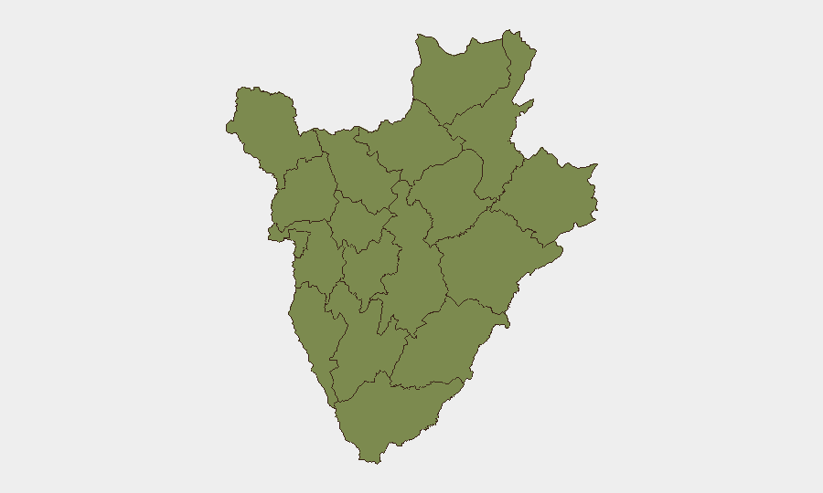
Gitega province dominates GeoBit's sub-national ranking with a composite score of 31.3, approximately 24× higher than all other provinces (each scoring 1.3). This concentration reflects Gitega's role as the political capital and seat of government administration, making it sensitive to state-level instability, leadership movements, and administrative disruptions. All remaining provinces—including Bujumbura Mairie (the economic capital), border regions (Cibitoke, Kirundo, Muyinga), and southern areas (Rumonge)—show uniform, low composite scores, indicating distributed baseline risk rather than geographic hotspots outside Gitega. For corporate operations, this pattern suggests that political or administrative shocks emanating from Gitega carry national spillover risk, while localized crime, cross-border activity, and refugee-related tensions are not currently driving measurable escalation elsewhere.
How GeoBit Would Assist
Security and duty-of-care teams should deploy AOI Monitoring & Early Warning on Gitega's government quarter, key transport nodes (Bujumbura airport, main highways to Rwanda and DRC), and Bujumbura's commercial districts to detect movement, protest activity, or incident signatures in real time. Intel Sweep combined with multi-language OSINT (including Kirundi, French, and Swahili social media) and sentiment & temporal analysis on Burundian and refugee community signals will surface emerging tensions before they escalate to violence. Network & Actor Analysis focused on state security apparatus, refugee camp leadership, and armed-group remnants will contextualize any future incidents within factional or resource-driven dynamics.
7-Day Outlook
No acute deterioration is forecast for the next seven days based on current signals. Gitega remains the primary policy and security center of gravity; any political decision, leadership change, or donor/diplomatic shift will likely transmit risk nationwide within hours. Refugee and humanitarian pressures remain chronic but not acute; teams should maintain standard duty-of-care protocols and monitor Gitega-level developments for secondary effects on their operations.
Highest-Risk Areas — Ranked
| # | State / Region | Risk |
|---|---|---|
| 1 | Gitega | 31.3 |
| 2 | Rumonge | 1.3 |
| 3 | Bujumbura Rural Province | 1.3 |
| 4 | Kirundo | 1.3 |
| 5 | Muyinga | 1.3 |
| 6 | Cibitoke | 1.3 |
| 7 | Bubanza | 1.3 |
| 8 | Bujumbura Mairie | 1.3 |
| 9 | Kayanza | 1.3 |
| 10 | Muramvya | 1.3 |
| 11 | Mwaro | 1.3 |
| 12 | Ngozi | 1.3 |
Sources
Previous Daily Briefs
A new Burundi brief is written every day — each with its own risk map and downloadable CSV. Here's the last week; use the calendar to go further back.
📅 Browse every day by calendar →
Highlighted days have a brief. Tap a day for that day's map & analysis, or “csv” for that day's dataset ($5).