Situation Summary
Cape Verde remains a low-threat environment with no significant security incidents reported in the last 24–48 hours. The composite national threat score of 2 reflects the country's overall stability; however, sub-national variation is material, with Praia, São Miguel, and São Vicente presenting elevated risk profiles driven primarily by urban crime and petty theft rather than political instability or organized violence. The security picture remains static and favourable for most routine corporate operations.
Key Developments
No discrete security, civil unrest, crime, political instability, or infrastructure incidents were identified in Cape Verde during the last 24–48 hours from reliable open sources. Web research surfaced World Cup–related content mentioning Cape Verdean football supporters but no incidents occurring within Cape Verde territory itself. Regional monitoring did not identify acute weather, aviation, or maritime disruptions affecting the country during this period.
Highest-Risk Areas
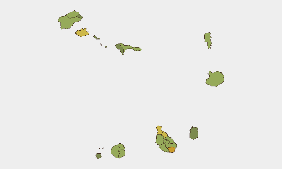
Praia (risk 72) and São Miguel (risk 68) drive the sub-national risk ranking, followed by São Vicente (65). Risk in these urban centres is concentrated in street crime, petty theft, and pickpocketing rather than political violence or gang activity. Praia's elevated score reflects its status as the capital and primary commercial hub, concentrating both population density and opportunistic criminal activity. Tarrafal, São Filipe, and Santa Catarina (all 58–62 range) maintain moderate risk; peripheral and rural municipalities fall below 50. For corporate teams, this stratification suggests that risk mitigation should focus on personal security discipline and asset protection in Praia and major towns, rather than systemic travel restrictions.
How GeoBit Would Assist
Teams operating in Cape Verde should leverage Intel Sweep and multi-language OSINT to monitor local crime trends, labour unrest, and port/aviation disruptions in near real-time. AOI Monitoring & Early Warning on Praia, São Miguel, and São Vicente would provide persistent watch on emerging gatherings, protests, or infrastructure incidents affecting corporate sites or staff commute routes. Maritime & Aviation tracking combined with Routing & Network Analysis would enable duty-of-care teams to identify alternative logistics corridors and safe passage routes in the event of port congestion or localised unrest. These capabilities allow teams to move beyond static risk scorecards to dynamic, actionable early warning.
7-Day Outlook
No acute threats are anticipated over the next seven days. Seasonal Atlantic weather patterns warrant routine monitoring through Environmental & Health feeds, though current data does not signal imminent impact. Baseline vigilance on petty crime in urban centres remains standard practice; no escalation in organized crime or political risk is forecast.
Report Confidence: High (low-threat environment, high open-source transparency). Next Update: 2026-06-12, 06:00 UTC or upon occurrence of reportable event.
Highest-Risk Areas — Ranked
| # | State / Region | Risk |
|---|---|---|
| 1 | Praia | 72 |
| 2 | São Miguel | 68 |
| 3 | São Vicente | 65 |
| 4 | Tarrafal | 62 |
| 5 | São Filipe | 58 |
| 6 | Santa Catarina | 58 |
| 7 | Santa Cruz | 55 |
| 8 | Mosteiros | 52 |
| 9 | São Salvador do Mundo | 52 |
| 10 | Ribeira Grande | 50 |
| 11 | Porto Novo | 48 |
| 12 | Sal | 48 |
Sources
Previous Daily Briefs
A new Cape Verde brief is written every day — each with its own risk map and downloadable CSV. Here's the last week; use the calendar to go further back.
📅 Browse every day by calendar →
Highlighted days have a brief. Tap a day for that day's map & analysis, or “csv” for that day's dataset ($5).