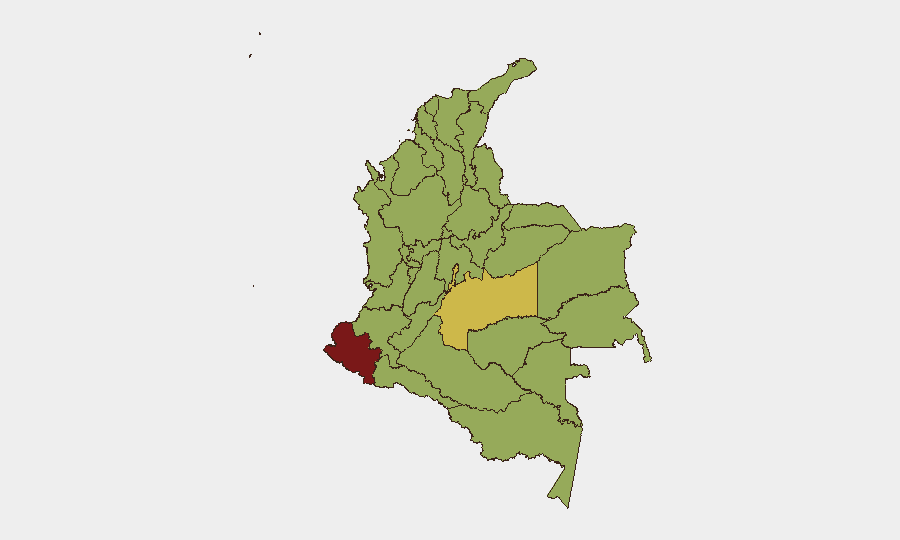
Situation Summary
Colombia remains a complex operating environment with composite threat score 73.7 (rank #20 globally), driven primarily by ongoing insurgency, organized crime, and street violence across multiple jurisdictions. Recent 24-hour event signals reflect political turbulence, property seizures, assassination activity, and military-level clashes between traffickers and state forces. The security picture is regionally fragmented: southern border departments (Nariño, Meta, Guaviare) and northern conflict zones (Norte de Santander, Arauca) face sustained armed-group presence and kidnapping risk, while major urban centers (Bogotá, Medellín, Cali) experience persistent street crime and gang-driven extortion.
Key Developments
- Bogotá, Bosa La Estación (2026-06-01): Armed robbery of two minors; motorcyclists seized cell phone in commercial sector. Security cameras captured incident; police investigation ongoing.
- Bogotá, Kennedy/Patio Bonito (ongoing): Selective robbery and extortion gangs ("robos selectivos") continuing operations targeting shops and public transport; police reinforced patrols and community alerts activated.
- Antioquia, rural areas near Medellín (ongoing): Clan del Golfo and allied illegal armed groups expanding presence; active use of IEDs and landmines reported on secondary roads outside urban core.
- Arauca department, border zone (persistent): Armed conflict between multiple groups, high kidnapping risk, U.S. "Do Not Travel" advisory in effect; river crossings and rural corridors remain high-threat.
- Norte de Santander, Catatumbo region (ongoing): ELN and FARC dissident clashes continue; prior mass displacement events; road blockages and armed confrontations remain routine.
- Cauca and rural Valle del Cauca (ongoing): Terrorism risk and infrastructure attacks (police stations, roads, government buildings) by armed groups; exclusion zones active in both departments.
- Colombia–Venezuela border (multi-departmental, persistent): Arbitrary detention risk, armed-group clashes affecting road networks; 10 km exclusion zone in effect for Norte de Santander and Arauca.
- Nationwide urban centers (ongoing): Street crime, armed robbery, and assault prevalent in Bogotá, Medellín, Cali, Barranquilla, Cartagena; nightlife and transport hubs identified as high-incident zones.
Highest-Risk Areas
Nariño (81.6) and Meta Department (69.3) lead the regional ranking, reflecting their proximity to Venezuela and established presence of ELN, FARC dissidents, and trafficking networks. Capital District (61.9) and northern departments (Norte de Santander, Arauca) combine armed conflict with kidnapping and border-instability threats. Southern and Pacific-corridor regions (Guaviare, Cauca, Valle del Cauca) face active terrorism campaigns and drug-trafficking violence. Urban security degradation—evidenced by gang-driven extortion in Bogotá's Kennedy locality and armed robbery in Bosa—indicates that even in the capital, street-crime risk requires persistent protective measures.
How GeoBit Would Assist
Security teams should deploy AOI Monitoring & Early Warning on Nariño, Meta, and Norte de Santander to detect armed-group movement and kidnapping indicators with persistent alerting. OSINT Sweep and multi-language Telegram/X intelligence enable real-time tracking of gang and paramilitary communications in urban centers (Bogotá, Medellín, Cali), feeding threat assessment cycles. Routing & Network Analysis provides alternative journey planning around active conflict zones and extortion hotspots, while Conflict & Military force-structure tracking monitors ELN and Clan del Golfo operational capacity.
7-Day Outlook
Political instability and recent assassination activity suggest heightened risk of inflammatory public statements or confrontations among state, paramilitary, and insurgent actors over the near term. Street crime in Bogotá and Medellín is expected to remain elevated; gang activity in Kennedy and Patio Bonito will likely persist absent major police intervention. Border regions (Arauca, Catatumbo) face continued armed-group clashes as Venezuelan spillover effects remain unresolved.
Highest-Risk Areas — Ranked
| # | State / Region | Risk |
|---|---|---|
| 1 | Nariño | 81.6 |
| 2 | Meta Department | 69.3 |
| 3 | Capital District | 61.9 |
| 4 | Guaviare | 55.5 |
| 5 | Cundinamarca Department | 54.9 |
| 6 | Atlántico Department | 53.8 |
| 7 | Quindío Department | 53 |
| 8 | Bolívar Department | 52.8 |
| 9 | Norte de Santander Department | 52.8 |
| 10 | Santander Department | 52.5 |
| 11 | Cauca | 52.5 |
| 12 | Valle del Cauca Department | 52.4 |
Previous Daily Briefs
A new Colombia brief is written every day — each with its own risk map and downloadable CSV. Here's the last week; use the calendar to go further back.
📅 Browse every day by calendar →
Highlighted days have a brief. Tap a day for that day's map & analysis, or “csv” for that day's dataset ($5).