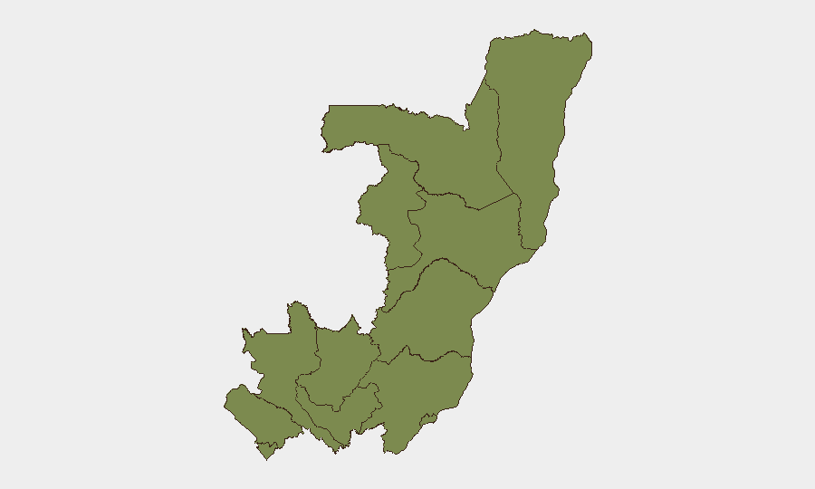
Situation Summary
Congo (Republic of the Congo) remains at moderate global risk rank (#42, composite score 51) with 539 tracked events. The country shows geographic concentration of threat in Cuvette-Ouest Department (risk score 31.8), which accounts for the majority of the composite risk signal; all other departments score uniformly at 1.8. No clearly documented, corroborated new security incidents have been identified in the last 24–48 hours across open-source and multi-language monitoring; the current event signal mix reflects older incidents (primarily from 16–18 July involving rebel-civilian clashes and small-arms combat in other regions) and regional wildfire activity affecting eastern border zones.
Key Developments
- No confirmed new security incidents documented in last 24–48 hours (as of 19 July 2026). Multi-source monitoring including social media and traditional media across French and English sources reports no discretely time-stamped, corroborated attacks, clashes, arrests, or civil unrest in the immediate window.
- Cuvette-Ouest Department remains highest-concentration threat zone. Risk score of 31.8 is significantly elevated relative to all other departments (scored at 1.8 each), indicating sustained or recurring driver(s) of instability in that region; specific causal events require AOI-level monitoring to identify.
- Regional wildfire activity ongoing in eastern DRC and Angola border zones. Multiple active wildfires tracked across DRC provinces (Kasai, Katanga, Ituri regions) and shared Angola–DRC border areas may impact logistics, air quality, and population displacement; extent of overlap with Congo Republic territory requires spatial verification.
- Recent rebel-vs-civilian clashes reported 16–18 July (outside 24–48h window). Older signal data indicates small-arms combat involving non-state actors and civilian populations; geographic specificity of these incidents and their proximity to Congo Republic operations require clarification.
- U.S.–Iran conventional military signal flagged 17 July. Originating outside Congo; relevance to Congo territory or operations requires assessment of regional spillover risk and maritime/aviation chokepoints.
Highest-Risk Areas
Cuvette-Ouest Department drives the country-level risk composite at 31.8—a score nearly 18 times higher than any other subnational zone. All remaining departments (Sangha, Likouala, Cuvette, Kouilou, Niari, Pointe-Noire, Lékoumou, Bouenza, Plateaux, Pool, Brazzaville) score uniformly at 1.8, indicating either lower incident density or homogenous baseline risk. The Cuvette-Ouest concentration suggests either localized instability (resource competition, militia activity, border tension) or a data-collection artifact; corporate security teams with assets or personnel in that department should prioritize granular monitoring and access to real-time alerts.
How GeoBit Would Assist
AOI Monitoring & Early Warning with persistent watch on Cuvette-Ouest and border zones would trigger alerts on new clashes, military movement, or protest activity before they escalate. Conflict & Military battle mapping and force-structure analysis would clarify the nature of the elevated risk signal in Cuvette-Ouest and identify non-state actors. OSINT fusion via multi-language media, social platforms, and radio SIGINT would provide early warning of incidents not yet picked up by traditional reporting, enabling proactive duty-of-care response.
7-Day Outlook
No acute deterioration is signaled for the next 7 days based on current incident trajectory and open-source indicators. Cuvette-Ouest remains a persistent elevated-risk zone requiring continuous monitoring; wildfire activity may disrupt transport routes or create secondary humanitarian issues affecting operational access. Recommend weekly reassessment pending new incident corroboration.
Highest-Risk Areas — Ranked
| # | State / Region | Risk |
|---|---|---|
| 1 | Cuvette-Ouest Department | 31.8 |
| 2 | Sangha | 1.8 |
| 3 | Likouala | 1.8 |
| 4 | Cuvette Department | 1.8 |
| 5 | Kouilou Department | 1.8 |
| 6 | Niari Department | 1.8 |
| 7 | Pointe-Noire (département) | 1.8 |
| 8 | Lékoumou Department | 1.8 |
| 9 | Bouenza Department | 1.8 |
| 10 | Plateaux Department | 1.8 |
| 11 | Pool Department | 1.8 |
| 12 | Brazzaville (department) | 1.8 |
Sources
Previous Daily Briefs
A new Congo brief is written every day — each with its own risk map and downloadable CSV. Here's the last week; use the calendar to go further back.
📅 Browse every day by calendar →
Highlighted days have a brief. Tap a day for that day's map & analysis, or “csv” for that day's dataset ($5).
Atlas — our AI intelligence desk — emails them this snapshot personally. Nothing else, no list.