Situation Summary
DR Congo remains in a protracted state of multi-domain instability, with active armed conflict concentrated in the eastern provinces and persistent political tension in the capital. No major new security incidents have been corroborated across multiple open sources within the past 24–48 hours (16–18 July 2026); however, the underlying threat environment—characterized by jihadist attacks, inter-militia clashes, and opposition protest risk in Kinshasa—remains volatile and capable of rapid escalation. The country's composite threat score of 60 places it at #37 globally, with risk heavily concentrated in Kinshasa and eastern conflict zones rather than distributed across the national territory.
Key Developments
- UN Security Council sanctions (17 July 2026, New York): The UNSC imposed targeted sanctions on leaders of AFC/M23 and FDLR armed groups operating in eastern DR Congo, signaling continued international pressure on key conflict actors but not indicating new ground-level incidents.
- No discretely documented new security incidents (16–18 July 2026, countrywide): Open-source monitoring and multi-language media scanning confirm no clearly time-stamped security events—attacks, protests, arrests, or clashes—corroborated across independent sources within the 24–48 hour window. The threat picture is characterized as *ongoing* rather than event-specific.
- Continued ADF jihadist activity (North Kivu, 12–15 July 2026 – earlier window): Suspected ADF attacks west of Beni city and Mangina killed approximately 20 civilians between 12–15 July; these incidents, while confirmed by Africanews and other outlets, fall outside the immediate 24–48 hour reporting window but indicate sustained militant pressure in the region.
- Eastern provinces: heavy fighting and infrastructure targeting (North Kivu, South Kivu, Ituri, Tshopo – ongoing): Artillery, drone strikes, and attacks on health facilities and supply lines continue, though specific new incidents within 16–18 July are not independently dated in available reporting; the trend remains high-intensity.
- Kinshasa protest risk: political tensions persist (Kinshasa – ongoing, no new 16–18 July incidents reported): Opposition and civil-society mobilization over constitutional reforms continues to create volatile conditions in the capital; no specific clashes or arrests have been reported in the last 48 hours, but the risk environment is persistent.
Highest-Risk Areas
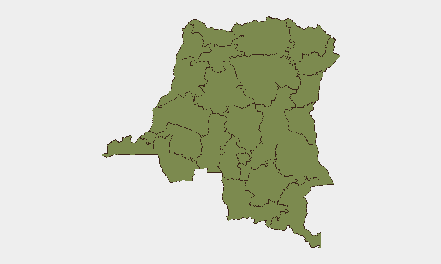
Kinshasa dominates the sub-national ranking with a composite risk score of 34—roughly three times higher than any other province—driven by protest activity, political sensitivity, and presence of government and diplomatic infrastructure. Maniema (12.6) ranks second but remains substantially lower, reflecting eastern conflict spillover. The remaining ten provinces cluster at risk score 4, indicating a stark concentration of hazard in the capital and the eastern conflict corridor (North Kivu, South Kivu, Ituri, Tshopo). For organizations with personnel or assets in DR Congo, Kinshasa requires continuous political monitoring and contingency planning; eastern provinces demand conflict-tracking and armed-group-activity awareness.
How GeoBit Would Assist
Teams managing people and assets in DR Congo should deploy AOI Monitoring & Early Warning (persistent watch on Kinshasa, Maniema, and North Kivu with automated alerting) and Network & Actor Analysis to track armed-group leadership and faction movements following the 17 July sanctions. OSINT Fusion & Corroboration across X/Telegram, local news aggregation, and multi-language media enables real-time discernment between genuine incident reports and rumor, reducing false-alarm travel disruptions. Routing & Network Analysis supports contingency-route planning for staff movement in volatile zones.
7-Day Outlook
No major escalation indicators are visible in the 24–48 hour reporting window, but the underlying conflict dynamics in the east and political tensions in Kinshasa remain high-risk and prone to rapid change. Continued monitoring for armed-group repositioning (especially post-sanctions) and for opposition mobilization around constitutional deadlines is essential. Duty-of-care teams should maintain elevated alert posture without assuming imminent crisis.
Highest-Risk Areas — Ranked
| # | State / Region | Risk |
|---|---|---|
| 1 | Kinshasa | 34 |
| 2 | Maniema | 12.6 |
| 3 | Sud-Ubangi | 4 |
| 4 | Équateur | 4 |
| 5 | Nord-Ubangi | 4 |
| 6 | Mongala | 4 |
| 7 | Lower Uele | 4 |
| 8 | Tshopo | 4 |
| 9 | Tshuapa | 4 |
| 10 | Upper Uele | 4 |
| 11 | Ituri | 4 |
| 12 | North Kivu | 4 |
Previous Daily Briefs
A new DR Congo brief is written every day — each with its own risk map and downloadable CSV. Here's the last week; use the calendar to go further back.
📅 Browse every day by calendar →
Highlighted days have a brief. Tap a day for that day's map & analysis, or “csv” for that day's dataset ($5).
Atlas — our AI intelligence desk — emails them this snapshot personally. Nothing else, no list.