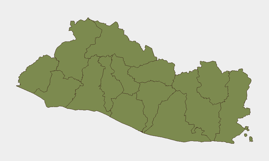
Situation Summary
El Salvador remains under an extended state of emergency that has enabled mass gang crackdowns and large-scale detentions, creating a volatile security environment despite a composite threat ranking of 19 globally (#72). The country faces persistent baseline risks from organized crime, robbery, and sexual assault, alongside unpredictable civil unrest and hazardous driving conditions during the rainy season. No discrete security incidents have been reliably reported in the last 24–48 hours from multiple independent sources. The overall trajectory remains one of chronic structural instability rather than acute crisis.
Key Developments
- No verified discrete incidents in the last 24–48 hours. Open-source reporting does not contain time-stamped, multi-source-confirmed security or unrest events for June 28–29, 2026. Any statement of a specific incident on these dates would require direct corroboration from local media (e.g., El Faro, La Prensa Gráfica) or official sources.
- Nationwide – State of emergency operations (ongoing context). The extended emergency framework continues to drive mass detention operations, police checkpoints, and broad enforcement authority, creating unpredictable friction points for movement and increasing risk of arbitrary detention.
- Nationwide – Rainy-season hazards intensifying. June–September peak rainfall increases landslide risk on unpaved roads and rural routes, compounding existing constraints on safe ground transport outside major urban corridors.
- Nationwide – Random sobriety enforcement active. "Zero Tolerance" drunk-driving enforcement (any blood alcohol level carries 2–5 years' prison) and emergency-regime checkpoints remain frequent, particularly affecting evening and inter-city travel.
- San Salvador Department and major urban centers – persistent street crime. Robbery, carjacking, and sexual assault remain endemic in and around the capital; public transport (especially buses) and night driving outside secure areas remain high-risk.
Highest-Risk Areas
Cabañas Department stands alone with a composite risk score of 31.4—substantially higher than all other departments, which cluster at 1.4. This anomaly suggests concentration of gang activity, trafficking routes, or active enforcement operations in the region. All other departments show equivalent baseline risk, indicating that threat distribution in El Salvador is not evenly dispersed: security teams with personnel or assets in Cabañas face materially elevated exposure to gang violence, extortion, and police operations compared to other regions. San Salvador (capital) and La Libertad carry standard urban crime and transit risks. The ranking suggests that geographic specificity—rather than national-level alerts—is critical for duty-of-care assessment.
How GeoBit Would Assist
Corporate security teams should deploy AOI Monitoring & Early Warning on Cabañas Department and major transport corridors (especially inter-city highways) to detect emerging roadblocks, gang activity, or police operations in near-real time. Multi-language OSINT and X/Twitter intelligence can capture local reporting, community warnings, and activist alerts that precede or accompany unrest or crime events. Routing & Network Analysis enables rapid identification of alternative routes around checkpoints, high-crime zones, or weather-affected roads, reducing exposure during planned movement. Cross-referencing conflict and crime search with sentiment and temporal analysis provides early warning of protest mobilization or gang escalation before they materialize as discrete incidents.
7-Day Outlook
No acute escalation is indicated in the current reporting window. The extended state of emergency is likely to persist as the baseline operational constraint, with continued random enforcement, rainy-season hazard exposure, and endemic street crime in urban centers. Security teams should treat the next week as a sustained-vigilance period rather than an escalation scenario, with focus on route planning, checkpoint avoidance, and real-time situational awareness in Cabañas and the capital.
Highest-Risk Areas — Ranked
| # | State / Region | Risk |
|---|---|---|
| 1 | Cabañas Department | 31.4 |
| 2 | Ahuachapán Department | 1.4 |
| 3 | Sonsonate Department | 1.4 |
| 4 | Santa Ana Department | 1.4 |
| 5 | Chalatenango Department | 1.4 |
| 6 | La Libertad Department | 1.4 |
| 7 | San Salvador Department | 1.4 |
| 8 | Cuscatlán Department | 1.4 |
| 9 | La Paz Department | 1.4 |
| 10 | San Vicente Department | 1.4 |
| 11 | Usulután Department | 1.4 |
| 12 | San Miguel Department | 1.4 |
Sources
Previous Daily Briefs
A new El Salvador brief is written every day — each with its own risk map and downloadable CSV. Here's the last week; use the calendar to go further back.
📅 Browse every day by calendar →
Highlighted days have a brief. Tap a day for that day's map & analysis, or “csv” for that day's dataset ($5).