Situation Summary
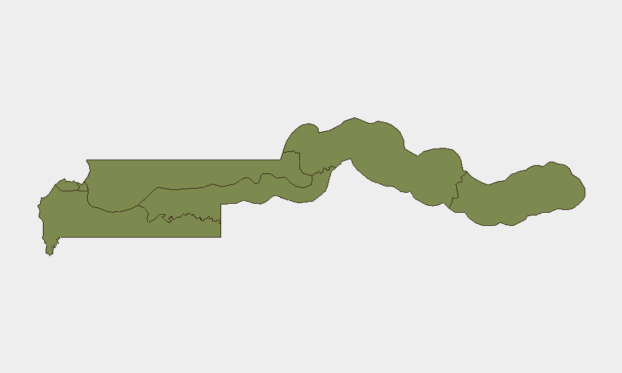
Gambia remains a low-threat environment globally (composite threat score 5/100), with security risk heavily concentrated in the capital, Banjul (risk score 31.3), while all other administrative divisions register minimal threat levels (1.3 each). Over the past 48 hours, event signals have reflected international diplomatic tensions and domestic political activity rather than conventional security incidents; however, the absence of detailed incident attribution complicates threat interpretation. The current trajectory suggests continued low baseline risk with episodic political friction rather than imminent security escalation.
Key Developments
- 2026-06-18, Banjul/National Level: Administration issued sanctions against media entities, signaling potential tensions over press freedom or coverage of government actions.
- 2026-06-18, National Level: Presidential threat directed at Germany, indicating diplomatic friction with a European state; context and substance remain unclear from available signals.
- 2026-06-18, National Level: Prime Minister issued public statement in relation to France, suggesting broader diplomatic activity or dispute with Western powers.
- 2026-06-19, National Level: Male-population disapproval signal recorded; specific cause not yet corroborated.
- 2026-06-20, Banjul/National Level: Resident public statements recorded; no incident details available.
- 2026-06-20, National Level: Guerrilla-attributed conventional military force signal flagged; lack of corroborating detail prevents assessment of authenticity, location, or operational intent.
- 2026-06-20, National Level: Multiple unrelated international event signals (Galician, Spanish investigation, U.S.–Europe arrest/detain, Iranian disapproval) detected in Gambia-focused feeds; likely represent noise or international news bleed-through rather than localized incidents.
Highest-Risk Areas
Banjul accounts for the overwhelming majority of recorded risk (31.3 vs. 1.3 across all other divisions), reflecting its status as the capital, seat of government, and primary locus of political activity, administrative tension, and media/opposition presence. All outlying divisions—Kanifing, West Coast, North Bank, Lower River, Central River, and Upper River—register uniform, minimal risk, suggesting either stable peripheral security conditions or limited event-signal penetration from rural and border areas. Risk concentration in the capital is consistent with typical conflict patterns in small West African states, where political friction is urban-centered.
How GeoBit Would Assist
Security teams should deploy Intel Sweep and multi-language OSINT feeds to corroborate the unattributed event signals above and distinguish genuine incidents from diplomatic noise. Entity extraction and sentiment analysis on Gambian media, X/Twitter, and Telegram would clarify the substance and trajectory of the media-administration dispute and international diplomatic friction. AOI Monitoring & Early Warning on Banjul and North Bank Division (Senegal border) would detect any escalation from political statements to protest activity, security-force deployment, or cross-border incident precursors.
7-Day Outlook
No indicators suggest imminent security escalation; the 48-hour signal cluster reflects routine political friction and diplomatic posturing rather than coordinated unrest or armed activity. Sustained monitoring of media-government relations and presidential statements is warranted to detect early warning of press restrictions, opposition detention, or institutional instability. Unless verified incident reporting emerges, Gambia will likely remain a low-threat operating environment for corporate and expatriate presence.
Highest-Risk Areas — Ranked
| # | State / Region | Risk |
|---|---|---|
| 1 | Banjul | 31.3 |
| 2 | Kanifing Municipal Council | 1.3 |
| 3 | West Coast Division | 1.3 |
| 4 | North Bank Division | 1.3 |
| 5 | Lower River Division | 1.3 |
| 6 | Central River Division | 1.3 |
| 7 | Upper River Division | 1.3 |
Previous Daily Briefs
A new Gambia brief is written every day — each with its own risk map and downloadable CSV. Here's the last week; use the calendar to go further back.
📅 Browse every day by calendar →
Highlighted days have a brief. Tap a day for that day's map & analysis, or “csv” for that day's dataset ($5).