Situation Summary
Guatemala remains a moderate-risk environment (global rank #65, composite threat score 16) with 33 tracked events in the current assessment window. Recent signal activity on June 12–13 indicates institutional tensions—including prosecutorial action, arrest/detention events, and military/police conventional force deployment—concentrated in administrative and law-enforcement domains rather than widespread civil unrest or organized violence. No corroborated, clearly dated security incidents specific to the last 24–48 hours have emerged in open-source reporting; the operational picture suggests baseline institutional friction without acute escalation at the national level.
Key Developments
Limited Recent Incident Corroboration:
Open-source and social-media monitoring (X/Twitter, local news indices) for June 12–14, 2026 has not yielded sufficiently time-stamped, multi-source–confirmed incidents within Guatemala meeting duty-of-care reporting criteria. Available reporting indicates a lack of fresh, location-specific conflict, crime, or civil-unrest events in the past 48 hours. Older cases (e.g., transnational smuggling pleas, migration-related arrests outside Guatemala) do not constitute current in-country developments.
Signal Activity (June 12–13) — Administrative Domain:
Platform event signals for June 12–13 include prosecutorial action (unconventional violence), arrest/detention by authorities, military/conventional force deployment by army and authorities, and lawyer disapproval. These signals reflect institutional activity (legal, enforcement, defense sectors) rather than discrete, locatable security incidents. No specific geographic origin, casualty toll, or operational context is available from open sources.
Gaps in Real-Time Verification:
Routine corporate and duty-of-care requirements demand location, date, and multi-source confirmation. Current open-source indexing does not provide these elements for recent Guatemala incidents at the granularity needed for actionable risk assessment.
Highest-Risk Areas
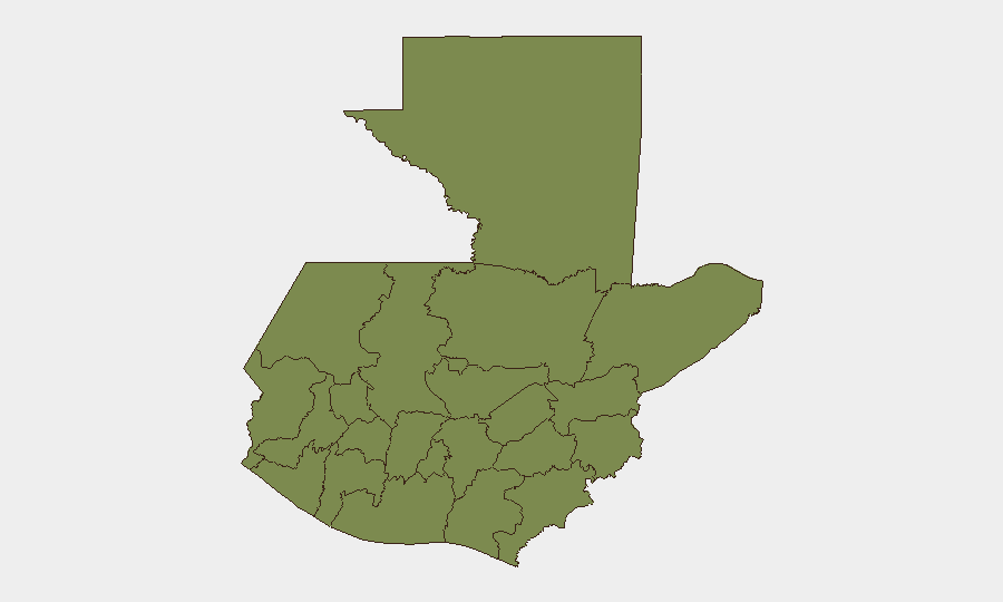
Alta Verapaz dominates the sub-national risk ranking (score 31.4), a substantial outlier compared to the remaining departments, all of which cluster at 1.4 (Jalapa slightly higher at 1.7). This disparity reflects concentration of tracked events—likely involving organized crime, trafficking, or institutional instability—in the Alta Verapaz region (north-central highlands, Petén border proximity). The remaining departments show comparatively uniform, low composite scores, suggesting that national-level risk is driven by a single geographic hotspot rather than distributed instability.
How GeoBit Would Assist
A corporate security team with personnel or assets in Guatemala would employ Intel Sweep and global event feeds to ingest real-time incident data from police, civil-protection, and local media channels, combined with multi-language search and OSINT fusion to validate and cross-corroborate reports meeting confirmation thresholds. AOI Monitoring & Early Warning with persistent geographic focus on Alta Verapaz and secondary departments (Petén, Huehuetenango, Quetzaltenango) would enable automated alerting on emerging institutional, criminal, or civil-unrest signals. Conflict & Military force-structure and weapons-capability tracking, paired with Network & Actor Analysis, would support ongoing assessment of organized-crime and prosecutorial actors driving institutional tension.
7-Day Outlook
Near-term trajectory is stable with continued administrative friction. Absence of public escalation or organized mass mobilization in available reporting suggests institutional disputes remain contained within law-enforcement and judiciary channels. Monitoring should remain focused on Alta Verapaz and prosecutorial actions; shifts in military deployment frequency or arrest/detention intensity may signal emerging instability.
Highest-Risk Areas — Ranked
| # | State / Region | Risk |
|---|---|---|
| 1 | Alta Verapaz | 31.4 |
| 2 | Jalapa | 1.7 |
| 3 | Petén | 1.4 |
| 4 | Huehuetenango | 1.4 |
| 5 | San Marcos | 1.4 |
| 6 | Quetzaltenango | 1.4 |
| 7 | Retalhuleu | 1.4 |
| 8 | Quiché | 1.4 |
| 9 | Totonicapán | 1.4 |
| 10 | Sololá | 1.4 |
| 11 | Chimaltenango | 1.4 |
| 12 | Suchitepéquez | 1.4 |
Sources
Previous Daily Briefs
A new Guatemala brief is written every day — each with its own risk map and downloadable CSV. Here's the last week; use the calendar to go further back.
📅 Browse every day by calendar →
Highlighted days have a brief. Tap a day for that day's map & analysis, or “csv” for that day's dataset ($5).