Situation Summary
Guyana faces an acute maritime and security crisis following the capsizing of the MV Barima on 18–19 July with 66 people still missing and ongoing search-and-rescue operations. Concurrent with the ferry disaster, violent crime has escalated in East Coast Demerara, with gang-related shootings and armed raids on mining camps in the interior demonstrating persistent threats across multiple threat vectors. A formal investigation into potential systemic failures within the Police Force, Defence Force, and Maritime Administration has been announced, signaling institutional accountability concerns and potential operational gaps in safety oversight.
Key Developments
- MV Barima maritime disaster (North Atlantic coast, 18–19 July 2026): A passenger ferry capsized seven miles offshore between Georgetown and Port Kaituma carrying 133 people; 67 rescued, 66 remain missing. Search-and-rescue operations ongoing near the Pomeroon River mouth. Prime Minister Mark Phillips announced a formal investigation into potential wrongdoing by the Guyana Police Force, Defence Force, and Maritime Administration Department.
- Homicide in South Vigilance (East Coast Demerara, late July 2026): Shawn Edwards, 38, shot at close range and found on a roadway around 4:30 PM; died the following morning. Police launched a major homicide investigation and manhunt; incident attributed to gang-related retaliatory violence. Second fatal shooting in Vigilance South within one week.
- Armed mining-camp raid (68 Backdam, Cuyuni River, mid-July 2026): Three masked, armed men attacked a remote mining operation; illustrates continued targeting of interior mining sites.
- Drug and weapons seizure (Georgetown wharf, last week): Joint Customs Anti-Narcotics and Guyana Revenue Authority operation intercepted foreign cannabis (G$71–72 million value), three pistols, and 18 rounds of 9mm ammunition at Monessar's Wharf, reflecting heightened transnational trafficking activity through capital port facilities.
Highest-Risk Areas
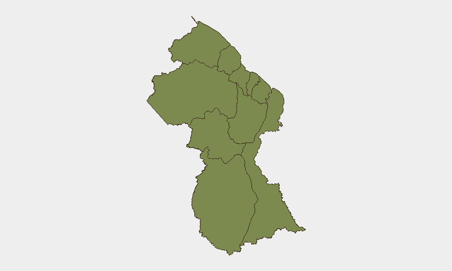
Barima-Waini and Demerara-Mahaica jointly drive the country's highest composite risk scores (31.8 each), with the current ferry disaster and ongoing search operations in Barima-Waini and violent gang crime in Demerara-Mahaica (East Coast corridor) directly explaining elevated rankings. Potaro-Siparuni (16.8) remains elevated due to persistent armed raids on interior mining operations. Remaining regions carry minimal isolated risk (1.8), reflecting concentration of threats in coastal urban and near-coastal northern zones rather than uniform national distribution.
How GeoBit Would Assist
Security teams with personnel or assets in Guyana should employ AOI Monitoring & Early Warning on high-risk coastal and East Coast Demerara corridors to detect emerging crime and operational disruptions in real time. Maritime & Aviation tracking combined with GIS & Spatial Analysis would provide persistent visibility of ferry routes, port activity, and supply-chain movement to detect anomalies or safety risks. Network & Actor Analysis and Sentiment & Temporal Analysis via OSINT fusion (X/Twitter, local news feeds) would enable rapid detection of escalating gang activity or institutional instability signaling wider security degradation.
7-Day Outlook
The ferry investigation is expected to dominate institutional attention and media focus over the next week, with potential findings on safety failures likely to trigger further operational reviews. Gang violence in East Coast Demerara will remain elevated absent significant law-enforcement intervention; the second homicide in one week suggests retaliatory cycle escalation. Maritime transport and interior mining operations remain vulnerable to disruption and criminal targeting.
Highest-Risk Areas — Ranked
| # | State / Region | Risk |
|---|---|---|
| 1 | Barima-Waini | 31.8 |
| 2 | Demerara-Mahaica | 31.8 |
| 3 | Potaro-Siparuni | 16.8 |
| 4 | Cuyuni-Mazaruni | 1.8 |
| 5 | Pomeroon-Supenaam | 1.8 |
| 6 | Essequibo Islands | 1.8 |
| 7 | Mahaica-Berbice | 1.8 |
| 8 | Upper Demerara-Berbice | 1.8 |
| 9 | East Berbice-Corentyne | 1.8 |
| 10 | Upper Takutu-Upper Essequibo | 1.8 |
Sources
Previous Daily Briefs
A new Guyana brief is written every day — each with its own risk map and downloadable CSV. Here's the last week; use the calendar to go further back.
📅 Browse every day by calendar →
Highlighted days have a brief. Tap a day for that day's map & analysis, or “csv” for that day's dataset ($5).
Atlas — our AI intelligence desk — emails them this snapshot personally. Nothing else, no list.