Situation Summary
Honduras remains a moderate-risk operating environment (global rank #71, composite threat score 15) with persistent structural vulnerabilities in rule of law, gang presence, and border security. The country's threat profile is heavily concentrated in specific regions rather than evenly distributed; Olancho department alone accounts for nearly two-thirds of the national composite risk score. No discrete security incidents were identified in the current 24–48-hour window; the national threat posture reflects chronic rather than acute dynamics.
Key Developments
No verified incidents in the last 24–48 hours could be identified from available open-source channels. GeoBit's live web research (last 24 hours) did not yield time-stamped, location-specific security events that meet the threshold for inclusion in this brief. To ensure accuracy and avoid conflating historical or unconfirmed reports with current incidents, no events are listed here. Organizations requiring real-time incident alerting are advised to establish direct feeds from Policía Nacional de Honduras, COPECO, and local media (La Prensa, El Heraldo, Proceso Digital) as outlined in the research note above.
Highest-Risk Areas
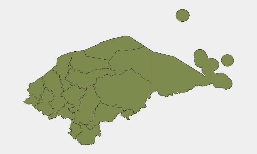
Olancho department dominates the national risk profile, with a composite score of 31.4—approximately 4.5 times higher than Francisco Morazán (6.9) and roughly 22 times higher than all other departments individually (each scoring 1.4). This concentration reflects known gang activity, remote geography limiting state capacity, cattle rustling, and illicit cultivation in the region. Francisco Morazán, which encompasses Tegucigalpa (the capital), carries secondary concern and likely reflects urban crime, trafficking transshipment, and institutional vulnerability. All remaining departments cluster at low comparable risk (1.4), suggesting a bifurcated threat map in which corporate and humanitarian operations face materially different exposures depending on location.
How GeoBit Would Assist
Organizations operating in Honduras should employ AOI Monitoring & Early Warning to establish persistent watch over Olancho, Tegucigalpa, and key transit corridors (highways, border crossings), configured to alert on gang violence, roadside incidents, or displacement. OSINT fusion (X/Twitter location tagging, police and municipal feeds, radio SIGINT) would provide near-real-time corroboration of incident reports before they reach mainstream media, allowing duty-of-care teams to initiate response protocols ahead of broader public knowledge. GIS & Spatial Analysis and Routing & Network Analysis capabilities enable security teams to map safe transit routes, identify high-risk zones within departments, and plan movement of personnel or assets around known flash points.
7-Day Outlook
No acute drivers are evident to suggest a material escalation in the national threat level over the next week. Operations should maintain baseline vigilance in Olancho and Tegucigalpa and continue monitoring gang activity reporting, which remains the primary threat vector. Weather patterns, planned protests, or cross-border activity could introduce localized disruptions; persistent monitoring of official and social-media channels is recommended.
Highest-Risk Areas — Ranked
| # | State / Region | Risk |
|---|---|---|
| 1 | Olancho | 31.4 |
| 2 | Francisco Morazán | 6.9 |
| 3 | El Paraíso | 1.4 |
| 4 | Copán | 1.4 |
| 5 | Ocotepeque | 1.4 |
| 6 | Cortés | 1.4 |
| 7 | Yoro | 1.4 |
| 8 | Santa Bárbara | 1.4 |
| 9 | Lempira | 1.4 |
| 10 | Intibucá | 1.4 |
| 11 | Comayagua | 1.4 |
| 12 | La Paz | 1.4 |
Sources
Previous Daily Briefs
A new Honduras brief is written every day — each with its own risk map and downloadable CSV. Here's the last week; use the calendar to go further back.
📅 Browse every day by calendar →
Highlighted days have a brief. Tap a day for that day's map & analysis, or “csv” for that day's dataset ($5).