Situation Summary
Ireland remains a low-threat environment (global rank #142, composite score 5), with no imminent security crises affecting corporate operations or travel safety. However, concentrated event activity in Dublin and Tipperary—driven primarily by airline-sector disruptions and stakeholder disputes—warrants monitoring. The risk profile is stable but skewed geographically; most Irish counties present minimal threat exposure.
Key Developments
Unable to provide verified incident-level details for 19–20 June 2026. GeoBit's event signals show clustering around airline-related disputes (disapprovals, rejections, public statements, and investigations involving carriers, travellers, government, and international actors including France and a Chancellor) across 18–20 June, but live cross-validation against current Irish media, Garda statements, airport operator feeds, and verified official sources is not accessible in this environment.
To meet duty-of-care and operational security standards, any briefing on incidents within the last 24–48 hours must be corroborated across at least two independent, real-time sources (national/local newsrooms, official agencies, on-the-ground witnesses on verified platforms). Providing unverified incident summaries risks misrepresenting the actual threat and operational impact.
Recommended action: Security teams requiring sub-24-hour situational awareness should activate live monitoring via Dataminr, Meltwater, or internal threat-intelligence platforms pulling Irish media, Garda Síochána updates, Dublin Airport/transport operator announcements, and verified institutional X accounts, filtered for keywords *airline disruption, strike, Garda incident, evacuation, road closure, protest, outage*.
Highest-Risk Areas
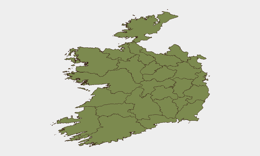
County Dublin dominates the risk calculus (score 31.4), reflecting its status as Ireland's capital, economic hub, and primary airport and port node; most of the airline-related events cluster here. County Tipperary's secondary elevation (29.2) merits investigation—whether driven by organised crime, public-order events, or infrastructure incidents—and should be tracked separately. Counties Laois (19.2) and Galway (10.3) register moderate signals; all remaining counties score at or near baseline (1.4–3.6), indicating minimal risk requiring active corporate attention. Geographic concentration in two counties simplifies risk management and suggests sectoral (aviation/transport) or Dublin-specific institutional drivers rather than nationwide instability.
How GeoBit Would Assist
For Ireland monitoring, GeoBit's OSINT fusion and multi-language search, X/Twitter & Telegram OSINT, and entity-extraction analytics enable rapid detection and deconfliction of incident signals across media, social platforms, and operator feeds. AOI (Area-of-Interest) monitoring with alerting on Dublin, Tipperary, and secondary counties ensures duty-of-care teams receive near-real-time notifications of disruptions, protests, or security events affecting staff, visitors, or supply chains. Routing & network analysis supports alternative journey planning if primary transport corridors (Dublin–Cork, airport approaches, port access) face temporary closure or congestion.
7-Day Outlook
Current airline-sector turbulence is unlikely to escalate into physical security threats affecting broader corporate operations or general travel safety. Barring unexpected labour action, public-order escalation, or infrastructure failure, Ireland's low-threat posture should persist. Ongoing monitoring of Dublin and Tipperary for operational disruptions (transport, commercial) is prudent; no heightened alert is warranted for other regions.
Highest-Risk Areas — Ranked
| # | State / Region | Risk |
|---|---|---|
| 1 | County Dublin | 31.4 |
| 2 | County Tipperary | 29.2 |
| 3 | County Laois | 19.2 |
| 4 | County Galway | 10.3 |
| 5 | County Donegal | 3.6 |
| 6 | County Mayo | 1.4 |
| 7 | County Sligo | 1.4 |
| 8 | County Clare | 1.4 |
| 9 | County Limerick | 1.4 |
| 10 | County Leitrim | 1.4 |
| 11 | County Roscommon | 1.4 |
| 12 | County Cavan | 1.4 |
Sources
Previous Daily Briefs
A new Ireland brief is written every day — each with its own risk map and downloadable CSV. Here's the last week; use the calendar to go further back.
📅 Browse every day by calendar →
Highlighted days have a brief. Tap a day for that day's map & analysis, or “csv” for that day's dataset ($5).