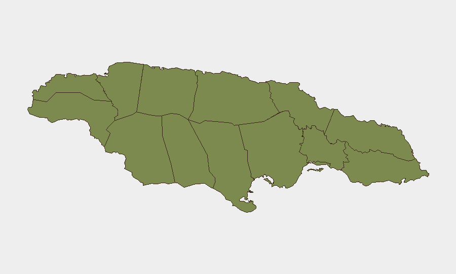
Situation Summary
Jamaica remains at composite threat score 19 (global rank #null) with 12 tracked events, reflecting persistent underlying crime and gang activity concentrated in two parishes. The past 24 hours have seen a cluster of high-visibility incidents—a child homicide in Trelawny, a custody death under investigation in Kingston, and a university student drowning—that have elevated public concern and media attention. Overall threat trajectory remains stable but with localized volatility in West Kingston and select parishes; baseline remains Level 2 (exercise increased caution) per U.S. State Department guidance.
Key Developments
- Trelawny – child homicide (Troy community, July 22): Police opened a homicide investigation into the murder of 10-year-old Nickisha Coke, whose body was discovered in Troy. The case has generated significant national media and social-media coverage, amplifying child-protection and community-safety concerns across the parish.
- Kingston – death in police custody (July 23): The Independent Commission of Investigations (INDECOM) launched a formal probe after a detainee fell ill and died while in Kingston police custody; this marks the 15th custody death recorded this year, underscoring detention-condition accountability issues relevant to corporate staff or contractors who may encounter Jamaica's justice system.
- Kingston – firearm seizure in Tivoli Gardens (July 18, reported July 22–24): The National Strategic Anti-Gang Division conducted an operation in an abandoned structure and seized a 9mm pistol with six rounds; one suspect was detained. The case reflects ongoing gang-firearms circulation in West Kingston.
- Saint Elizabeth – coastal drowning (Treasure Beach, July 22): A Caribbean Maritime University student (Jaleel Simpson) drowned in strong undertow at All Rafters, Treasure Beach. The incident underscores water-safety risks for visitors and residents in coastal areas during peak season.
- Kingston – vehicular accident involving media personnel (July 22–23): OnStage host Winford Williams and team members were injured in a road accident, drawing attention to transport and infrastructure-safety risks in the capital.
- National – ODPEM pre-positions hurricane-season supplies (July 23): The Office of Disaster Preparedness and Emergency Management distributed emergency supplies to local authorities ahead of the 2026 Atlantic hurricane season, affecting logistics and infrastructure resilience planning for coming weeks.
- National – dengue alert remains active (July 2026 baseline): Global health notice for dengue continues to influence travel-risk assessment; Jamaica is coded at 35/100 (moderate risk) by Travel Risk Calculator.
Highest-Risk Areas
Clarendon (31.3) and Saint Andrew (22.3) drive the national composite risk score and account for the majority of tracked violent-crime and gang-activity signals. Kingston—located in Saint Andrew—remains the geographic epicenter for firearms seizures, custody incidents, and organized-crime enforcement activity. Saint Ann (4.3) presents secondary concern; all other parishes score ≤1.3, indicating that risk is sharply concentrated in two urban/peri-urban zones. West Kingston localities (Tivoli Gardens, similar communities) continue to exhibit the highest firearms and gang-violence frequency.
How GeoBit Would Assist
A corporate security team operating in Jamaica would use Intel Sweep and multi-language OSINT to monitor real-time crime reporting, police statements, and social-media sentiment in high-risk parishes; AOI Monitoring & Early Warning to track Clarendon and Saint Andrew for escalation signals; and Routing & Network Analysis to identify safer transport corridors and alternative logistics routes around West Kingston. Risk & Threat Assessment modules would flag custody and detention-related risks for staff-safety protocols.
7-Day Outlook
No immediate escalation signals are present. Child-homicide and custody-death investigations will likely dominate local news and social discourse, maintaining public pressure on law-enforcement accountability. Hurricane-season preparations will continue, with potential for disruption to road infrastructure and logistics in mid-to-late July; baseline crime and gang-activity patterns in Clarendon and Kingston are expected to persist at current levels absent new catalysts.
Highest-Risk Areas — Ranked
| # | State / Region | Risk |
|---|---|---|
| 1 | Clarendon | 31.3 |
| 2 | Saint Andrew | 22.3 |
| 3 | Saint Ann | 4.3 |
| 4 | Hanover | 1.3 |
| 5 | Westmoreland | 1.3 |
| 6 | Saint James | 1.3 |
| 7 | Saint Elizabeth | 1.3 |
| 8 | Trelawny | 1.3 |
| 9 | Manchester | 1.3 |
| 10 | Saint Catherine | 1.3 |
| 11 | Saint Mary | 1.3 |
| 12 | Portland | 1.3 |
Sources
Previous Daily Briefs
A new Jamaica brief is written every day — each with its own risk map and downloadable CSV. Here's the last week; use the calendar to go further back.
📅 Browse every day by calendar →
Highlighted days have a brief. Tap a day for that day's map & analysis, or “csv” for that day's dataset ($5).
Atlas — our AI intelligence desk — emails them this snapshot personally. Nothing else, no list.