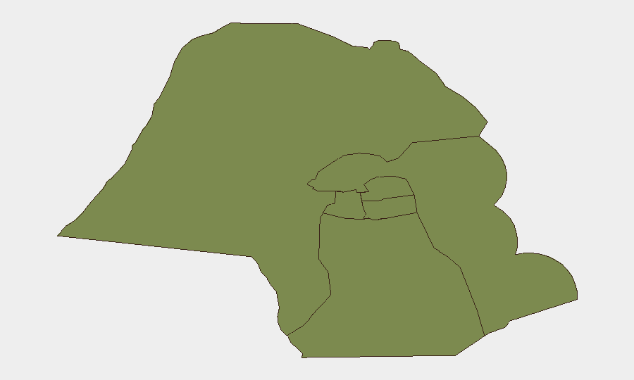
Situation Summary
Kuwait is experiencing an active military crisis following Iranian drone and ballistic-missile strikes against military, energy, and maritime targets across the country on July 18–20, 2026. While Kuwaiti air defenses have intercepted the majority of incoming threats, several critical infrastructure sites—including a power-and-water generation facility, oil installations, military bases, and offshore platforms—have sustained direct or debris-related damage, with scattered military and civilian injuries reported. The threat environment remains elevated, with ongoing interception activity reported as recently as July 20, and cross-border attack capability demonstrated against northern land posts and territorial waters.
Key Developments
- Ali Salem Air Base (July 18–19): Iranian drones and ballistic missiles targeted the base; Kuwaiti air defenses intercepted most rounds, but shrapnel wounded several soldiers. Iranian state media claimed strikes on US-linked assets at the facility.
- Kuwait City airspace (July 18–19): Air-defense engagement generated audible explosions and sirens across the capital; authorities confirmed interceptions rather than direct impacts on populated areas.
- Power-and-water facility (July 18–19): A major generating and desalination plant sustained direct damage, causing fires and shutdown of multiple units; emergency crews were deployed to contain the incident.
- Kuwait International Airport (July 18): Flight operations were temporarily suspended; Kuwait Airways rescheduled services in response to the missile and drone activity.
- Kuwait Oil Company facility (July 19): A petroleum installation was struck, causing material damage and injuries; repeated attacks were reported against oil-sector infrastructure.
- Northern border posts (July 20): Three land-border checkpoints in the north sustained material damage from attacks.
- Offshore platform and navy vessel (July 20): A hostile drone targeted a Kuwait Oil Company drilling platform in territorial waters, injuring one worker; a navy vessel was also struck, with four troops injured and ongoing air-defense activity reported.
Highest-Risk Areas
Jahra Governorate presents significantly elevated risk (31.8 composite score), driven by proximity to the Iraqi border, military installations, and demonstrated cross-border attack capability. The remaining five governorates—Ahmadi, Farwaniya, Hawalli, Mubarak al-Kabir, and Capital—cluster at much lower individual scores (1.8–2.7) but collectively represent the geographic concentration of critical infrastructure (power, water, oil, ports, and airspace), making them targets for cascading disruption. Northern and western border regions remain vulnerable to further unconventional and conventional attack.
How GeoBit Would Assist
Security teams monitoring Kuwait should employ AOI Monitoring & Early Warning on military bases, energy facilities, ports, and the airport to detect pre-attack indicators and track real-time missile/drone activity. Conflict & Military capabilities—including battle mapping, force-structure intelligence, and weapons-capability tracking—enable assessment of Iranian strike range, interception rates, and likely follow-on attack vectors. Maritime & Aviation tracking and GIS & Spatial Analysis support route planning for personnel and asset movement around damaged infrastructure and active engagement zones.
7-Day Outlook
Iranian strike capability has been demonstrated across Kuwait's full geography; further waves of attacks remain credible if regional tensions do not de-escalate. Critical-infrastructure repair and military-readiness efforts will dominate the near term, while airports, ports, and energy supply chains face prolonged disruption risk. Duty-of-care teams should anticipate extended flight delays, fuel and water rationing, and heightened military activity around sensitive sites.
Highest-Risk Areas — Ranked
| # | State / Region | Risk |
|---|---|---|
| 1 | Jahra Governorate | 31.8 |
| 2 | Ahmadi Governorate | 2.7 |
| 3 | Farwaniya Governorate | 1.8 |
| 4 | Hawalli Governorate | 1.8 |
| 5 | Mubarak al-Kabir Governorate | 1.8 |
| 6 | Capital Governorate | 1.8 |
Sources
Previous Daily Briefs
A new Kuwait brief is written every day — each with its own risk map and downloadable CSV. Here's the last week; use the calendar to go further back.
📅 Browse every day by calendar →
Highlighted days have a brief. Tap a day for that day's map & analysis, or “csv” for that day's dataset ($5).
Atlas — our AI intelligence desk — emails them this snapshot personally. Nothing else, no list.