Situation Summary
Laos remains a low-threat environment globally (rank #146; composite score 2.0) with no confirmed major security incidents, civil unrest, terrorism, or large-scale crime reported in the last 24–48 hours. Background risks—including petty theft, motorcycle crime, and road-safety hazards—persist as chronic issues rather than emerging threats. The security posture is stable, with no new incident clusters or government-issued alerts flagging imminent danger to personnel or assets.
Key Developments
No confirmed security incidents, protests, attacks, or significant disruptions have been independently verified in Laos during the last 24–48 hours. Open-source monitoring (international wires, regional security outlets, government travel advisory updates, and local media) has produced no evidence of:
- Active civil unrest, demonstrations, or politically motivated violence in major urban centers (Vientiane, Luang Prabang, Pakse, Savannakhet)
- Terrorist incidents or confirmed insurgent activity
- Cross-border security breaches or infrastructure disruptions tied to security events
- Crime spikes or new incident clusters beyond routine advisory-level risks (petty theft, bag snatches, vehicle theft)
Current reporting reflects the *status quo risk environment* documented in standing travel advisories rather than newly emerged threats.
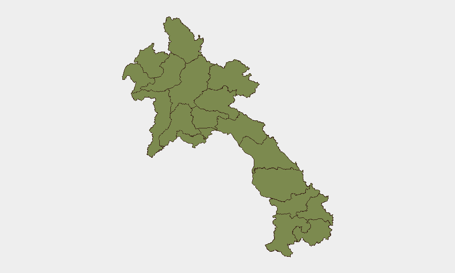
Highest-Risk Areas
Bolikhamsai Province drives the sub-national risk ranking disproportionately (score 31.4), creating a significant outlier against all other regions (scores ≤4.1). This elevation likely reflects historical cross-border dynamics, remote terrain, limited state control, and persistent background concerns regarding trafficking and smuggling routes, though no acute incident spike has been confirmed in the reporting window. Vientiane Prefecture (4.1) follows as the secondary concern, consistent with its status as the capital and seat of government, where political sensitivity and concentration of foreign nationals and critical infrastructure elevate baseline risk. All remaining provinces cluster at 1.4, indicating relatively uniform low risk across the rest of the country.
Security teams should treat Bolikhamsai as a no-travel or high-restriction zone pending operational justification; Vientiane Prefecture warrants standard duty-of-care protocols (staff movement awareness, liaison with diplomatic missions, contingency comms). Other regions support routine commercial and development activity with standard travel-security precautions.
How GeoBit Would Assist
Teams with personnel or assets in Laos should employ AOI Monitoring & Early Warning on Bolikhamsai and Vientiane Prefecture to detect incident emergence in real time. Intel Sweep and multi-language OSINT fusion (including X/Twitter, Telegram, and local-language regional news) will surface unverified or early-stage reports before mainstream international wires, enabling faster escalation. Routing & Network Analysis supports alternative-route and safe-transit planning, particularly for movement through or near Bolikhamsai or cross-border zones where road-safety and security ambiguity are highest.
7-Day Outlook
No near-term escalation is anticipated based on current signals and regional stability indicators. Wet-season travel hazards (road safety, flooding, landslides) remain the primary operational risk over the next week; security risks are expected to remain at background levels. Monitoring should continue on Bolikhamsai and Vientiane for any shift in political messaging, cross-border activity, or law-enforcement posture.
Highest-Risk Areas — Ranked
| # | State / Region | Risk |
|---|---|---|
| 1 | Bolikhamsai | 31.4 |
| 2 | Vientiane Prefecture | 4.1 |
| 3 | Luang Namtha | 1.4 |
| 4 | Bokeo Province | 1.4 |
| 5 | Phongsaly | 1.4 |
| 6 | Oudomxay | 1.4 |
| 7 | Luang Prabang | 1.4 |
| 8 | Houaphanh | 1.4 |
| 9 | Xiangkhouang Province | 1.4 |
| 10 | Sainyabuli Province | 1.4 |
| 11 | Vientiane Province | 1.4 |
| 12 | Xaisomboun Province | 1.4 |
Sources
Previous Daily Briefs
A new Laos brief is written every day — each with its own risk map and downloadable CSV. Here's the last week; use the calendar to go further back.
📅 Browse every day by calendar →
Highlighted days have a brief. Tap a day for that day's map & analysis, or “csv” for that day's dataset ($5).