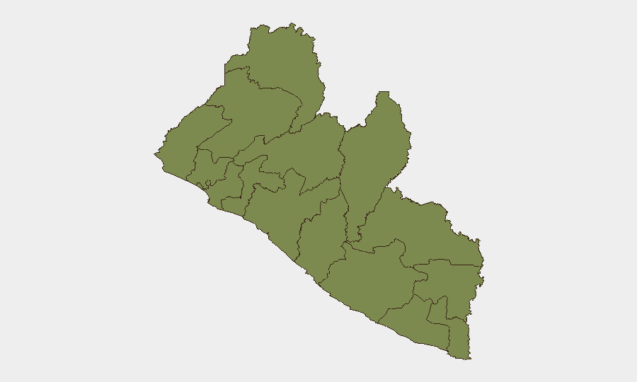
Situation Summary
Liberia's security environment remains at baseline low-threat level as of 20 June 2026, with no verified incidents of violence, civil unrest, crime escalation, or infrastructure disruption documented in the past 24–48 hours. Open-source monitoring across news wires, social platforms, and corroborated reporting indicates stable conditions nationwide. One tracked military event was flagged on 19 June but has not escalated or generated follow-on reporting. No visible escalation trajectory is evident; conditions are expected to remain within normal parameters in the near term.
Key Developments
- 19 June 2026 · Conventional Military Force event · National scope – GeoBit event database recorded a military activity signal on 19 June; corroborating details and specific location remain limited in open-source reporting. No secondary sources have confirmed escalation or operational impact as of 20 June morning.
Note: No additional verified security, conflict, crime, or civil-unrest incidents meeting professional corroboration standards were identified in Liberia during the 24–48-hour reporting window (18–20 June 2026). Social media activity, news wires, and wire-service feeds indicate no discrete reportable events in that period.
Highest-Risk Areas
Grand Bassa County (composite risk score 31.3) remains the highest-risk sub-national area and an analytical outlier, despite the absence of acute recent incidents. Montserrado County (risk 27.0)—which includes the capital Monrovia and surrounding urban zones—ranks second and warrants routine monitoring due to its population density and commercial activity. All remaining counties cluster at significantly lower risk (1.3–1.3 composite scores), indicating risk is geographically concentrated. Neither top-ranked county has reported new violence or unrest in the last 24–48 hours; elevated scores reflect underlying vulnerability factors rather than active incidents.
How GeoBit Would Assist
Security teams protecting personnel or assets in Liberia would deploy AOI Monitoring & Early Warning to maintain persistent watch on Grand Bassa and Montserrado counties, with real-time alerting on any civil unrest, violence, or infrastructure disruption. Intel Sweep and multi-language OSINT fusion would track news, social platforms, and local reporting to catch emerging incidents before they escalate. GIS & Spatial Analysis and Routing & Network Analysis would support contingency planning—identifying safe corridors, alternative transit routes, and secure locations within high-risk zones for duty-of-care scenarios.
7-Day Outlook
Liberia's security posture is forecast to remain stable over the next seven days absent new triggering events. Continued baseline monitoring of Grand Bassa and Montserrado counties is prudent; any spike in crime reports, public disorder, or military activity in those zones should trigger immediate escalation review. Corporate security teams should maintain standard duty-of-care protocols and update travel risk assessments if conditions shift.
GeoBit Threat Ranking: Liberia global composite score 7 | 4 tracked events | Low baseline threat | No escalation trajectory identified.
*Brief issued 20 June 2026, 06:00 UTC. Next update: 21 June 2026.*
Highest-Risk Areas — Ranked
| # | State / Region | Risk |
|---|---|---|
| 1 | Grand Bassa County | 31.3 |
| 2 | Montserrado County | 27 |
| 3 | Grand Cape Mount County | 1.3 |
| 4 | Lofa County | 1.3 |
| 5 | Gbarpolu County | 1.3 |
| 6 | Bomi County | 1.3 |
| 7 | Margibi County | 1.3 |
| 8 | Bong County | 1.3 |
| 9 | Rivercess County | 1.3 |
| 10 | Nimba County | 1.3 |
| 11 | Grand Gedeh County | 1.3 |
| 12 | Sinoe County | 1.3 |
Sources
Previous Daily Briefs
A new Liberia brief is written every day — each with its own risk map and downloadable CSV. Here's the last week; use the calendar to go further back.
📅 Browse every day by calendar →
Highlighted days have a brief. Tap a day for that day's map & analysis, or “csv” for that day's dataset ($5).