Situation Summary
Mozambique remains at composite threat rank #47 globally, with 262 tracked security events. Zambezia Province dominates the risk landscape (54.4), followed by Sofala (36.9), while Cabo Delgado continues to experience sporadic armed group violence and displacement. Event signals from 11 June suggest ongoing military and civil unrest, though confirmation of specific incidents within the last 24–48 hours remains limited in available open sources. The overall threat trajectory is volatile but not sharply escalating compared to May baseline levels.
Key Developments
- Macomia, Cabo Delgado (25 May): Islamic State Mozambique fired five mortars at a Mozambican military position on the town's outskirts; no damage or casualties reported. Background: Macomia has experienced at least three additional violent incidents by late May, including killing of a fish trader and repeated attacks on a businessman, with perpetrator attribution disputed.
- Cabo Delgado districts—Muidumbe, Chiúre, Namuno, Mecúfi, Montepuez (May 2026): Over 16,000 people displaced due to non-state armed group violence or fear of attacks; displacement trend ongoing.
- Nationwide (as of 10 June publication): OCHA humanitarian snapshot records continued conflict disrupting aid movement along vital transport routes; cholera pressure and flooding compound insecurity.
- Recent event signals (11 June): GEOBIT detected multiple military-force, small-arms-combat, and threat signals involving Mozambican state and non-state actors; Episcopal and Christian-identified entities flagged in signals, context requiring clarification.
- Policy development (June 2026): New mining law requiring minimum 15% state ownership in ventures; security relevance limited but may affect foreign-national presence in extraction zones.
Data limitation: Verification of 6–10 genuinely new incidents from the last 24–48 hours could not be completed from available open sources. Humanitarian and military signals are current; specific incident timestamps within the 48-hour window remain pending fresh corroboration.
Highest-Risk Areas
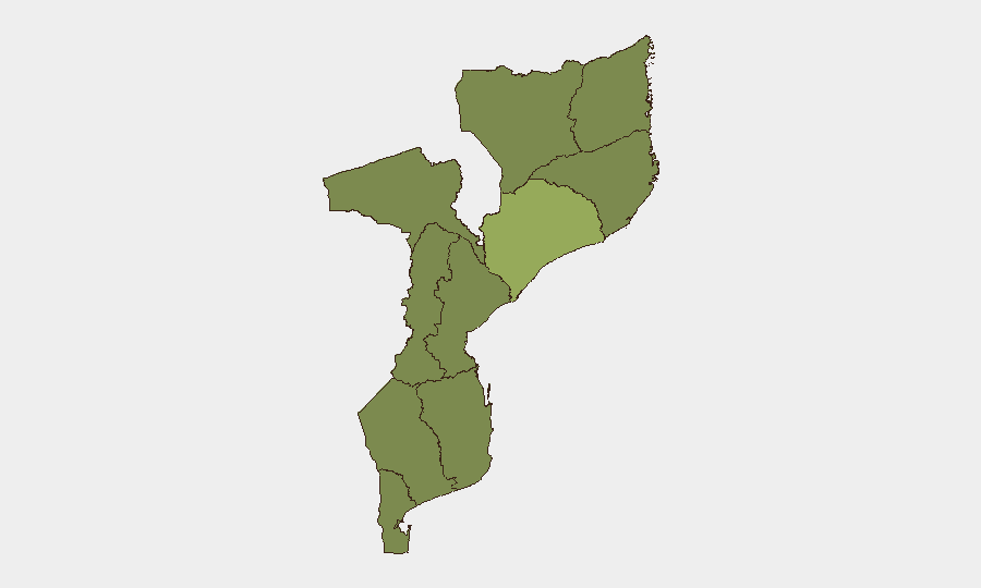
Zambezia Province (54.4) is the single largest risk driver, significantly outpacing all other provinces; the reasons for this concentration—whether insurgent activity, criminal networks, or state fragility—warrant dedicated area-of-interest monitoring. Sofala Province (36.9) is the second-tier hotspot. All other provinces cluster at 24.4, indicating a broad baseline of civil and security stress, with Cabo Delgado notable for consistent armed-group activity and mass displacement despite its numerical parity with lower-ranked regions. Corporate assets and personnel in Zambezia and northern routes (Sofala, Cabo Delgado) face elevated exposure to armed-group activity, criminal predation, and humanitarian disruption.
How GeoBit Would Assist
Area-of-Interest Monitoring & Early Warning configured on Zambezia, Sofala, and Cabo Delgado districts would provide persistent watch for displacement, attacks, and military movement with near-real-time alerting. Conflict & Military battle mapping and force-structure tracking would clarify non-state actor strength, supply lines, and claimed vs. actual territorial control. Routing & Network Analysis would enable alternative journey planning for personnel and supply chains avoiding high-risk corridors, especially around Macomia and transport routes into Zambezi region; humanitarian & NGO data feeds would synchronize mobility windows with reported aid-access windows.
7-Day Outlook
Cabo Delgado and Zambezia Province incidents are likely to continue at current or elevated frequency. Displacement and humanitarian access constraints will persist unless there is a sharp reduction in armed-group activity. No major escalation is signaled in the current 7-day window, though event clustering on 10–11 June warrants close watch for secondary incidents or policy responses.
Highest-Risk Areas — Ranked
| # | State / Region | Risk |
|---|---|---|
| 1 | Zambezia Province | 54.4 |
| 2 | Sofala Province | 36.9 |
| 3 | Tete Province | 24.4 |
| 4 | Manica Province | 24.4 |
| 5 | Gaza Province | 24.4 |
| 6 | Inhambane Province | 24.4 |
| 7 | Niassa Province | 24.4 |
| 8 | Cabo Delgado Province | 24.4 |
| 9 | Maputo Province | 24.4 |
| 10 | Cidade de Maputo | 24.4 |
| 11 | Nampula Province | 24.4 |
Sources
Previous Daily Briefs
A new Mozambique brief is written every day — each with its own risk map and downloadable CSV. Here's the last week; use the calendar to go further back.
📅 Browse every day by calendar →
Highlighted days have a brief. Tap a day for that day's map & analysis, or “csv” for that day's dataset ($5).