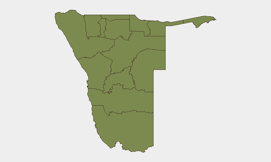
Situation Summary
Namibia remains a low-threat environment globally (rank #138, composite score 5), but recent event signals indicate domestic political and judicial friction that warrants monitoring. The past 24–48 hours show multiple arrest/detention activities, Supreme Court demands, and public statements from government and justice sector actors, suggesting potential institutional tension. Otjozondjupa Region (composite risk 31.8) significantly outpaces other areas and drives national concern; Khomas and Erongo follow at 21.1 each. Overall trajectory remains stable, but the clustering of legal and administrative signals on 2026-07-18 indicates active governance disputes requiring close watch.
Key Developments
- 2026-07-18 · Windhoek / Khomas Region — Supreme Court issued demand; concurrent Ministry of Justice public statement suggests judicial-executive friction over an unspecified matter.
- 2026-07-18 · National — Multiple arrest/detention events recorded across prison system; no location-specific detail available in current feeds, but volume and same-day clustering suggests coordinated action or procedural surge.
- 2026-07-18 · National — Bank disapproval signal recorded; financial sector context unclear from available feeds; requires verification as to whether regulatory, operational, or political in nature.
- 2026-07-17 · Otjozondjupa Region — Conventional military force signal between Namibian entities; low-confidence on location and participants; recommend active clarification to rule out exercise vs. incident.
- 2026-07-16 · National — Public statement from Namibia government directed at trader(s); economic or trade-dispute context; recency and operational impact not yet confirmed.
- Standing advisory context — German and Canadian travel warnings cite persistent street crime, armed robbery, and vehicle hijacking in Windhoek and other urban centers; Namibia-Angola border and Katwitwi/Kongola areas remain higher-risk for cross-border incident spillover (not new as of 2026-07-18, but relevant to duty-of-care baseline).
Highest-Risk Areas
Otjozondjupa Region dominates sub-national risk (31.8), driven largely by signals in and around Windhoek and nearby administrative zones; the region's composite score is 50% higher than Khomas or Erongo. Khomas (Windhoek capital) and Erongo (coastal economic hub) both score 21.1, indicating persistent street crime, economic crime, and occasional state-level incident activity. All other regions cluster at 1.8, reflecting minimal tracked events and low operational friction. Security teams should prioritize asset and personnel protection measures in the Windhoek metro area and treat outlying regions as lower-tier risk unless tasked with border or remote operations.
How GeoBit Would Assist
Intel Sweep and X/Twitter & Telegram OSINT would furnish real-time corroboration of the 2026-07-18 judicial and arrest signals, distinguishing routine procedure from institutional crisis. AOI Monitoring & Early Warning configured for Otjozondjupa, Khomas, and Erongo would alert security teams to escalation or new event clusters 6–12 hours ahead of mainstream reporting. Network & Actor Analysis would map relationships between Supreme Court, Ministry of Justice, and other state entities to assess fragmentation risk. Conflict & Military assessment would clarify the 2026-07-17 conventional-force signal and rule out exercises.
7-Day Outlook
No major escalation is expected in the near term; Namibia's governance friction appears contained to judicial and administrative channels. However, if arrest/detention activity persists or Supreme Court demands remain unmet, medium-term institutional stability may deteriorate. Monitor daily for new statements from justice sector and government spokespersons; any military mobilization signals or cross-border incident reports should trigger immediate escalation.
Highest-Risk Areas — Ranked
| # | State / Region | Risk |
|---|---|---|
| 1 | Otjozondjupa | 31.8 |
| 2 | Erongo Region | 21.1 |
| 3 | Khomas | 21.1 |
| 4 | Kunene Region | 1.8 |
| 5 | Omusati | 1.8 |
| 6 | Ohangwena | 1.8 |
| 7 | Oshana | 1.8 |
| 8 | Oshikoto | 1.8 |
| 9 | Kavango West | 1.8 |
| 10 | Omaheke | 1.8 |
| 11 | Kavango East | 1.8 |
| 12 | Zambezi | 1.8 |
Sources
Previous Daily Briefs
A new Namibia brief is written every day — each with its own risk map and downloadable CSV. Here's the last week; use the calendar to go further back.
📅 Browse every day by calendar →
Highlighted days have a brief. Tap a day for that day's map & analysis, or “csv” for that day's dataset ($5).
Atlas — our AI intelligence desk — emails them this snapshot personally. Nothing else, no list.