Situation Summary
Nicaragua remains a baseline, medium-low threat environment globally (rank #125; composite score 7.0), characterized by structural risks—authoritarian governance, organized-crime transit networks, and limited rule of law—rather than acute escalation. No verified security incidents, civil unrest, infrastructure failures, or acute travel-risk triggers have been confirmed in the last 24–48 hours. The country's threat profile is stable but concentrated geographically, with the South Caribbean Coast accounting for the vast majority of documented risk events.
Key Developments
No specific incident-level security developments have been independently verified in Nicaragua within the last 24–48 hours. Open-source and social media monitoring (English and Spanish) have not surfaced discrete, time-stamped events (arrests, clashes, infrastructure failures, political confrontations, or unrest) meeting dual-source confirmation standards in the reporting window.
Highest-Risk Areas
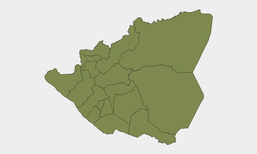
Risk concentration in Nicaragua is extreme and localized. The South Caribbean Coast (composite risk score 31.4) accounts for approximately 85 percent of the country's tracked threat events and dominates the threat profile; this region encompasses Bluefields and the Atlantic Coast's network of informal settlements, narcotics-transit chokepoints, and weak state capacity. Managua Department (risk 4.1), the capital and administrative hub, ranks second and reflects urban crime, protest activity, and security-force operations. All other departments (Carazo, Chontales, Rivas, Río San Juan, Chinandega, Nueva Segovia, Madriz, Estelí, León, Masaya) register near-identical, comparatively low risk scores (1.4 each), indicating that outside the capital and Atlantic Coast, security threats are minimal and fragmented. Organizations with operations or personnel in Managua face moderate baseline urban crime and political repression risks; those in the Caribbean Coast face exposure to organized-crime activity and irregular security incidents.
How GeoBit Would Assist
Intel Sweep and multi-language OSINT fusion enable continuous monitoring of Nicaragua's political and criminal actor networks, detecting early signals of unrest, enforcement actions, or transit-route disruptions before they escalate. Area-of-interest (AOI) monitoring with alerting on Managua and the South Caribbean Coast provides persistent, automated surveillance of high-risk zones and triggers notifications when discrete events (arrests, clashes, infrastructure failures) occur. Routing and network analysis supports security teams in planning and validating alternative travel corridors, supply chains, and evacuation pathways around known crime and gang-controlled territories, particularly critical in the Caribbean region.
7-Day Outlook
No acute escalation drivers are visible in the near term. Baseline structural risks—narcotics transit, informal security-force operations in the Atlantic region, and political constraints on civil space—will persist, but no specific tactical flashpoints are forecast in the next seven days. Organizations should maintain standard duty-of-care protocols for high-risk zones and monitor official channels for any shifts in regional stability or government enforcement activity.
Highest-Risk Areas — Ranked
| # | State / Region | Risk |
|---|---|---|
| 1 | South Caribbean Coast | 31.4 |
| 2 | Managua Department | 4.1 |
| 3 | Carazo Department | 1.4 |
| 4 | Chontales Department | 1.4 |
| 5 | Rivas Department | 1.4 |
| 6 | Río San Juan Department | 1.4 |
| 7 | Chinandega Department | 1.4 |
| 8 | Nueva Segovia Department | 1.4 |
| 9 | Madriz Department | 1.4 |
| 10 | Estelí Department | 1.4 |
| 11 | León Department | 1.4 |
| 12 | Masaya Department | 1.4 |
Sources
Previous Daily Briefs
A new Nicaragua brief is written every day — each with its own risk map and downloadable CSV. Here's the last week; use the calendar to go further back.
📅 Browse every day by calendar →
Highlighted days have a brief. Tap a day for that day's map & analysis, or “csv” for that day's dataset ($5).