Situation Summary
Oman faces a sharp escalation in maritime security risk following a cluster of attacks on commercial shipping in the Gulf of Oman and Sea of Oman between 8–11 June 2026. At least three confirmed incidents involving Indian-flagged or Indian-crewed vessels have resulted in one confirmed fatality report (MT Settebello, 3 Indian crew killed) and multiple crew injuries or missing persons, with a fourth vessel (MT Jalveer) attacked but all crew reported safe. The incidents are being framed by regional actors—including Indian officials—as connected to U.S. enforcement actions, though attribution remains contested and diplomatic friction between India and the United States has intensified.
Key Developments
- MT Settebello (Palau flag) – 10 June 2026, Gulf of Oman off Oman coast: Oil tanker attacked; 3 Indian crew members confirmed killed, 25 safely evacuated (21 Indian nationals among them). Incident cited by Indian government in formal briefings as part of an active threat cluster to merchant shipping.
- MT Jalveer (Guinea-Bissau flag) – 11 June 2026, off Shinas Port, northern Oman: Asphalt/bitumen tanker attacked; 20 Indian seafarers on board, all confirmed safe with no casualties. Indian government classified as "maritime security incident."
- Iranian cargo vessel (150-ton, ex-Sirik) – 11 June 2026, Sea of Oman ~5 miles off Khasab, Musandam Governorate: Vessel struck by projectile while transiting to Iran; 5 crew rescued, no injuries. Iranian authorities characterized incident as U.S. attack, elevating Strait of Hormuz risk perception.
- MT Marivex – 8 June 2026, waters off Oman: Vessel carrying 24 Indian crew attacked; all crew rescued by Omani Air Force. Cited in Indian Ministry briefings as part of ongoing incident pattern.
- Diplomatic escalation – 10–11 June 2026: India summoned U.S. envoy twice within 48 hours over attacks on vessels off Oman coast; public and official anger reported over Indian seafarer deaths. Indian Navy warships deployed to Gulf of Oman to provide merchant-shipping escort.
- Unnamed tanker incident – 10–11 June 2026, Sea of Oman/Gulf of Oman: Suspected U.S. missile strike reported; 2 crew missing, 1 injured. Casualty figures suggest either a fifth separate incident or evolving reporting of earlier attacks.
Highest-Risk Areas
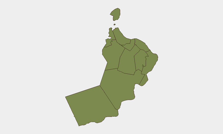
Al Wusta Governorate dominates the risk ranking (31.3 composite score) and represents the overwhelming concentration of threat activity; however, the maritime incidents are occurring in international waters adjacent to Musandam Governorate (Khasab area, Strait of Hormuz approaches) and unspecified Gulf of Oman coordinates. Risk elevation is driven by active kinetic attacks on commercial shipping, geopolitical tension between major powers (U.S., India, Iran), and the critical maritime chokepoint role of the Strait of Hormuz. All other governorates remain at baseline risk (1.3–2.9).
How GeoBit Would Assist
Maritime & Aviation tracking and AOI Monitoring with alerting would enable continuous watch on vessel movements and attack patterns in the Gulf of Oman and approaches to the Strait of Hormuz, with real-time alerts to security teams. Network & Actor Analysis and Intel Sweep (X/Twitter, Telegram OSINT, regional media) would track attribution claims, Indian–U.S. diplomatic messaging, and Iranian official statements to assess escalation risk and clarify incident patterns. Routing & Network Analysis would support alternative maritime routing around high-risk zones for any corporate shipping or personnel-movement operations.
7-Day Outlook
Continued elevated risk to maritime traffic in the Gulf of Oman and Sea of Oman is probable through 20 June, with Indian Navy presence and potential for further incidents if geopolitical posturing (U.S.–India friction, Iran framing) persists. Onshore risk in Oman proper remains low; however, port operations and expatriate communities in Muscat and northern coastal areas should monitor for diplomatic incidents or secondary effects of maritime tension. Risk trajectory depends on U.S.–India de-escalation dialogue and clarity on attribution.
Highest-Risk Areas — Ranked
| # | State / Region | Risk |
|---|---|---|
| 1 | Al Wusta Governorate | 31.3 |
| 2 | Al Batinah North Governorate | 2.9 |
| 3 | Musandam Governorate | 2.7 |
| 4 | Muscat Governorate | 1.3 |
| 5 | Al Buraymi Governorate | 1.3 |
| 6 | Ad Dhahirah Governorate | 1.3 |
| 7 | Al Batinah South Governorate | 1.3 |
| 8 | Ad Dakhiliyah Governorate | 1.3 |
| 9 | Ash Sharqiyah North Governorate | 1.3 |
| 10 | Ash Sharqiyah South Governorate | 1.3 |
| 11 | Dhofar Governorate | 1.3 |
Sources
Previous Daily Briefs
A new Oman brief is written every day — each with its own risk map and downloadable CSV. Here's the last week; use the calendar to go further back.
📅 Browse every day by calendar →
Highlighted days have a brief. Tap a day for that day's map & analysis, or “csv” for that day's dataset ($5).