ملخص الوضع
تواجه سلطنة عمان تصعيداً حاداً في الأمن البحري والإقليمي يتمحور حول الضربات العسكرية الإيرانية على منصات الرادار العمانية وسلسلة من الهجمات بالقذائف على ناقلات تجارية في مضيق هرمز وأقترابات الخليج. وقعت ثلاث حوادث مؤكدة تتضمن ضربات على الناقلات أو إطلاق نار مباشر خلال 48 ساعة (17-19 يوليو 2026)، مع إعلان فيلق الحرس الثوري الإسلامي الإيراني مسؤوليته عن الضربات على منصات الرادار في الأراضي العمانية. أصدرت تحذيرات السفر الدولية وقيود الطيران وعمليات الحصار البحري قيوداً على الحركة والتجارة عبر المياه والمجال الجوي العماني، مع تركيز الخطر في محافظات الشمال (مسندم) والوسط الشرقي (الوسطى).
التطورات الرئيسية
- ضربة ناقلة شرق خصب، مسندم (الجمعة، 18 يوليو 2026): ضربت ناقلة نفط تجارية بقذيفة مجهولة على بعد حوالي 19 ميلاً بحرياً شرق خصب؛ أضرار هيكلية طفيفة، الطاقم آمن؛ التحقيق جار من قبل السلطات العمانية.
- حريق سفينة شمال غرب قمزم، مسندم (الأحد، 19 يوليو 2026): ضربت ناقلة بقذيفة على بعد حوالي 8 أميال بحرية شمال غرب قمزم، اشتعلت فيها النيران، وتم إجلاء الطاقم واستعادته بأمان؛ السفينة لا تزال طافية مع استمرار الحريق.
- حادثة عسكرية شرق دقم، الوسطى (الجمعة، 17 يوليو 2026): أبلغت عمليات التجارة البحرية البريطانية عن حادثة أمنية تتضمن ناقلة تجارية وقوات عسكرية على بعد حوالي 100 ميل بحري شرق دقم؛ التفاصيل الكاملة وتقييم الأضرار لا تزال غير واضحة.
- الضربات الإيرانية على منصات الرادار العمانية (الجمعة، 18 يوليو 2026): أعلن فيلق الحرس الثوري الإسلامي الإيراني علناً عن ضربات صاروخية على منصات الرادار في عمان، بما في ذلك رادار التحكم الجوي الأمريكي، متزامنة مع هجوم الناقلة شرق خصب.
- تحديث التحذيرات الأمريكية والفرنسية للسفر (18-19 يوليو 2026): أصدرت السفارة الأمريكية في مسقط وزارة الخارجية الفرنسية تحذيرات معززة ضد السفر غير الضروري إلى مسندم ودقم والسلالة وناطق الحدود مع اليمن؛ يواجه موظفو الحكومة الأمريكية الآن قيود سفر رسمية إلى مسندم ودقم.
- التحذير الأوروبي للطيران (18-19 يوليو 2026): نصحت وكالة سلامة الطيران الأوروبية مشغلي الطائرات بتجنب المجال الجوي للخليج، بما في ذلك الطرق بالقرب من عمان، حتى 29 يوليو 2026، بسبب زيادة النشاط العسكري وتبادل الصواريخ والطائرات بدون طيار.
- عمليات الحصار البحري (18-19 يوليو 2026): أعادت قيادة القوات المركزية الأمريكية نشر القوات البحرية وعطلت السفن التجارية في حارات الشحن بالخليج بالقرب من المياه العمانية كجزء من توسيع الحصار على إيران، مما زاد من تعطل حركة المرور البحري وفحوصات الأمن.
مناطق الخطر الأعلى
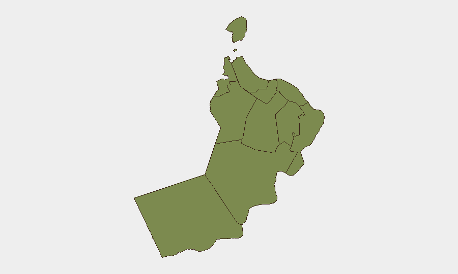
محافظة الوسطى (درجة خطر 31.3) ومحافظة مسندم (2.6) تحدد ملف التهديد الوطني. يعكس الخطر المرتفع في الوسطى تجمع الحوادث العسكرية والضربات على الناقلات في ممرات بحرية شرق دقم خلال آخر 48 ساعة، بينما تواجه مسندم التعرض المباشر لأعمال العنف البحري في مضيق هرمز والمطالبات الإيرانية بالضربات على منصات الرادار العمانية. تحمل مسقط (10.1) خطراً ثانوياً بسبب التركيز الدبلوماسي والإداري؛ جميع المحافظات الأخرى تسجل تهديداً أساسياً بحداً أدنى. يعكس التركيز الجغرافي للحوادث في المناطق البحرية والحدود الشمالية تجاوز النزاع الإقليمي بدلاً من عدم الاستقرار المحلي الواسع.
كيف يمكن لـ GeoBit المساعدة
يجب على فريق الأمن نشر المراقبة والإنذار المبكر للمناطق محددة الاهتمام على ممرات مسندم والوسطى البحرية للكشف عن الحوادث البحرية في الوقت الفعلي؛ تتبع البحري والجوي لمراقبة مسارات السفن وقيود المجال الجوي من خلال تحذيرات وكالة سلامة الطيران الأوروبية؛
المناطق الأعلى خطورة — مرتبة
| # | الولاية / المنطقة | الخطر |
|---|---|---|
| 1 | Al Wusta Governorate | 31.3 |
| 2 | Muscat Governorate | 10.1 |
| 3 | Dhofar Governorate | 3.3 |
| 4 | Musandam Governorate | 2.6 |
| 5 | Al Buraymi Governorate | 1.3 |
| 6 | Ad Dhahirah Governorate | 1.3 |
| 7 | Al Batinah North Governorate | 1.3 |
| 8 | Al Batinah South Governorate | 1.3 |
| 9 | Ad Dakhiliyah Governorate | 1.3 |
| 10 | Ash Sharqiyah North Governorate | 1.3 |
| 11 | Ash Sharqiyah South Governorate | 1.3 |
المصادر
الموجزات اليومية السابقة
يُنشر موجز جديد عن Oman كل يوم — لكل منها خريطة مخاطر وملف CSV قابل للتنزيل. هذا هو الأسبوع الأخير؛ استخدم التقويم للرجوع أبعد.
📅 Browse every day by calendar →
Highlighted days have a brief. Tap a day for that day's map & analysis, or “csv” for that day's dataset ($5).
Atlas — our AI intelligence desk — emails them this snapshot personally. Nothing else, no list.