Situation Summary
Palau's domestic security environment remains stable with no credible reports of civil unrest, terrorism, or infrastructure attacks within its territory as of 14 June 2026. The primary security exposure affecting Palau stems from the flag-of-convenience risk to Palau-registered commercial vessels transiting high-threat maritime zones, specifically the Arabian Sea and Strait of Hormuz region. Recent incidents involving Palau-flagged tankers off Oman (MT Settebello strike resulting in three fatalities on 12–13 June) and U.S. military engagement with another Palau-flagged vessel near the Strait of Hormuz underscore elevated maritime risk for Palau-registered shipping rather than territorial or civil instability within Palau itself.
Key Developments
- MT Settebello (Palau-flagged tanker) struck off Oman – 12–13 June 2026
Vessel attacked in the Arabian Sea off Oman's coast; three crew members confirmed dead. Incident location: international waters near Oman, not Palau territory. Indicates heightened risk to Palau-flagged commercial assets transiting West Asian maritime corridors.
- U.S. military engagement with Palau-flagged vessel near Strait of Hormuz – 12–13 June 2026
U.S. forces reported firing precision munitions into the engine room of a Palau-flagged vessel during operations to intercept attack drones and protect shipping. Location: Gulf region / Strait of Hormuz area. Reflects U.S.–Iran tensions and collateral exposure of Palau-flagged commercial traffic.
- Palau–Taiwan transnational-crime cooperation announcement – within last 24–48 hours
Diplomatic statement highlighting new law-enforcement and security partnership between Palau and Taiwan to combat transnational crime. Assessment: stabilizing policy measure with no associated civil unrest or security incident.
- Presidential economic and connectivity briefing – within last 24–48 hours
Palau leadership issued routine briefing on post-pandemic tourism recovery, aviation expansion, and economic growth. Location: Koror / national level. No reports of political protest or civil unrest linked to the announcement.
- Palau maritime surveillance capacity deployment – referenced in last 24–48 hours (policy, not incident)
National ocean policy highlights deployment of new 40-meter surveillance vessel and reef-protection craft for territorial waters. Assessment: capacity-building measure aimed at combating illegal fishing and maritime crime; no active incident triggered this announcement.
Highest-Risk Areas
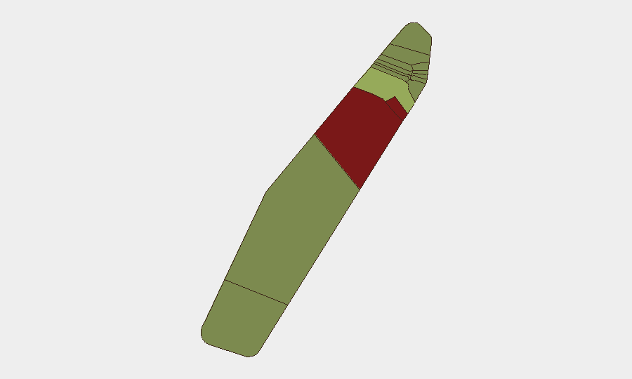
Peleliu and Angaur together account for the two highest sub-national risk scores (92 and 88 respectively), significantly above the national average and all other states. The drivers of risk in these two states are not documented in current open sources as active civil conflict or terrorism; elevated scores likely reflect historical factors (e.g., Peleliu's World War II legacy and heritage-site access complexities) or infrastructure/maritime vulnerability assessments. Koror, as Palau's commercial and diplomatic capital, carries moderate elevated risk (45) consistent with higher population density and administrative concentration. The remaining nine states show substantially lower and converging risk profiles (35 and below), indicating risk is concentrated in the northern and central island groupings rather than dispersed nationwide.
How GeoBit Would Assist
Teams with personnel or assets in Palau should deploy AOI (Area-of-Interest) Monitoring & Early Warning on Koror and other administrative centers to detect sudden political or civil incidents before escalation. For corporate assets dependent on Palau-flagged or Palau-crewed shipping, Maritime & Aviation Tracking combined with multi-language OSINT fusion across regional news feeds will provide early alert to attacks or detentions in the Arabian Sea and Gulf corridors. Network & Actor Analysis linked to transnational-crime networks and election monitoring (if national elections are scheduled within the outlook period) will help identify emerging political or security pressure points.
7-Day Outlook
No imminent security deterioration is anticipated within Palau's territory over the next seven days. Maritime risk to Palau-flagged vessels in West Asia will remain elevated given ongoing U.S.–Iran tensions and recent attack patterns. Diplomatic and capacity-building initiatives (Taiwan partnership, ocean surveillance) suggest the government's focus remains on institutional strengthening rather than crisis response.
Highest-Risk Areas — Ranked
| # | State / Region | Risk |
|---|---|---|
| 1 | Peleliu | 92 |
| 2 | Angaur | 88 |
| 3 | Koror | 45 |
| 4 | Melekeok | 35 |
| 5 | Airai | 32 |
| 6 | Ngatpang | 28 |
| 7 | Ngeremlengui | 26 |
| 8 | Ngaraard | 25 |
| 9 | Ngardmau | 24 |
| 10 | Aimeliik | 23 |
| 11 | Ngiwal | 22 |
| 12 | Ngchesar | 21 |
Sources
Previous Daily Briefs
A new Palau brief is written every day — each with its own risk map and downloadable CSV. Here's the last week; use the calendar to go further back.
📅 Browse every day by calendar →
Highlighted days have a brief. Tap a day for that day's map & analysis, or “csv” for that day's dataset ($5).