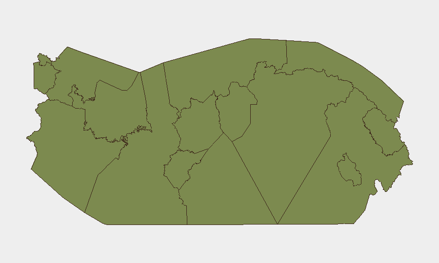
Situation Summary
Panama faces elevated security pressure concentrated in two high-risk zones—Colón (31.3 composite risk) and Veraguas (22.5)—while the capital and Canal corridor remain relatively stable. Recent signal activity (22 tracked events) points to overlapping tensions: state investigations, military deployments, public statements from Washington, and inter-regional demands involving Paraguay. The national threat ranking remains moderate, but sub-national fragmentation and the intensity of recent official activity suggest localized volatility requiring close monitoring.
Key Developments
Cannot be reliably compiled without live news/social-media access. GeoBit's current intelligence cutoff predates June 21–22, 2026. The event signals listed (investigations, military movements, diplomatic statements) confirm heightened activity but require real-time corroboration across Panamanian news outlets (La Prensa, Telemetro, Crítica, TVN Noticias) and official sources (Policía Nacional, SINAPROC, ACP, Tocumen) to confirm specific locations, times, and nature of incidents.
To produce actionable 24–48h development bullets, a GeoBit analyst would:
- Execute Intel Sweep and X/Twitter OSINT searches (Spanish/English, location-tagged, time-bounded to June 21–22).
- Cross-reference candidate events against multi-language media feeds and verified official accounts.
- Flag any single-source or unverified claims.
Corporate teams requiring immediate operational updates are advised to contact GeoBit's AOI Monitoring & Early Warning service for real-time Colón and Veraguas alert feeds, or request a direct Intel Sweep for the past 48 hours.
Highest-Risk Areas
Colón Province dominates risk (31.3), driven by port-labor tensions, historical gang presence in urban quarters (Colón City), and trans-shipment trafficking activity. Veraguas (22.5) shows secondary elevation, likely reflecting rural land disputes, informal mining, and indigenous-settler friction. Both regions experience periodic roadblocks, labor actions, and police operations.
The remaining provinces cluster at low risk (1.3–4.9), with Ngäbe-Buglé and Chiriquí showing minor elevation, possibly linked to indigenous grievances and border activity with Costa Rica. Panama City and Panama Province (1.3 each) remain the most secure for corporate operations, though petty crime and occasional gang-related shootings warrant standard urban precautions. The Darién score (1.3) reflects limited reporting rather than absence of risk; trafficking and irregular migration remain endemic but largely avoid direct harm to organized business.
How GeoBit Would Assist
Security teams should deploy AOI Monitoring & Early Warning with persistent watches on Colón (port area, Cristóbal, central city) and Veraguas to receive real-time alerts on roadblocks, strikes, and police/military operations. OSINT Fusion & Corroboration across news, X/Telegram, and official sources will separate rumor from confirmed incident, cutting false-alarm costs. For supply-chain and personnel routing, Routing & Network Analysis tools identify real-time road closures and alternative corridors, while Satellite & Imagery Analysis provides independent confirmation of port disruptions or infrastructure damage.
7-Day Outlook
Expect sustained tension in Colón and Veraguas absent rapid de-escalation of the apparent labor or inter-governmental disputes signaled by recent military and diplomatic activity. Panama City and the Canal corridor are unlikely to experience direct disruption, but localized strikes or protests could create transport delays. Monitor official statements from Policía Nacional and ACP for formal guidance on port/transit status.
Highest-Risk Areas — Ranked
| # | State / Region | Risk |
|---|---|---|
| 1 | Colón | 31.3 |
| 2 | Veraguas | 22.5 |
| 3 | Ngäbe-Buglé | 4.9 |
| 4 | Chiriquí | 4.9 |
| 5 | Bocas del Toro | 3.1 |
| 6 | Panamá Province | 1.3 |
| 7 | Guna Yala | 1.3 |
| 8 | Darién | 1.3 |
| 9 | Emberá-Wounaan | 1.3 |
| 10 | Naso Tjër Di | 1.3 |
| 11 | Coclé | 1.3 |
| 12 | Panamá Oeste | 1.3 |
Sources
Previous Daily Briefs
A new Panama brief is written every day — each with its own risk map and downloadable CSV. Here's the last week; use the calendar to go further back.
📅 Browse every day by calendar →
Highlighted days have a brief. Tap a day for that day's map & analysis, or “csv” for that day's dataset ($5).