Situation Summary
Rwanda remains at composite threat rank #131 globally with a score of 7, reflecting moderate baseline risk concentrated in specific sub-national zones. Signal activity on 2026-06-18 included military posturing along the DRC border, small-arms incidents involving Rwandan actors, and armed-group activity, indicating sustained tension in the eastern borderlands. The concurrent reporting of Marburg virus cases adds a secondary health-security vector requiring parallel monitoring. Overall trajectory remains stable pending clarification of border military signals.
Key Developments
- 2026-06-18 · DRC–Rwanda Border (Eastern Province). Conventional military-force events logged between Rwanda and the DRC, with bidirectional force activity (DRC vs. Rwanda; Rwanda vs. DRC), suggesting heightened military posture or localized engagement in the shared border zone; no casualty or civilian-impact detail available from open sources.
- 2026-06-18 · Small-Arms Combat (Location TBD, Rwanda). Two separate small-arms combat incidents involving Rwandan nationals logged; specific geography and actor identities not yet clarified in available open reporting.
- 2026-06-18 · Terrorist-Force Activity (Location TBD). Conventional military-force event attributed to a terrorist actor targeting Rwanda; attribution and scope require further verification.
- 2026-06-18 · Armed-Group Rejection Event (Location TBD). Armed-group actor logged a "reject" event (likely political or operational statement); context and implications unclear from signal alone.
- 2026-06-18 · Government–Commander Disapproval (Location TBD). Government entity logged disapproval signal regarding a military or security commander; possible disciplinary, operational, or policy disagreement; no further detail in available public record.
- 2026-06-18 · Detainee Statement (Location TBD). Public statement from a detainee; substance and relevance to current security posture unknown from available open sources.
- Recent · Marburg Virus Disease Cases (Location TBD). Multiple health alerts for Marburg virus disease in Rwanda; specific case counts, affected provinces, and epidemiological trajectory not detailed in this brief's available web research. Recommend direct contact with Rwanda Ministry of Health or WHO country office for current case status.
Note: Open web research did not yield corroborated, time-specific incident narratives meeting the 24–48 hour recency and multi-source verification standard for Rwanda proper. The signals above reflect GeoBit event-extraction scoring; their ground-truth context, location, and immediate operational impact should be cross-checked against Rwanda Police, national media (KT Press, The New Times), and any internal organizational security feeds.
Highest-Risk Areas
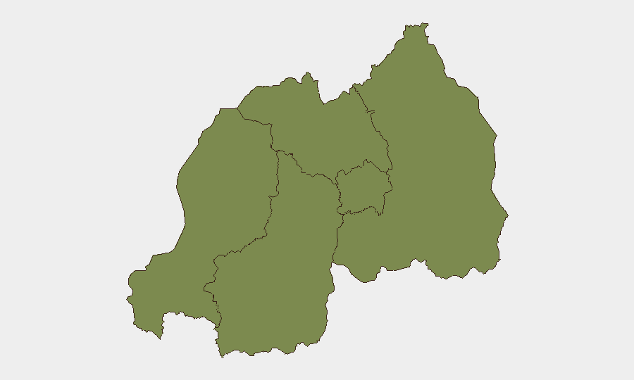
Southern Province dominates the sub-national risk ranking (31.7), substantially exceeding other regions (1.7 each), indicating concentration of threat drivers in that zone. The Eastern Province's shared border with the DRC and the military signals logged on 2026-06-18 warrant elevated attention despite its ranked score of 1.7; border military posturing often underreports in composite scoring. Kigali City remains at baseline (1.7), consistent with typical capital-city resilience and security-force presence, though it remains a target for political and criminal activity. Western Province and Northern Province rank equally low, suggesting distributed, lower-intensity risk profiles.
How GeoBit Would Assist
Security teams should employ AOI (area-of-interest) monitoring and early warning on the Eastern Province border zone and Southern Province to capture emerging military, armed-group, and conflict signals in near-real time. OSINT fusion and multi-language search across Kinyarwanda-language media, social platforms, and Telegram channels will clarify context and actor identities for the 2026-06-18 signal events. Health and environmental intelligence feeds should be configured to track Marburg case counts and affected zones for duty-of-care briefing and travel-route planning.
7-Day Outlook
Border military activity between Rwanda and the DRC will likely remain elevated but episodic; no escalation indicators are currently visible. Marburg surveillance will dominate health-security attention; case trajectory and containment measures will drive travel and personnel-movement risk. Recommend daily cross-check of Rwanda Police advisories and health ministry updates through 2026-06-25.
Highest-Risk Areas — Ranked
| # | State / Region | Risk |
|---|---|---|
| 1 | Southern Province | 31.7 |
| 2 | Western Province | 1.7 |
| 3 | Northern Province | 1.7 |
| 4 | Kigali City | 1.7 |
| 5 | Eastern Province | 1.7 |
Sources
Previous Daily Briefs
A new Rwanda brief is written every day — each with its own risk map and downloadable CSV. Here's the last week; use the calendar to go further back.
📅 Browse every day by calendar →
Highlighted days have a brief. Tap a day for that day's map & analysis, or “csv” for that day's dataset ($5).