Situation Summary
Saint Kitts and Nevis remains in a low-threat security environment with no verified reports of acute incidents, civil unrest, or political violence in the last 24–48 hours. Recent event signals flagged by the platform appear largely legislative and diplomatic in nature, with no ground-truth confirmation of destabilizing events. The federation's governance activity is focused on financial-sector regulation and infrastructure remediation, particularly water-supply management ahead of the Atlantic hurricane season. Risk trajectory is stable.
Key Developments
- Basseterre, St. Kitts – 18 June 2026: The National Assembly completed a sitting in which five bills were approved, including financial-sector and consumer-protection measures. Government communications characterize this as regulatory strengthening rather than response to crisis or instability.
- Federation-wide – 18 June 2026: Government amplified a formal drought warning tied to water security during the 2026 Atlantic hurricane season, indicating proactive infrastructure messaging rather than acute service failure.
- St. Peter's, St. Kitts – 18 June 2026: Government announced plans to restore 24/7 water supply following infrastructure upgrades, signaling remedial work and service improvement in progress.
- Federation-wide – 18 June 2026: A U.S. Embassy Nassau security alert (dated 15 June) circulated in local social-media discussion regarding loss of life elsewhere in the Caribbean region; this reflects regional awareness but is not specific to Saint Kitts and Nevis incidents.
- Open-source monitoring (24–48h): No verified reports of new crime spikes, violent protest, political violence, assassination threats, or travel disruptions appear in curated news feeds, government statements, or social platforms monitoring Saint Kitts and Nevis specifically.
Highest-Risk Areas
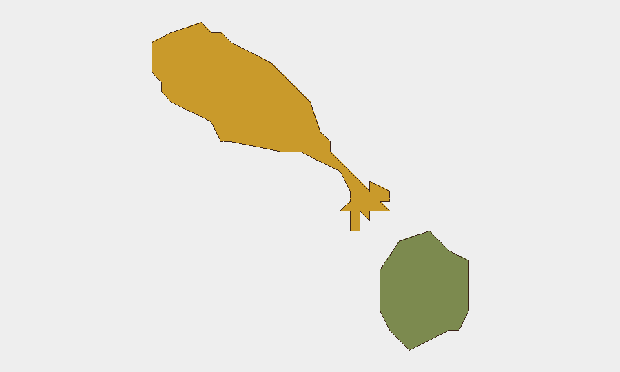
Saint Kitts accounts for the majority of tracked risk (score 72 versus Nevis at 28), reflecting larger population, economic activity, and administrative concentration in the island. Basseterre and surrounding parishes are the primary loci of governance, commerce, and civil activity and therefore command monitoring priority. Nevis presents materially lower composite risk and does not show comparable event-signal density. The risk differential is consistent with population and asset distribution rather than acute localized instability in either island.
How GeoBit Would Assist
A security team with personnel or assets in Saint Kitts and Nevis would employ AOI Monitoring & Early Warning to establish persistent watch over Basseterre and key infrastructure sites, with automated alerting on civil unrest, traffic disruption, or security incidents. OSINT fusion and multi-language search across government feeds, social media, and local news sources would provide real-time corroboration or refutation of event signals and enable rapid duty-of-care decision-making. Conflict & regime-stability search combined with sentiment and temporal analysis would detect shifts in political or civil climate before they manifest in acute incidents.
7-Day Outlook
No indicators suggest material deterioration in the security environment over the next seven days. Legislative and infrastructure activity will likely continue; hurricane-season preparedness messaging should be expected. Monitoring should maintain standing watch for any upstream political or social signals that might precede disruption, particularly around governance or resource-allocation disputes.
Highest-Risk Areas — Ranked
| # | State / Region | Risk |
|---|---|---|
| 1 | Saint Kitts | 72 |
| 2 | Nevis | 28 |
Sources
Previous Daily Briefs
A new Saint Kitts and Nevis brief is written every day — each with its own risk map and downloadable CSV. Here's the last week; use the calendar to go further back.
📅 Browse every day by calendar →
Highlighted days have a brief. Tap a day for that day's map & analysis, or “csv” for that day's dataset ($5).