Situation Summary
Senegal remains a low-threat operating environment with a composite threat score of 16 globally. No verified security incidents, civil unrest, or infrastructure disruptions have been reported in the last 24–48 hours. The country's baseline stability is underpinned by relatively resilient institutions and low active conflict; however, sub-national variation is significant, with Tambacounda Region experiencing substantially elevated risk.
Key Developments
No verified security, civil-unrest, crime, or travel-risk incidents in Senegal have been confirmed in the last 24–48 hours from cross-checked open-source reporting. Live web research identified one unverified social-media reference to a football-pitch incident involving Senegal supporters and security, but it lacked specific date confirmation, independent corroboration, and clear indication of location within Senegal. All other recent event signals in the GeoBit feed relate to non-Senegal jurisdictions (Singapore, Cambodia, Thailand, Vietnam) or are thematically unrelated to Senegal security.
Highest-Risk Areas
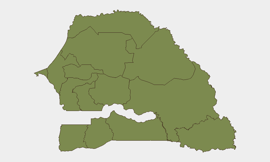
Tambacounda Region, in eastern Senegal bordering Mali, dominates the risk profile with a composite score of 31.3—approximately 13 times higher than the national average. This disparity reflects exposure to Sahel-zone instability, including cross-border movement of armed groups, trafficking networks, and sporadic communal tensions. All other tracked regions (Thiès, Kolda, Dakar, Saint-Louis, Ziguinchor, and others) score between 1.3 and 2.3, indicating substantially lower and broadly comparable risk. Organizations with personnel or assets in Tambacounda should apply heightened duty-of-care protocols; those in Dakar and coastal regions face minimal elevated risk relative to global norms.
How GeoBit Would Assist
Security teams should deploy AOI (Area-of-Interest) Monitoring & Early Warning focused on Tambacounda Region to detect cross-border activity, armed-group movement, or communal tensions in near-real time. Intel Sweep and multi-language OSINT (X/Twitter, Telegram, local media) would provide continuous awareness of political statements, protest activity, or security force actions affecting operations. For personnel movement planning, Routing & Network Analysis can generate alternative travel corridors and real-time risk assessment on primary routes, while Conflict & Military tracking monitors force deployments and weapon movements that may affect regional stability.
7-Day Outlook
No imminent security escalation is anticipated in Senegal over the next seven days. Baseline conditions in Dakar and urban centers are expected to remain stable. Tambacounda Region warrants continued monitoring for seasonal trafficking patterns and low-level cross-border activity, particularly as the dry season advances, but no specific triggering events have been identified.
GeoBit Assessment Date: 2026-06-23 | Confidence: Moderate (limited recent verified incident reporting) | Next Update: 2026-06-24
Highest-Risk Areas — Ranked
| # | State / Region | Risk |
|---|---|---|
| 1 | Tambacounda Region | 31.3 |
| 2 | Thiès Region | 2.3 |
| 3 | Kolda Region | 2 |
| 4 | Dakar Region | 1.3 |
| 5 | Louga Region | 1.3 |
| 6 | Fatick Region | 1.3 |
| 7 | Diourbel Region | 1.3 |
| 8 | Kaolack Region | 1.3 |
| 9 | Saint-Louis Region | 1.3 |
| 10 | Kaffrine Region | 1.3 |
| 11 | Ziguinchor Region | 1.3 |
| 12 | Sédhiou Region | 1.3 |
Previous Daily Briefs
A new Senegal brief is written every day — each with its own risk map and downloadable CSV. Here's the last week; use the calendar to go further back.
📅 Browse every day by calendar →
Highlighted days have a brief. Tap a day for that day's map & analysis, or “csv” for that day's dataset ($5).